Sunday, July 30, 2006

Bizarre flying cubes in Prospect Park


Under the ruse of a movie shoot, a mysterious and well-organized cabal released these luminous cubes into the air above Prospect Park a few weeks ago. Vaguely evocative of the park's blinking fireflies, the cubes produced a pleasantly alluring psychological effect to attract dozens of curious bystanders.


The cubes began to advance northward, towards downtown Brooklyn and Manhattan beyond. But to what diabolical purpose? Perhaps they are behind the inexplicable fad of bottled water from Fiji.


In this last photograph (completely undoctored), a cube glows brightly as it prepares to suck in a cyclist. I made haste to arrange my own escape before I could document or witness the gruesome outcome.

Friday, July 28, 2006

What New York can learn from Houston

For most of last year, I lived in Houston, Texas, a city famous for instructive examples of what not to do in the realms of urban planning and conservation.

But Houston, which has endured a comeuppance of regular floods for decades, is finally doing something innovative to improve the water quality of its bayous, reduce the risk of flooding, and provide new parks and trails for its residents - all in one project.

Project Brays is a venture of the Harris County Flood Control District and the Army Corps of Engineers. Brays Bayou traverses the southern edge of central Houston, from the Third Ward to Tom Delay's hometown of Sugar Land. For much of its length, the bayou is paved under concrete, (a la the Los Angeles River), because the Corps of Engineers once believed that the best way to deal with floodwaters was to carry them as quickly as possible to the ocean.

Unfortunately, paved surfaces are more a part of the problem than a part of the solution. Before Houston overwhelmed them, the prairies and riparian forests that once thrived in the bayou's watershed absorbed and slowly released stormwaters into the waterway. But paved surfaces sent rainwater straight to the bayou, which overflowed more and more frequently as the city grew. When the bayou itself was paved, the watershed lost its last vestiges of natural vegetation and absorption capacity. Needless to say, the Corps has been forced to acknowledge and correct its mistakes.

Now, Harris County and the Corps are taking a more holistic view of flood control. Project Brays is acquiring the most flood-prone private property and linking together a string of new green spaces along the bayou that will double as cachement basins during storms. A vegetation management program will re-introduce riparian plants and trees to intercept and absorb stormwater, mitigate Houston's intense heat island, and provide new wildlife habitat. And the new retention basins will double as parks with recreational facilities for surrounding neighborhoods.

These projects will also improve water quality in the region's waterways, since the stormwaters will have more chances to filter through the ground before they drain into the bayou and Galveston Bay.

New York's watersheds and stormwater systems (see my previous post) are very different from Houston's. But there are plenty of similarities, too, and the elegant solution of Project Brays is certainly worth admiring.

New York's regimented bureaucracy seems often to obstruct interdisciplinary problem-solving like this, but maybe the shame of being showed up by Houston (and Dallas, and Los Angeles, and others) will spur this city to action.

Other watershed restoration and flood control projects:

Wednesday, July 26, 2006

The new watersheds


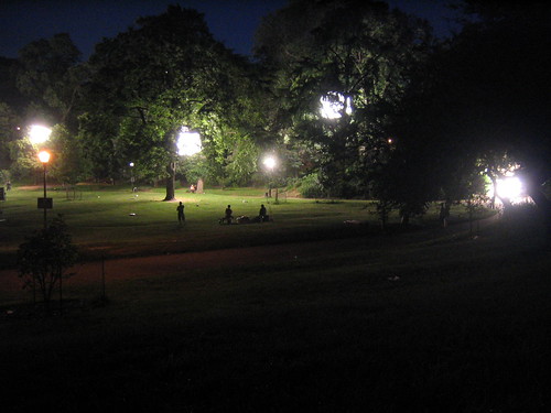
Every day that I ride my bike to work from Brooklyn, the Hudson River greenway bike path takes me past the huge North River sewage treatment plant in Harlem. There's a number of interesting things about this place - the state park on its roof, for instance, with picnic areas, playing fields and swimming pools - but today I fancied to think of it as the mouth of New York City's man-made wastewater river. Or one of the mouths, anyhow.

A little bit of background - we've been doing a lot of bald eagle programs at Inwood now that the birds are flying around the park, and I've been asking participants for ways they might be able to help these new New Yorkers. I try to get them to name ways they can improve water quality, since the eagles rely on healthy fish for food, and the Hudson River's pollution was the main factor that drove the bald eagles away from the city a hundred years ago. But it's been surprising how little people know about where their water goes beyond the drain or the gutter.

Eventually, it all goes into the river. But first, wastewater from Inwood, Washington Heights, and the rest of the western half of Manhattan above Greenwich Village drains to the treatment plant beneath Riverbank State Park. During dry weather, the plant treats 125 million gallons of wastewater a day, and the plant is designed to handle up to 340 million gallons during storms, according to the DEP. New York City's entire system of treatment plants are designed to handle 1.8 billion gallons of wastewater a day from the five boroughs. To put that into context, the Delaware River carries about 5.3 billion gallons of water past Trenton, New Jersey on a typical June day. So New York's sewers are a respectably-sized watershed, with a delta of fourteen mouths spread out across the harbor, and millions of tributaries in households, streets, and businesses all over the city.

Unfortunately, this is a very polluted watershed, and it floods into the rivers and bays of the region with alarming frequency. Because stormwater from the streets mixes with sewage from homes and businesses, every big rainstorm strains the city's treatment capacity. An inch of rain falling on the city's 120,000 acres produces 3.14 billion gallons of water. Some of that gets absorbed into the ground (the rain that falls on parks and street trees, for instance), but much of it ends up going down gutters and into the sewers. Thus, all the nasty stuff on the city's streets, from gasoline to household chemicals to dog crap, washes away with every storm, mixes with our raw sewage, overwhelms treatment plants, and ends up untreated in the region's waterways. Riverkeeper estimates that an average of half a billion gallons of sewage get discharged from overflowing sewers every week.

Everyone who sends water down a drain is culpable, to some degree, for creating wastewater. Individuals can make a huge difference by minimizing water use during storms and by being vigilant against dumping nasty stuff on the streets and down the gutters. For information on what the city government might do to fix this problem, take a look at Riverkeeper's website.

Tuesday, July 11, 2006

The "salt marsh"

One of my favorite areas of the park is what we call the "salt marsh" - though it's really just a tidal mud flat with a few marsh grasses around its riprapped edges. The nature center's porch overlooks the marsh and offers good birding. We have an egret that hunts for fiddler crabs during low tides, an occasional green-backed heron or cormorant, and views of the bald eagles' hack platform.

The "marsh" is actually a silted-up old course of the first United States Ship Canal (see previous post), but still, it gives an idea of what the edges of Manhattan used to be like. The mats of reeds typical of most marshes are restricted to only a few spots along the edge of Inwood's marsh, thanks to big boulders placed as riprap around the edges of the water. This is too bad - those grasses do a great deal in other marshes to filter out all sorts of pollution. All too often, fast-food litter and dog sewage from the park's fields wash away unimpeded into the marsh and the river beyond.

Still, the mud flats provide a good enough refuge not only for birds, but also for bird food like perch, crabs, oysters, and smaller fish called mummichogs.

The eagles, by the way, are just starting to fly off the platform and around the park. I spotted one last Friday gliding above the soccer field by Shorakapok rock.