Wednesday, December 27, 2006

Plum Creek's economic benefits: a closer reading

This past weekend, the Maine Sunday Telegram published an op-ed column I'd written about the economic benefits of Plum Creek's plan for the Moosehead region. The article is reprinted in full here at the Natural Resources Council of Maine webpage.

The Telegram gave it the misleading headline "Plan no benefit to region's economy." I argued that the plan does provide some much-needed economic benefits to the region; however, most of those benefits come from investments in the region's forest and tourist industries. The most controversial aspects of the plan - the hundreds of houselots scattered across the wilderness - would contribute little, and might actually detract from, the region's economy.

The graph below shows the expected income, in thousands of dollars, from residential development of house lots compared with expected income from one industrial forest products facility (source: Dr. Charles Colgan, "Estimated Economic Impacts...", 2006):

Note how income from hundreds of house lots plunges to zero after peaking in 2015, while the income from one sawmill rises and exceeds construction income every year. Also, though Colgan doesn't break it down by individual counties, it's widely expected that most of the construction income from residential development will go to construction firms and workers from outside of the Moosehead region (mostly in Bangor, in Penobscot County). The bulk of industrial income, on the other hand, will go to long-term employees living within a feasible commuting distance of the mill, which is proposed to go on the road between Greenville and Rockwood.

Then there's the fact that the sawmill will have fewer demands of municipal services than nine hundred seventy-five new houses. And all of those houselots are going to take thousands of acres of productive forest land out of production, off-limits to the much more lucrative businesses of forestry and recreation.

So yes, Plum Creek's plan does have some economic benefits. But those benefits would be a lot less ambiguous if the company stuck to the business of forestry and struck the wilderness housing developments from its proposal.

Thursday, December 21, 2006

New York still stands, and thinks to look ahead

Twenty-five years ago, New York was almost bankrupt. Robert Caro had written a book subtitled "The Fall of New York" and won a Pulitzer Prize for it. And the new movie "Escape from New York" was premised on the idea that by 1997, Manhattan would be abandoned and adaptively reused as a maximum-security prison.

In hindsight, New York didn't fall. In fact, the city is worth trillions of dollars and is basically ruling the planet. And so, flush with cash and ambition, the city is looking to the future with an optimism it hasn't had in decades.

The Bloomberg administration articulated that optimism last week with PLANYC 2030. The Plan anticipates that "our city will be getting bigger, our infrastructure older, and our environment more unpredictable" (the last is a reference to global warming, which could soon turn downtown New York into a Venice of the New World). These three broad issues are broken down into ten goals sorted under one-word headlines, which, for the sake of print design, all end in the letter "N" (for NYC, get it?).

Under the "OPENYC" initiative, the goals are to build housing for one million new residents, add transit capacity to serve them and improve travel times, and to insure than every New Yorker lives within a 10-minute walk from a park. Goals of the MAINTAINYC initiative deal with upgrading the city's water, transportation, and electicity infrastructure. And the four goals of GREENYC are to reduce climate-change pollutants by 30%, to have the cleanest air of any large American city, to clean all of New York's contaminated brownfields, and to open 90% of city waterways to recreation with natural area restoration and water quality improvements.

In spite of the references to "opening" and "maintaining" the city, every one of the ten goals involves making New York, and by extension, America, more sustainable. The plan claims that "New York is one of the most environmentally-efficient cities in the world." The world can disagree, but certainly NYC is the most efficient place to live in the United States. Imagine how much worse off we would be if New York's 8.5 million people - almost 3% of the nation's population - lived the same SUV-driving, McMansion-living lifestyle that the rest of America practices, instead of riding subways and living on an average of two-hundredths of an acre? If a million more people can live there instead of Peoria, the world will be in comparatively better shape.

Adding transit capacity and accessibility to parks have obvious environmental benefits. Upgrading water infrastructure will likely involve additional investments in protecting the city's upstream watersheds, and offers the possibility that New Yorkers might abandon the stunningly inefficient practice of importing water in plastic bottles from places like Fiji and Poland, Maine. The committment to transportation infrastructure might be a chance for the city to spread the gospel of congestion charging. And electrical infrastructure improvements will look toward cleaner power with better distribution, including buildings that generate their own electricity.

Even though the plan doesn't mince words about the problems that might face the city (flooding, blackouts, all-day rush hours), the overall tone is strikingly optimistic. These goals might be prerequisites for New York's continued dominance, but they also give good reason for the world to keep following New York's lead.

  • PLANYC2030 website
  • The Economist: The new New York
  • Streetsblog: Futurama 2030

  • Tuesday, December 19, 2006

    The Eastern Prom Wilderness: Trailhead

    The Eastern Prom Wilderness Trail begins on the northern tip of the Portland peninsula, where Back Bay empties into Casco Bay. To get to the trailhead, either walk east to the end of Marginal Way or take bus 6 or 7 to the last stop before the bridge.

    Aeration poolsThe trail starts where Marginal Way - which technically becomes Sewage Plant Road as it crosses under the Washington Avenue overpasses - ends. At a small parking area, the Back Bay trail enters from the left and the Eastern Prom Wilderness Trail (paved for both hikers and cyclists) heads straight ahead, between the sewage treatment plant and the bay.

    Many wilderness trails take visitors to the splendors of our rivers and estuaries, and the Eastern Prom Wilderness Trail is no different. This sewage treatment plant, run by the Portland Water District, is the mouth of a huge man-made watershed that runs from Sebago Lake in Standish to the outlet pipe here in Casco Bay.

    Like many coastal estuaries, the plant filters out contaminants from the watershed before emptying into the bay. This plant typically treats about 20 million gallons of sewage a day (a similar amount of water flows through the mouth of the Stroudwater River). During storms, when rain and melting snow washes off all the flotsam of city streets and parking lots into storm sewers, the plant handles as much as 80 million gallons daily. Often, it's not enough, and stormwater, mixed with sewage and whatever garbage was washed from the streets, flows untreated into the Bay.

    Still, before the plant opened in 1979, all of Portland's sewage got dumped into Casco Bay.

    Heading east, the trail passes several excellent signs from the Water District that describe each step of the treatment process. Heading west to east, as the Wilderness Trail does, follows the process in reverse: this is a picture of the last sign the trail passes, at the plant's Process Building.

    Past the plant, the trail descends toward the waterfront and gains the open fields of the Eastern Prom park. Here there are fine views of the harbor, including the landmark that will be the subject of next week's trail report: the East End Beach.

  • Portland Water District wastewater treatment facilities
  • Related posts: The New Watersheds, What New York Can Learn From Houston
  • Saturday, December 16, 2006

    The Plank

    This is the neighborhood of Portland where Congress Street crosses under the freeway. According to the city, the neighborhood is "Libbytown," but I call it "the Plank" because of the hazards involved in walking it.

    This picture is taken from Congress in front of the bus and train station, looking toward downtown. Suppose that you're a hapless pedestrian who's recently arrived by train in the Forest City. Downtown is only a twenty minute walk away. But first, you'll have to traverse the Plank's dozens of acres of on ramps, which the Department of Transportation (motto: "Death to Pedestrians!") has thoughtfully designed to punish anyone who doesn't use a car all the time.

    The photo shows the first of four freeway-style crosswalks that an eastbound walker must navigate. Cross the first lane of turning (but not stopping) traffic to gain the relative safety of a tiny traffic island, where you will be surrounded on three sides by rushing traffic. After that, there's a four-lane crossing and another island, then a hop across another turn lane, then a dark underpass, two more freeway ramps, and that's the Plank.

    At the other side, treat your injuries at Maine Medical Center, only six more blocks ahead (ambulances pass through the Plank frequently, and if you're lucky, that's the kind of vehicle that will hit you).

    The Plank is even more staggering when seen from above: here's the link to the Google satellite image. The Plank is in the middle of a central-city neighborhood: dense residential neighborhoods to the east and north, a growing cluster of medical offices to the west, the future site of Mercy Hospital to the south. The dozens of empty acres that its loopy ramps occupy are probably worth millions of dollars, and it could be a thriving employment district, the home to hundreds of offices and homes within walking distance of hospitals and the train station. Instead, it's a barrier that forces everyone in those surrounding neighborhoods to get into their cars in order to get to the other side. The Plank exists to move traffic, but by taking up so much space, it creates a lot of traffic, too.

    What were those traffic engineers thinking when they built this thing? I'd like to hear from them - perhaps on a rush-hour walking tour of their creation. Let's go, traffic engineers. Get into that crosswalk you designed. I'll be right behind you.

    Thursday, December 14, 2006

    File under: indulgent self-reference

    This blog looks better because the benevolent overlords of world knowledge at Google have upgraded their Blogger software. New features to enhance the vigor of your northern experience include:

    • Labels! Are you frustrated by this blog's lack of focus? Can't waste your time with anything that doesn't have to do with The Hamilton Hustle (i.e., fiscal policy)? Or perhaps you're plain old narrow-minded? If you answered "yes" to any of these questions, the new Gallery of Labels is for you!

    • More Courier! The Courier font plays a much larger role in this new layout. Its bold serifs will serve as valuable structural supports to my weighty arguments.

    Well, the list of improvements could go on and on, but I'm out of breath after two. The long and short of it is this: the upgrade may have caused some panic and ugliness when my old layout was lost in the progressive ether of the Bay Area, but after two hours of fiddling around with the new templates, this blog works better and looks even more DIY (you know, a hip kind of cheap) than before.

    On another note, daily readership has edged up into the double digits. Thanks for the attention, everyone - enjoy and share! Digg!

    Tuesday, December 12, 2006

    No such thing as free parking


    The image above is a satellite image of downtown Portland, with surface parking lots (solid red) and parking garages (shaded red). Congress Street runs diagonally through the picture. This does not include on-street parking or parking garages that occupy the first level of larger office buildings (like One City Center).

    Consider these quick facts:

  • The construction cost of one parking spot in an above-ground garage is $20,000. The land cost for one surface parking spot is about $2,500.
  • The City of Portland provides hundreds of acres of rent-free real estate for automobile storage on its streets. Many of the city's homeless live in cars, because Portland has reserved much more of its land and money for free parking than for affordable housing.
  • Portland taxpayers, businesses, and consumers pay the true costs of parking. Commuters from Standish, Windham, and other outlying communities generally don't pay for them, even though they use the majority of parking infrastructure.
  • It needs further research, but it's my educated guess that subsidies for free parking exceed subsidies for affordable housing by one or two orders of magnitude.

    It comes down to this: like almost every city in the nation, Portland has Socialized Parking. Every developer who wants to do business in the city has to meet Stakhanovite parking production quotas. From each taxpayer according to his means, to each motorist according to his auto-addiction.

    Click the link above to learn more about the book The High Cost of Free Parking, by Donald Shoup.
  • Sunday, December 10, 2006

    The Eastern Prom Urban Wilderness Trail: Introduction

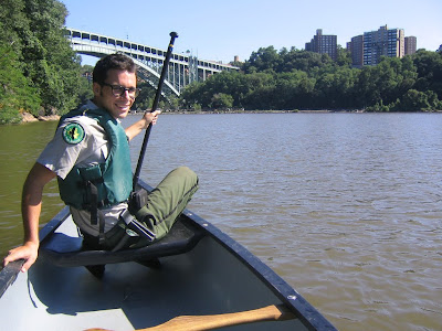
    This is a picture of me in my park ranger uniform: I'm canoeing in the tidal basin at Inwood Hill Park in New York City. I wrote a bit about urban rangering in my op-ed column in last week's Press Herald, when I encouraged readers to think more about how cities use natural resources.
    Here's an excerpt from an earlier draft (the piece was originally intended for this blog):
    Few people care to live near wastewater treatment plants, power stations, or working farms, no matter how much they benefit from the products of these places.

    The problem is, when city- and suburb-dwellers truck off their waste to distant out-of-state landfills (as New York City does) or bury hundreds of streams underneath city streets (as the other Portland did) or otherwise attempt to hide nature and our responsibilities to it, environmental problems tend to follow (e. g., garbage pollution that supports a population of 100 million rats and sewage overflows that render the Willamette River untouchable in New York and Portland, OR, respectively).

    So more power to us that oil tankers still berth past Bug Light, that the Wyman Power Station blinks ominously on Cousins Island, that sewage aerates on the Eastern Prom, that the trash incinerator's smokestack looms over I-95 and the airport. If we don't always find them pretty, they at least remind us that we ourselves are responsible for them - and capable of solving their problems ourselves.
    With this, I'd like to kick off a new feature here on this blog: an urban wilderness tour of the Eastern Prom. First stop, the East End wastewater treatment plant. Stay tuned next week.

    Thursday, December 07, 2006

    Chain stores downtown: another perspective

    In the brouhaha over "formula businesses" in downtown Portland, an article in the latest issue of The Atlantic brings some important arguments to the debate.

    Unfortunately, the links above don't quote the entire article, but the Houston Strategies blog (highly recommended reading, whether or not you live in Texas) quotes extensively from the article, and adds some Space City perspective.

    Particularly applicable to the debate in Portland are these arguments: that chains "increase local variety, even as they reduce the differences from place to place," and that "Chains let people in a city of 250,000 enjoy retail amenities once available only in a huge metropolitan center."

    There are times when author Virginia Postrel seems to be writing specifically about Portland: "Contrary to the rhetoric of bored cosmopolites, most cities don’t exist primarily to please tourists." Zing!

    And there are some choice quotes from planning consultant Robert Gibbs, who works with cities to help revive moribund downtown areas:
    To his frustration, he finds that many cities actually turn away national chains, preferring a moribund downtown that seems authentically local. But, he says, the same local activists who oppose chains “want specialty retail that sells exactly what the chains sell—the same price, the same fit, the same qualities, the same sizes, the same brands, even.” You can show people pictures of a Pottery Barn with nothing but the name changed, he says, and they’ll love the store. So downtown stores stay empty, or sell low-value tourist items like candles and kites, while the chains open on the edge of town. In the name of urbanism, officials and activists in cities like Ann Arbor and Fort Collins, Colorado, are driving business to the suburbs. “If people like shopping at the Banana Republic or the Gap, if that’s your market—or Payless Shoes—why not?” says an exasperated Gibbs. “Why not sell the goods and services people want?”

    Candles and kites? She's got to be writing about Portland. Or maybe she's talking about any one of thousands of quaint tourist trap communities. It's hard to tell - kind of like driving through a strip of chain stores.

    Related post: Buy Local, While You Still Can (November 20)

    Welcome, Press Herald readers!

    Today the Press Herald printed an op-ed column I wrote, as well as the first printed reference to The Vigorous North (identified as my "e-mail" address). So, for those of you visiting from the realm of analog news, welcome! This here blog is updated almost daily with news of the Maine environment and economy. Here's a sample of what you can find here, which will hopefully entice you to stay a while and come back often:

  • The Central Park S'more Inferno

  • Bald eagles of Manhattan Island

  • What's wrong with the property tax

  • The aesthetics of clean air
  • Wednesday, December 06, 2006

    The local psychogeography


    Charlie Poole's map of Portland harbor.

    Today at the Coastal Enterprises office I noticed an old poster for an art project that solicited individals' maps of the Maine coast. The artists, a group called Spurse, look like they were based in Maine until recently, and have since moved on to bigger scenes. Wish I'd been around to see their gallery shows, but the web site's the next best thing, and worth a look.

  • Spurse: mapping Maine coasts
  • Boston's Institute for Infinitely Small Things
  • Monday, December 04, 2006

    Up Plum Creek without a paddle

    Thanks to Maine Environmental News for the tip on this one.

    The Oregonian reported on Saturday that the same Plum Creek we're dealing with in the Moosehead region of Maine is looking to make an end run around Oregon's strict land-use laws in order to develop 32,000 acres of coastal forestland.

    For decades, Oregon's laws have dictated that working farms and forests are strictly off-limits to housing development. These laws allowed foresters and farmers to work in natural resource industries without pressure to sell out to the latest real estate boom, and as a result, Oregon has gained a reputation as the state that does the best job of protecting its natural landscapes from the forces of suburban sprawl.

    Then, a few years ago, Oregon voters passed Measure 37, a proposal from a right-wing property rights advocacy group. Few voters understood what the consequences of Measure 37 would be at the time of the election, but in effect, the initiative allows landowners to either ignore land use laws or demand compensation from the government if they can demonstrate that the regulations have adversely affected the value of their land. Never mind that Oregon's laws have increased state land values tremendously by making the entire place a more attractive place to live, but that's a whole other topic, because this particular blog entry is about Plum Creek.

    Plum Creek, a corporation whose timber interests have benefited tremendously from Oregon's timber-protective laws, is now saying that the rules that have kept them from turning their forests into houselots have cost their company $95 million.

    Which means, that under the auspices of Measure 37, Plum Creek is holding 32,000 acres of Oregon's coast - which is certainly a state treasure, if not a national one - hostage for $95 million.

    The fact that Plum Creek filed their claims with little fanfare at the last minute before a regulatory deadline speaks to their shame in the matter, since they are clearly trying to avoid criticism. The difference between the time zones may only be three hours, but what passes as good timing for Plum Creek in Oregon amounts to horrible timing in Maine. Hearings on Plum Creek's designs on the Moosehead region begin in just a few weeks. The news from Oregon hardly inspires faith in the corporation that would transform Maine's north woods.

  • Measure 37 explained
  • More Measure 37 wackiness, from Sightline
  • Sunday, December 03, 2006

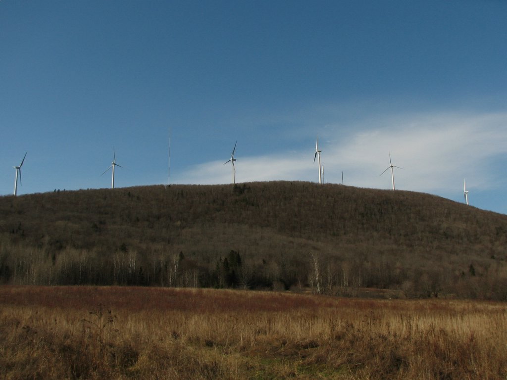
    Just look at that ugly clean air!

    This photo links from The Thing of the Moment, where there are many excellent photos of Mars Hill and other Maine places.


    A pretty good article in today's Press Herald reported on locals' reactions to the Mars Hill wind power project, scheduled to start generating electricity this month.

    Althouth the article's headlines in the front page of the printed edition make much of a supposed "controversy" over an "eyesore," the text of the article only reveals a few objections, which come off sounding relatively petty.

    The Bangor Daily News, in its reports, has focused more on the town's tax benefits. Since Bangor's newspaper is a lot closer, geographically and politically, to Mars Hill, I'm inclined to believe that there's really less controversy than the Portland paper's headlines warrant.

    Still, the Press Herald article brings up the point that the Mars Hill windmills will be a test case for other wind power proposals pending elsewhere in the state. One of those proposals, for Redington Mountain, does face some more serious opposition, due to its proximity to the Appalachian Trail. The Maine Appalachian Trail Club, Audubon Society, and Appalachian Mountain Club have all expressed their opposition to that proposal, not only because of visual impacts, but also because of the project's potential impacts to alpine zone habitats.

    Considering that global warming is a certain way to eliminate all alpine habitats from the state within the next fifty years, these objections, while they have some merit, amount to an attempt to rearrange deck chairs on the Titanic.

    Links to other wind-power projects and news:

  • Redington Mountain
  • A compromise proposal for Redington
  • A three-turbine proposal in Freedom, east of Waterville
  • Cape Wind, an offshore project near Cape Cod.
  • Thursday, November 30, 2006

    Plum Creek

    Perhaps you've heard about what Plum Creek, the stockholder-owned real estate and timber company, has planned in Northern Maine. In a landscape that today stands as a largely undeveloped working forest, with pristine lakes and a remarkable wealth of renewable forest resources, Plum Creek has proposed building 975 houses and two large resorts.

    By way of comparison, North Conway, New Hampshire has 1,602 housing units in all (2000 Census), and Bar Harbor has 1,558 (2000 Census).

    Plum Creek has also tried to sweeten the deal by including a proposed "conservation framework" that would put 368,000 acres under easements or conservation ownership. The possibility for conservation is indeed impressive: the framework would connect a million acres of conserved lands stretching from Baxter State Park to the Canadian border. The only hitch is that the company demands approval of their development plans, then expects state taxpayers and conservation nonprofits to pony up millions of dollars for the framework to take effect.

    I'll be writing about this business in greater depth in the weeks to come, until and during the time when the state conducts public hearings on the plan. In the meantime, a few links:

    -Natural Resources Council of Maine (who are shaping up as the main opposition group)

    -Plum Creek Moosehead Plan site

    And this is the big plan: Plum Creek's own documents (these are huge files):

    Vol. 1: Petition for rezoning (PDF, 90 mb)

    Vol. 2: Plan description (PDF, 165 mb)

    Vols. 3 and 4: Appendices (PDF, 110 mb)

    The Maine Land Use Regulation Commission (LURC) has a whole web page devoted to the concept plan and its path through the regulatory process here, as well as a calendar of updates and upcoming events.

    Monday, November 20, 2006

    Buy local... while you still can.

    I spent last Saturday evening at Stacy Mitchell's book reading in the old Center for Cultural Exchange space. The event was sponsored by the Portland Buy Local campaign, a new organization that's gaining lots of steam as a sort of chamber of commerce for homegrown businesses.

    Mitchell was an excellent speaker, and her concerns with big box retailing are well founded and well researched. I should say that I generally agreed with her from the outset: big box retailers exploit structural inefficiencies in our economy (cheap suburban land and cheap gas, chief among them) at tremendous expense to workers, communities, and even to the consumers they are supposed to serve.

    But I was also troubled by another aspect of Saturday's gathering: the expensive snacks donated by local caterers. Not that they weren't tasty - I certainly sampled the offerings - but the fact that fancy foods like these are typically beyond the means of most Portlanders, myself included. What value is there in local businesses that produce and sell things that most locals don't really need, or can't afford?

    Indeed, the proliferation of upscale boutiques (call it retail gentrification) in downtown Portland seems, in some ways, to be the other side of the big box coin: consumers seeking bargains head for the burbs, while well-heeled consumers rebel against big box tastelessness by patronizing rarefied shops downtown. Where does that leave someone who can't afford to drive out to the fringes - do we expect them to eat cake, or a ten dollar block of cheese?

    I asked a question in to this effect in the Q and A session that followed Mitchell's lecture, and in her excellent response (I hope that the wine and cheese retailers in attendance were listening) she noted that local shops had better serve local residents, or else face rebellion when the big boxes come courting with low prices for practical goods. She also noted that Portland's retail scene, while changing, is far from completely gentrified: we still have Maine Hardware, Paul's Grocery, as well as the empty storefronts and porn stores on Congress Street.

    Still, the old Surplus Store has been replaced by three tony food merchants. As one other guy asked me after the event, "where's a guy to get socks and underwear around here?"

    Saturday, November 18, 2006

    What's wrong with the property tax

    Taxes aren't just for raising money: they also serve to discourage activities that are undesirable to the public by raising their prices. A government subsidy, on the other hand, can be thought of as a "negative tax", something that encourages certain purchases and investments for the public good. Thus we have high taxes on things like cigarettes and booze, and low taxes and subsidies for things like affordable housing and some types of health care.

    So what about property taxes? The property tax is almost always thought of exclusively as a fundraising tool for local municipalities. But a tax of its magnitude will inevitably have a big economic effect, by effectively increasing the costs of landownership. Thus, the property tax acts as an incentive for big landowners (say, farmers and woodlot proprietors) to subdivide and sell off their land in smaller parcels.

    The property tax made a certain amount of sense in colonial times, when the amount of land a family owned was a good measure of how rich they were. And in some cases, the value of a property might still be a good indicator of wealth (if, for example, an appraiser values a big McMansion on five acres as worth more than a working farm on a hundred). But other taxes - like an income tax, gasoline tax on commuting, or - best of all - a progressive consumption tax would be more effective and fair.

    In more ways than one, property taxes are too expensive for New England.

    Wednesday, November 15, 2006

    The secret formula

    The Bollard reports today on the proposed "formula business" limits proposed for downtown Portland.

    This idea, a reaction to a recent proposal to install a Hooters joint on Congress Street, rides the wave of "Keep Portland Independent" sentiment, which finds its expression in bumper stickers and tee shirts in nearly every Old Port storefront. And, on some level, it's a nice idea: support local businesses by keeping big franchises out.

    Too bad this proposed legislation is such a mess.

    The ordinance, championed by Karen Geraghty, is full of tortured legal language that tries to define what a "formula" business really is. It's difficult, because many of Portland's businesses, which no one wants to expel from the city, already follow some sort of "formula." As a result, the ordinance is long, confusing, and full of loopholes.

    Which shouldn't be surprising, given the fact that this is all a knee-jerk reaction to the idea (horrifying to Portland's well-heeled bobos) that a roughneck joint like Hooters might end up on Congress Street. Where was Geraghty when other chains like Starbucks or Cold Stone Creamery moved in?

    Downtown Portland has a bigger problem than the prospect of Hooters. This city's retail trade is thriving, but there's very little diversity among its businesses. You can "Keep Portland Independent" if you need to buy a tee shirt or precious bits of pottery, but good luck finding independent retailers of sensible things like nails, wastebaskets, or reasonably priced groceries. Ultimately, keeping chain businesses out of downtown will keep on driving (literally) the middle class out of the city to buy the things they really need at the mall.

    Maddeningly, this might be exactly what certain members of the Council are after. Gereaghty's "Keep Portland Real" coalition, formed to support her legislation, consists of such tony retailers as Standard Baking and Aurora Provisions. Certainly a place like Hooters is anethma to the upscale shopping mall that they want Portland to be. But a functional city that serves its residents shouldn't be.

    Wednesday, November 08, 2006

    TABOR tabled

    A little over two years ago, I wrote this op-ed piece about Carol Palesky's first tax-cap proposal.

    Voters rejected the second tax-reform referendum in as many years yesterday. And for a second time, we'll wait expectantly for our state legislature to take up the crucial issue of tax reform.

    After the failure of the 1% tax cap in 2004, most people expected the Governor and the legislature to jump on the issue of tax relief. There have been a few initiatives, like the effort to regionalize services and to transfer more school funding to the state, but the near-success of TABOR tesifies to how unsatisfactory the results have been thus far.

    Today's Press Herald argues that the voters who rejected TABOR were concerned more with this specific initiative than with tax reform in general, and that the next legislature will be expected to make Maine's tax system more equitable.

    Only 37% of voters approved Question 1 in 2004. Last night, 46% of voters said "yes" to TABOR. If the legislature doesn't act quickly, we'll have another citizen-led effort to hack the state budget in 2008 - and the third time's the charm.

    Sunday, November 05, 2006

    The million-dollar plan

    Conventional wisdom regarding Maine's economy cites high taxes and closed mills, but conventional wisdom is also a handy tool for political hacks. GrowSmart Maine has commissioned a study from the Brookings Institution that promises us that Maine "stands within reach of a new prosperity-" if we follow their think tank advice.

    I've only read a bit of the report so far, but the executive summary cites some striking statistics. For example, between 1980 and 2000, Maine converted more than 1,300 square miles (an area the size of Rhode Island) from rural fields and woodlots to suburban subdivisions. "In the 1990s only Virginia lost a greater share of rural land than Maine." Maine is not an especially small state, and most of it is rural, but nevertheless, we plopped houses on farms and forests faster than Texans could turn their plains to shopping malls and Florida could turn its swamps into retirement communities. This has got to be rough news for Mainers inclined to think of those other places as self-consuming sprawl-slums: Maine is doing even worse.

    Here's another one: Maine's population was increasing faster than the populations of 24 states in 2000, and has had the 5th highest rate of domestic in-migration since 2000. The new arrivals are wealthier, older, and increasing Maine's average per-capita income simply by being here. On paper, this looks good: Maine's per-capita income is now almost as high as the national average. But if you have a town of four people who each earn $20,000 a year and a millionaire moves in, the per-capita, or average income of that town will suddenly get very high, even if the original four residents lose their incomes entirely. Similarly, we can have thousands of rich retirees move here and improve our economic statistics, but the lives of those who are here now won't necessarily improve.

    Indeed, the report notes that "many high-paying manufacturing and forest jobs have been replaced by lower-paying consumer services positions," such that job growth statistics mask a reality of decline.

    So, migration is causing some problems, but not as many as most Mainers would have you believe. New arrivals are giving us jobs in the state's most promising sectors, from organic farming (thanks, Casco Bay bobos) to health care (thanks, all you geriatrics), to financial services (thanks, Martha Stewart and all the rest of those midcoast MBAs). In fact, maybe we could harness the wealth of our new arrivals to offset some of the problems posed by their arrival... say, by lowering taxes, conserving rural land and enhancing downtowns, and providing job training for the rest of us?

    Well, the Brookings Institution has some advice about how to do that, too. More on the the solutions in a future post.

    Click here to read the Brookings report in its entirety.

    Thursday, November 02, 2006

    Back in Maine!

    After seven years of (mostly) absence, I will be returning very soon to my childhood home state of Maine. Jess and I plan to sign a lease for a Portland apartment as soon as we find one that suits us, and while I still haven't figured out whether or not I'm still registered to vote in Standish, I can at least start to participate as an electronic citizen.

    And so, reflecting the change in headquarters, the plan is for future posts to be more frequent and more Maine-focused. But, just as Maine's environmental issues usually relate to global forces beyond its control, I also plan to continue writing on the broad topic of nature and how people conceive of and relate to it.

    It's good to be back in the vigorous north.

    Monday, August 21, 2006

    haliaeetus leucocephalus

    Some photos of Inwood's bald eagles (click to enlarge). One bird has already crossed the Hudson and is headed north; the others are expected to follow soon.


    A bald eagle perched above the Harlem River in Manhattan. The Broadway Bridge and the Bronx are in the background.


    An eagle in flight over the tidal basin.


    This is one of the birds "branching" a few weeks ago. Before they're able to really fly, bald eagles typically spend a few weeks hopping around branches and getting a feel for how their wings work.

    Friday, August 11, 2006

    The tree that grows in Brooklyn (and anywhere else it cares to)

    Ailanthus Altissima doesn't get the respect it deserves. Also known as the Tree of Heaven, this tree is the preeminent pioneer species in urban ecosystems. You'll find it growing in the cracks of street pavement, on the edges of parking lots, on the eaves of neglected buildings, and almost anywhere else where there's more than a thimbleful of dirt. Once you know what to look for (see photo at left), you'll see it everywhere in New York.


    The Tree of Heaven in its typical habitat. Yep, that's heaven. Not quite what you expected, is it? Creative Commons photo by spike55151 on Flickr.


    Ailanthus is almost perfectly adapted to urban living. A mature tree can produce hundreds of thousands of seeds, which scatter in the wind and lodge themselves in precisely the same nooks and crannies where loose bits of dirt collect. The tree's powerful root growth is strong enough to break up concrete and pavement. Thus, Ailanthus trees are important pioneer species in the transformation of vacant lots: their roots break up impervious surfaces and loosen compacted soils so that other, less hardy plants can follow afterward. In Williamsburg, there are dozens of old parking lots that Ailanthus trees have helped to transform into grassy savannas.

    In spite of all this, some people think that Ailanthus trees are "weeds." They call Ailanthus "invasive" (it's native to China), they moan about cracks in their precious concrete infrastructure, and they claim that the trees have a "strong, offensive odor" (a quote from the National Parks Service Alien Plant Working Group, which has a desperado-style outlaw poster about Ailanthus here). Like it or not, though, Ailanthus is here to stay. So save yourself some hassle and appreciate this tree.

    Thursday, August 10, 2006

    Last chance to see these birds...

    Though we expect them to return someday, Inwood's bald eagles are due to leave New York City any day now.

    In the meantime, they're becoming excellent flyers and are really fun to watch. The Rangers, including yours truly, are putting on daily eagle programs at 2 pm, and sometimes at 11 am as well. The birds are easy to find, so we can almost guarantee that participants will be able to see a bald eagle. In New York City.

    Click here for directions to Inwood Hill Park and the nature center.

    Sunday, August 06, 2006

    What's in the water


    We received this message from the Parks' Natural Resources Group late last week:

    "We had a bona fide manatee sighting in the Hudson River heading North. This particular animal has been making his way north up the coastline with sightings reported first at 23rd Street and then later at 125th (40.81826 N - 73.96201 W). On both occasions it was observed at the surface adjacent to the bulkhead and appeared to be heading further north up the river. As you can imagine, we are very anxious about hearing about our wayward visitor... The animal has been described as approx. 10 feet in length and has barnacles on its dorsal surface. If you could both spread the word to anyone who may be in the vicinity to keep their eyes open. We are looking for photo-documentation of the animal and wish to be advised of any sightings immediately."


    Since manatees' range is usually limited to peninsular Florida, and occasionally as far north as Virginia, this particular animal is either: a) a psychopathic vagrant (use caution) or b) a manatee real-estate agent, getting in early on the New York waterfront's global-warming transformation into a sub-tropical mangrove swamp.

    Friday, August 04, 2006

    Heat island


    Streetsblog posted this satellite image of NYC earlier today (courtesy of NASA's Earth Observatory). They remarked on the obvious difference in temperatures between parks and urbanized areas. I'd also like to point out the streets (like 125th St. in Harlem and Flatbush in Brooklyn) that show up clearly as white-hot lines through neighborhoods. Thank internal combustion engines for that phenomenon: cars, trucks, and buses can heat up the air immediately around them by dozens of degrees on a hot day if they're idling in traffic with the a/c on.

    I rode my bike to work in Central Park on Wednesday, day one of the recent heat wave. Busy streets full of traffic, like Park Avenue in Midtown, were substantially warmer than adjacent streets with less traffic, and Belvedere Castle in Central Park was the least hot of all (the weather station there still reported 101 degrees of Fahrenheit yesterday).

    Air conditioning hurts the situation as much as it feels good, since a/c units blast waste heat outside in order to make a building or a vehicle cooler. I was therefore not overjoyed when I rode past a large department store whose open doors were refrigerating an entire city block on my way home that afternoon. I'm pretty sure you can make out that building's HVAC unit as the bright-white pixel west of Roosevelt Island on the map above.

    Wednesday, August 02, 2006

    The Central Park S'more Inferno


    This past weekend, a few of us Urban Park Rangers helped out at a Backpacker magazine campout on Central Park's Great Lawn. The campers, mostly 30-something adults with a few young families, hiked to the 120-foot summit of the Great Hill from various subway-station trailheads in the northern end of the park. Once there, they received freebie sleeping bags and other prizes from the magazine and its sponsors, as well as a catered dinner, before a ranger-led night hike.

    As one of the participants put it, "it wouldn't be a camping trip if something didn't go wrong." But the immaculately landscaped setting of Central Park, where every last rock was placed by the well-laid plans of Olmstead and Vaux, and every plant is planted and pruned by an army of gardeners, there seemed to be little room for the unexpected. We (the rangers) would stay up in shifts to guard the campsite against roaming vagrants, bathrooms nearby would be open all night, and the freshly-mown lawn that lay under our tents is a barren wasteland for roaming critters. It was slightly warm for outdoor sleeping, but that can hardly be termed as something going wrong. But if it were, then we discovered a solution at 2 am.

    That's when the goddamn lawn sprinklers went off. One of them emerged from the ground beneath my tent, which made for a damp and loud wake-up call. In the next hour, as soon as one sprinkler went dry, another sprung up elsewhere. Eventually, every tent on the hill was either awake, wet, or relocated.

    Luckily, most people seemed amused by the ordeal. Or so it seemed to me as I wandered around in early-morning stupor, trying and mostly failing to redirect the jets of water away from the tents. A real camping experience? In Central Park, it was.

    Sunday, July 30, 2006

    Bizarre flying cubes in Prospect Park


    Under the ruse of a movie shoot, a mysterious and well-organized cabal released these luminous cubes into the air above Prospect Park a few weeks ago. Vaguely evocative of the park's blinking fireflies, the cubes produced a pleasantly alluring psychological effect to attract dozens of curious bystanders.


    The cubes began to advance northward, towards downtown Brooklyn and Manhattan beyond. But to what diabolical purpose? Perhaps they are behind the inexplicable fad of bottled water from Fiji.


    In this last photograph (completely undoctored), a cube glows brightly as it prepares to suck in a cyclist. I made haste to arrange my own escape before I could document or witness the gruesome outcome.

    Friday, July 28, 2006

    What New York can learn from Houston

    For most of last year, I lived in Houston, Texas, a city famous for instructive examples of what not to do in the realms of urban planning and conservation.

    But Houston, which has endured a comeuppance of regular floods for decades, is finally doing something innovative to improve the water quality of its bayous, reduce the risk of flooding, and provide new parks and trails for its residents - all in one project.

    Project Brays is a venture of the Harris County Flood Control District and the Army Corps of Engineers. Brays Bayou traverses the southern edge of central Houston, from the Third Ward to Tom Delay's hometown of Sugar Land. For much of its length, the bayou is paved under concrete, (a la the Los Angeles River), because the Corps of Engineers once believed that the best way to deal with floodwaters was to carry them as quickly as possible to the ocean.

    Unfortunately, paved surfaces are more a part of the problem than a part of the solution. Before Houston overwhelmed them, the prairies and riparian forests that once thrived in the bayou's watershed absorbed and slowly released stormwaters into the waterway. But paved surfaces sent rainwater straight to the bayou, which overflowed more and more frequently as the city grew. When the bayou itself was paved, the watershed lost its last vestiges of natural vegetation and absorption capacity. Needless to say, the Corps has been forced to acknowledge and correct its mistakes.

    Now, Harris County and the Corps are taking a more holistic view of flood control. Project Brays is acquiring the most flood-prone private property and linking together a string of new green spaces along the bayou that will double as cachement basins during storms. A vegetation management program will re-introduce riparian plants and trees to intercept and absorb stormwater, mitigate Houston's intense heat island, and provide new wildlife habitat. And the new retention basins will double as parks with recreational facilities for surrounding neighborhoods.

    These projects will also improve water quality in the region's waterways, since the stormwaters will have more chances to filter through the ground before they drain into the bayou and Galveston Bay.

    New York's watersheds and stormwater systems (see my previous post) are very different from Houston's. But there are plenty of similarities, too, and the elegant solution of Project Brays is certainly worth admiring.

    New York's regimented bureaucracy seems often to obstruct interdisciplinary problem-solving like this, but maybe the shame of being showed up by Houston (and Dallas, and Los Angeles, and others) will spur this city to action.

    Other watershed restoration and flood control projects:

    Wednesday, July 26, 2006

    The new watersheds


    Every day that I ride my bike to work from Brooklyn, the Hudson River greenway bike path takes me past the huge North River sewage treatment plant in Harlem. There's a number of interesting things about this place - the state park on its roof, for instance, with picnic areas, playing fields and swimming pools - but today I fancied to think of it as the mouth of New York City's man-made wastewater river. Or one of the mouths, anyhow.

    A little bit of background - we've been doing a lot of bald eagle programs at Inwood now that the birds are flying around the park, and I've been asking participants for ways they might be able to help these new New Yorkers. I try to get them to name ways they can improve water quality, since the eagles rely on healthy fish for food, and the Hudson River's pollution was the main factor that drove the bald eagles away from the city a hundred years ago. But it's been surprising how little people know about where their water goes beyond the drain or the gutter.

    Eventually, it all goes into the river. But first, wastewater from Inwood, Washington Heights, and the rest of the western half of Manhattan above Greenwich Village drains to the treatment plant beneath Riverbank State Park. During dry weather, the plant treats 125 million gallons of wastewater a day, and the plant is designed to handle up to 340 million gallons during storms, according to the DEP. New York City's entire system of treatment plants are designed to handle 1.8 billion gallons of wastewater a day from the five boroughs. To put that into context, the Delaware River carries about 5.3 billion gallons of water past Trenton, New Jersey on a typical June day. So New York's sewers are a respectably-sized watershed, with a delta of fourteen mouths spread out across the harbor, and millions of tributaries in households, streets, and businesses all over the city.

    Unfortunately, this is a very polluted watershed, and it floods into the rivers and bays of the region with alarming frequency. Because stormwater from the streets mixes with sewage from homes and businesses, every big rainstorm strains the city's treatment capacity. An inch of rain falling on the city's 120,000 acres produces 3.14 billion gallons of water. Some of that gets absorbed into the ground (the rain that falls on parks and street trees, for instance), but much of it ends up going down gutters and into the sewers. Thus, all the nasty stuff on the city's streets, from gasoline to household chemicals to dog crap, washes away with every storm, mixes with our raw sewage, overwhelms treatment plants, and ends up untreated in the region's waterways. Riverkeeper estimates that an average of half a billion gallons of sewage get discharged from overflowing sewers every week.

    Everyone who sends water down a drain is culpable, to some degree, for creating wastewater. Individuals can make a huge difference by minimizing water use during storms and by being vigilant against dumping nasty stuff on the streets and down the gutters. For information on what the city government might do to fix this problem, take a look at Riverkeeper's website.

    Tuesday, July 11, 2006

    The "salt marsh"

    One of my favorite areas of the park is what we call the "salt marsh" - though it's really just a tidal mud flat with a few marsh grasses around its riprapped edges. The nature center's porch overlooks the marsh and offers good birding. We have an egret that hunts for fiddler crabs during low tides, an occasional green-backed heron or cormorant, and views of the bald eagles' hack platform.

    The "marsh" is actually a silted-up old course of the first United States Ship Canal (see previous post), but still, it gives an idea of what the edges of Manhattan used to be like. The mats of reeds typical of most marshes are restricted to only a few spots along the edge of Inwood's marsh, thanks to big boulders placed as riprap around the edges of the water. This is too bad - those grasses do a great deal in other marshes to filter out all sorts of pollution. All too often, fast-food litter and dog sewage from the park's fields wash away unimpeded into the marsh and the river beyond.

    Still, the mud flats provide a good enough refuge not only for birds, but also for bird food like perch, crabs, oysters, and smaller fish called mummichogs.

    The eagles, by the way, are just starting to fly off the platform and around the park. I spotted one last Friday gliding above the soccer field by Shorakapok rock.

    Thursday, June 22, 2006

    Robert Moses, Volume One

    One of my projects for this summer is to better understand Robert Moses. Moses, an unelected bureaucrat who held incredible power in the New York City government between the depression and the 1950s, has been known variously through history as a a savior of corrupt government and as a despot, as a champion of parks and public housing and as a racist, a visionary of the 20th-century city and as a scapegoat for the 20th-century city.

    Robert Moses portrait by Arnold NewmanThese days, the reputation of Robert Moses (left, in a famous portrait by Arnold Newman) usually runs towards the latter, less favorable of these pairs. In some cases, this is merely comeuppance: Moses was undoubtedly racist, for example, and many of his projects shoved inner city neighborhoods into steep decline after the second world war. Robert Caro's 1974 biography of Moses, The Power Broker, is another major contributing factor to Moses's bad reputation. Caro ruthlessly deconstructs all of the careful political machinations that Moses used to get his projects built, and, with the benefit of hindsight, documents the effects that Moses inflicted on neighborhoods and the city in general. The Power Broker won the Pulitzer Prize, and remains the authoritative volume on the man's political life.

    My most direct acquaintance with Moses comes from the West Side Highway, a six-lane freeway that decapitates the summit of Inwood Hill from the Hudson River waterfront. Yesterday I made the hike down through a pair of little-used underpasses to Inwood Hill Park's riverfront ballfields, a pretty bleak place where the fields are dusty and the trees, nourished on thin soil over landfill, provide scraggly shade. The ballfields were Moses's offering to the park to compensate for the highway that would slice it in two; today, that offering is paltry, and thanks to the highway, it's almost impossible to get there anyhow.

    Nevertheless, I'm a little bit suspicious of Caro's biography, which, after all, was written at a time when New York City was on the verge of bankruptcy, race wars, and other crises (the book is subtitled "Robert Moses and the Fall of New York", which seems melodramatic here in 2006). Moses seems too convenient a scapegoat for all of these problems, especially when every other large American city also built racist freeways and housing projects, and experienced the same consequences, without Robert Moses around. Robert Moses was simply a very effective executor of the dominant urban planning theories of the day, and up until his retirement, the majority of New York's intelligentsia (including, with an almost religious reverence, the editors of The New York Times) supported his projects.

    Caro seems a little too vindictive in his writing, as when he criticizes Moses for building playgrounds at the edges of parks: Caro treats this as a kid-hating scheme to keep children out of the great outdoors. I don't see it that way: where playgrounds are concerned, I'm more inclined to agree with Moses and say that they're better placed accessibly, near active streets, rather than deep in the woods.

    Even Caro admits that Moses did some good work: he created dozens of new parks all over the metropolitan region, opened up new public beaches, and built crucial infrastructure that no one else could build. Even his housing projects, long derided as racist slums, remain today (with renovations) as crucial elements of affordable housing in a superheated real estate market.

    So, for now, I'm inclined to look at Moses with ambivalence: a man whose failures were partly a product of his times, and whose successes were often incidental. It's telling, however, that as New York City enters the 21st century flush with money and ambition, it has few plans to "correct" the "mistakes" of Robert Moses.

    To be continued...

    Wednesday, June 14, 2006

    Wild, but not quite pristine

    Last week I wrote a bit about Inwood Hill's Forever Wild designation. And the park is undoubtedly wild, with dozens of different plant species and abundant fauna. Inwood Hill and its contiguous greenspaces are wild enough to hide certain critters that are officially "banned" from Manhattan by city policy, including white-tailed deer, the occasional coyote, and a pack of feral dogs. On the more remote hill-top paths, you're likely to see fewer people than one would see on most White Mountain trails in New Hampshire at the same time of year.

    At the same time, the park is not as "pristine" or "untouched" as it may seem at first glance. In fact, evidence of human influence and habitation is extensive.

    This map of the Spuyten Duyvil Creek in the 1890s, courtesy of Forgotten NY, shows Inwood Hill in the lower right corner, just south of where the creek/canal meets the Hudson River (the body of water on the map's left edge). Visible on this map are several buildings and a road where today there is only forest. During the 19th century, the hill was home to several country estates for wealthy Manhattan families, like the Lords of Lord and Taylor, and to a handful of institutions like a hospital and a "House of Mercy" for women. Most of these buildings were accessed by Bolton Road, which remains to this day as a park path.

    The hill's extensive poison ivy has kept me from searching the woods for the old foundations, but a few masonry ruins are still visible from park paths (especially Bolton Road). It's much easier to find botanical evidence of the old mansions, which had extensive gardens that probably introduced many of the park's non-native species.

    Anyone who is familiar with the park knows of a giant copper beech tree, its smooth bark carved extensively with initials. Since the tree seems to be well over 100 years old, and since this ornamental variety of a common beech is non-native with none like it anywhere nearby, it seems likely that this tree was planted for one of the estates. Garlic mustard, a biennial that is having a banner year on the western side of the hill, and the park's many daylilies are also likely descendants of pre-war garden plants.

    People have also shaped this park in a very literal way. Compare the map above with this Revolutionary War map of northern Manhattan, from the Columbia Map Library. This one shows the original course of Spuyten Duyvil Creek, which was modified after the Civil War when the federal government dug the first Ship Canal. The first Ship Canal eliminated the big oxbow bend near the mouth of the old creek, which subsequently silted up and became a marsh. The first canal also cut off Marble Hill from Manhattan. A modern satellite image shows the course of the second and current Ship Canal, dug in the late 1930s. The peninsula at the park's northeastern corner (where our nature center is located) is actually a piece of the Bronx that the second canal reattached to Manhattan with landfill. South and west of the peninsula is the old course of the first canal, which has since silted up and become our salt marsh; Columbia University accesses their boathouse on another section of the former canal to the east of the peninsula. The old course of Spuyten Duyvil Creek is also visible here as a crescent of green surrounding Marble Hill.

    The ship canal and the old estates are only a few of the more recent instances of human influence at Inwood Hill Park. But the park also has several archaeological sites associated with the Revolutionary War, and Manhattan's oldest known human residence is also inside the park's boundaries. More about these on another occasion.

    Tuesday, June 13, 2006

    The eagles of Manhattan

    Unlike the rest of Manhattan's parks, most of Inwood Hill has never been landscaped, and its forest is protected by New York's "forever wild" designation. The state has also been making major efforts to restore water quality and wildlife in the Hudson River in recent years, following extensive PCB contamination from a General Electric plant upstream (a topic which will soon receive a blog entry of its own).

    As a part of the city's and the state's efforts to restore ecosystems of the Hudson estuary, Inwood Hill Park has hosted a bald eagle hack site for the past five years. This summer, in the fifth and final year of the program, four newborn eaglets from Wisconsin are nesting and growing their flight feathers on a guarded platform that has a spectacular view of upper Manhattan. In a few weeks, they'll be sent out to try their wings; by the end of the summer, they are expected to leave the park and fend for themselves.

    After a five or six year period of adolescence, the eagles will develop the characteristic white head feathers and may return to the New York City area. Parks biologists are hoping that one or two of the eagles brought up five years ago in Inwood Hill Park may return to the lower Hudson this summer. Even if they don't return to Manhattan proper, there is plenty of decent eagle habitat across the river in the Palisades of New Jersey.

    A live video feed of the eagles in their hack site can be found at the park web link above.

    Monday, June 12, 2006

    Hi there.

    I owe this weblog an apology for my extended neglect. After a busy and internet-less spring spent renovating Lakes of the Clouds Hut for the AMC's construction crew, I've made a substantial change in scene, if not in employment.

    I'll be working this summer as an urban park ranger for New York City's Department of Parks and Recreation. The place where I live, Brooklyn, has little in common with my former residence in the mountains. However, the place where I work, Inwood Hill Park at the northern tip of Manhattan, is a designated Forever Wild site with views of the Palisades, a bald eagle hack site, and forests older than those found in the Whites.

    I plan to use this weblog this summer as a place to talk about this bit of Manhattan wilderness and how the country's largest city relates to its environment. Thanks for reading.

    Friday, April 14, 2006

    Spring skiing


    I love skiing. This is Jess's photo, on the summit snowfields of Agiocochook.

    Agiocochook!

    The winter caretaking season is over, and Jess and I have started working for the AMC's construction crew. These past two weeks, that's meant a lot of hanging around at Pinkham Notch Visitors' Center, painting the lodge and repairing the cargo nets we use for the annual springtime helicopter trips. Not quite as glamorous as caretaking, but it does let us spend more time with friends at work and elsewhere in the valley.

    Last Friday we received a tip that there were several cancellations for the Mount Washington Observatory's weekend "Edutrip," and that we were welcomed to join buddy Tom (2005 Carter winter caretaker and currently a scientist in the Observatory's valley office) on a snowcat ride to and overnight stay at the summit.

    We have several buddies working for the observatory right now, and we'd intended to pay a visit all winter. The chance to ride in a snowcat, along with all of our winter gear (including skis!) was not one that we would pass up. Plus, now that it was April, we could experience a slightly milder version of Agiocochook's winter weather, with long daylit evenings and temperatures up in the positive single digits of the Fahrenheit scale.

    We spent a strange and wonderful evening in the cavernous, well-heated summit building with the summit crew, two Observatory volunteers, and the other Edutrip people. I stepped outside a couple of times that night to take in a brilliant moonlit view from the lights of Portland to the pale outline of Mount Mansfield. Close by on the other side of Pinkham Notch, Carter Dome, that big mountain that had loomed over me all winter, was over one thousand feet beneath us. The low temperatures and steady north winds kept me from spending much time outside, though, and between our isolated and beautiful surroundings and the lively company indoors, I had to agree with our volunteer chef Anthony when he compared living at the Observatory to living on a big ship at sea.

    I made several excursions with Tom and weather observer Neil to enjoy the skiing on the east snowfields, a 700 foot drop from the summit complex to the Alpine Garden in the Observatory's backyard. We made four laps our first evening there, skiing until the sun dipped underneath the overcast clouds and shone on everything horizontally. It was spectacular light, and one of the photographs I took wound up next to Neil's weather column in the local "Mountain Ear" newspaper. My first published photograph - and in the Mount Washington Valley's second-finest newspaper!

    The next morning, Tom and I skied down the snowfields and Tuckerman's Ravine while Jess, still recovering from a knee injury, slid down in a series of long, controlled self-arrests. Sunday was a paragon of spring days, with sunshine and mild temperatures, and a beach party scene at the lunch rocks on the bottom of the ravine. A fine descent from a fine weekend. We're looking forward to returning to the rockpile when the construction crew begins renovations at Lakes of the Clouds Hut next week. Stay tuned for more ski pictures and (hopefully) a chronicle of our helicopter rides.

    Wednesday, March 29, 2006

    Critters of Carter Notch

    Now that I've finally gotten around to uploading my pictures, here's a field guide to the critters resident in and around Carter Notch Hut.

    Here's the female half of a mating pair of foxes that has been hanging around the Notch. I saw both of them "flirting" with each other - roughhousing, really - around the hut building right before I took this picture. A moment later, she peed on the sign. A few nights later, one of them begged to come inside out of the cold (the wildlife remains wild, however). I haven't seen them for a couple of weeks, but I do see lots of tracks and will occasionally smell their skunk-like urine.

    I woke up at 2 am Friday morning to frantic rodent scratching noises. I've so far been lucky not to have any rodents except for a harmless shrew (see below) that hung around for a couple of weeks, but as the warmer weather returns, they're becoming more active. I got out of bed so that I could set some traps and sleep in peace.

    Here's the shelf where we store the rodent traps, and, in the corner, you can see the vole that got itself stranded there, unable to climb up or jump down to escape. It took me a couple of seconds as I fiddled with the mousetraps and bait before I realized that I was looking straight at my quarry. I herded the little guy into an empty grey-water bucket from under the sinks, and left him out in the kitchen until the morning, when I hoped to provide him as live bait to one of the local predators. The plan fell through when I found him dead of hypothermia five hours later.

    The next afternoon, I trapped a second vole in a mousetrap. Hoping that I could attract predators and watch them dine through the big window next to my bed, I tossed this one into the same outdoor buffet as the hypothermia victim. The stirring chorus of Elton John's "The Circle of Life" played in my head as I shook the second corpse from the trap.

    And this is a shrew, a very tiny rodent that has to eat almost constantly to sustain its frenzied metabolism. I had one in January that kept the floors exceptionally clean until it climbed into a full bucket of grey water and drowned. This one here lasted only three days before it, too, perished in a mousetrap.

    And a local predator (I suspect the pine marten, whose tracks I found before and after the massacres) did snack on these treats, albeit in the privacy of darkness.

    Tuesday, March 14, 2006

    Ski Carter Notch!


    March 2006 on Carter Dome: Enough snow to confound navigation.


    So far, rain has fallen during every ten-day stint I've worked at Carter Notch this winter (most recently during the hike down to the valley for a backcountry meeting on Sunday afternoon). But, even if all of the major storms have accompanied tepid southern winds, a number of runt "systems" have persisted in keeping the mountains pretty with fresh snow in between the monsoons.

    This year, those of us who would like to consider ourselves vigorous northerners have been grasping at every meteorological suggestion of winter. Two or three of these scanty snowfalls piled on top of each other at least gave me the opportunity to recall the idea of "powder" on the top section of the Nineteen Mile Brook Trail, just as they've offered New Hampshire snowplow drivers the opportunity to resurface Route 16 with rock salt. In spite of the rain, the snowpack gradually got deeper, all the way to 24 inches this past week at the hut. Windblown cornices on top of the Dome were over my head. And so, if there was going to be a week for skiing Carter Notch this year, this last week was likely to be my best opportunity.

    I spent Monday on the Dome. I carried my skis to the summit on a brilliantly clear, calm, and cold day, then descended the Rainbow Trail on skis to the bald eastern ridge a mile east of the summit. Because few people ever travel on the Rainbow Trail, I enjoyed fresh, deep, and untracked powder the whole way, and the descent through was only steep and narrow enough to make me concerned about major trauma in an abstract (as opposed to concrete) sort of way. Actually, though the Rainbow Trail is ridiculously narrow, much of the spruce-fir woods around it are open enough to allow some degree of tree skiing. From the scrubby knob I had a fantastic view of Agiocochook rising over Wildcat, and I basked in the sunshine for about half an hour before heading back up to the summit and back down to the hut, on skis until Pulpit Rock, then on foot for the rocky last half mile.

    Wednesday was a similarly beautiful day and, though I was tempted to enjoy the greenhouse effect of the large window next to the caretaker's bed, I got an early start to do a long loop of a ski tour via the Wildcat Valley/River trails. The Wildcat Valley Trail, which is maintained by the Jackson Ski Touring Foundation, descends over 3000 vertical feet from the top of the Wildcat ski area to the town of Jackson. It is a long, meandering trail, not especially steep - it is meant for cross-country skiers, after all - but it can be fast if you want it to be, and the ride goes on for a long time. In my case, it took over half an hour, and I didn't even follow the trail to its end in Jackson Village.

    In the valley, I was in the somewhat unfamiliar territory of Jackson's cross-country ski trail network. I needed to find the Wildcat River Trail to get back up to the hut, and after some skiing on a groomed track, I found a yellow blaze and a rough trail in the woods to the west of what I believed to be Jackson's Carter Notch Road. I followed this for over a mile before I began to second-guess my sense of direction and suspect that I might be climbing Doublehead Mountain on the other side of the valley. This idea, troublesome because it would have put me nearer to Maine than to the hut, turned out not to be so. In hindsight, an interstate tale of nocturnal navigations and neglected hut guests would have been better blog material than this account of a merely satisfactory day. For my next excursion, I will keep this in mind.

    Monday, March 13, 2006

    Dr. Almond takes a hike

    On Saturday I learned that Dr. Almonds are a new superhero food. Filled with almond butter, honey and crushed graham crackers and dipped in dark chocolate, they are a tasty fuel and hearken the graham craze of the late 1890s. Let me know if you'd like the recipe.

    It was Satuday that I hutchecked Madison Springs and Lakes of the Clouds Huts with Chris Dufreese, a regular hutchecking companion. The hike across the ridge is my favorite hike anywhere in the White Mountains. It changes every time. Leaving Madison and ascending Adams' shoulder, we were buffeted by 70 mph winds, with higher gusts. The air, however, was warm enough to need little more than long underwear and a windbreaker. By the time we reached Edmonds Col, the winds had died a bit, and the clouds had lifted (or we had desceded below them). We could see the hem of a thick cloud curtain hanging over the Great Gulf and shrouding the summit of Mount Washington. Then my crampon broke.

    I hike in L.L.Bean boots with strap-on crampons and have since learned this is a mistake. My boots flex too much for the crampon, stressing the dinky clip that holds the back and front halves together. Fortunately, at the last moment, I packed some Dermatone which comes on what I had always thought was a useless carabeener keychain. Not so. The key ring worked perfectly to reconnect my crampon, so Chris and MacGuyver ate some Dr. Almonds, and carried on.

    The crampons (and Dr. Almonds) proved necessary for the hike around Jefferson. Its flanks were covered with chenille-like stretches of snow and ice. The clouds lifted, and by the time we reached Clay, the sun had peeked out from behind its curtain. Following more Dr. Almonds, we skirted Washington in the sun. Lakes hosted a quick snack and an illegal quinzee, and we warned a loitering hiker against camping next to the hut. The buttslide down the Ammonoosuc Ravine Trail was just an added bonus to a beautiful, brisk, ridge walk.

    Hutchecking both huts in one day allowed me to visit C.Neal at Carter that evening. I motored up in the moonlight to be welcomed by the Maine AMC chapter, led by C.Neal's high school chemistry teacher, and some delicious peach pie. It was a perfect day, and I can only attribute my endurance to a certain Doctor, and the coming of Spring.

    In other news, I saw the pine marten at Zealand this week. He spent much time sunning just below the front porch and nosing around in its ice scrapings. I was so excited about my visitor that I shot an entire roll of film, and I will be sure to share them here as soon as they are developed.

    This week in books:

    Cruddy, by Linda Barry
    The Corrections, by Johnathan Franzen
    The Wild Sheep Chase, by Haruki Murakami.

    Friday, March 03, 2006

    New York City

    It's Friday, which means that I hike back into Carter Notch this evening with a 10 day stint in front of me. But March is my favorite month of the year, with lots of snow and lengthening days and warming temperatures in which to enjoy it. There's enough white stuff in the Notch that it's feasible for me to bring up my skis for the first time in a month. I plan to attempt ski descents of Carter Dome and the Wildcat Valley Trail this week.

    This last set of days off were spent on the road, visiting friends in Vermont and New York City. We enjoyed good company and fresh vegetables, but New York was further away than I had thought, and I was also reminded of my extreme distaste for driving. What a relief it is, after a long day in the car, to arrive someplace where one gets around on foot, whether in the White Mountains or in Brooklyn. Jess and I also replenished our supplies of novels from the city's rich supplies of used books.

    My buddy Paul from Reed joins me on the hike up today. He's visiting from Oregon and it's his first time in New Hampshire. I hope that Carter Notch raises his regard for the Granite State enough that he can turn a blind eye to that lower intestinal tract of White Mountain tourism, the North Conway strip, when he drives back to Boston tomorrow.

    And before I head off to the hills, a shout-out to the crowd from Views From the Top website. They visited me over Presidents' Day weekend and shared two tremendous (in both the qualitative and quantitative meanings of the word) dinners of authentic Asian cuisine.

    Sunday, February 26, 2006

    A beaver gets busy

    After so many hikes, in and out, the beaver pond is the reason I still enjoy the Zealand Trail. I love the way the trail changes--winding around the ponds, through birches and over bridges. I think it best in new snow just as the sun peeks over the ridge and this week, in the early morning snow, I met a new obstacle, a delightful surprise.

    December 27, on my very first hike into Zealand as caretaker, I was new and nervous, filling my head with expectations for the new position, bold projects I would, in three months time, accomplish. Rounding the curve after Z-bridge, I met the signs of a beaver, and was reminded that I was no longer in Houston. He had gnawed a 12 -inch patch into a tree of even greater diameter. Did he really think he would fell it, and if so, how would he put it to use?

    Hiking out, a week later, I noticed more signs, as he'd begun a number of new projects (and I had yet to begin any of mine). He'd scoped out a few trees more proportional to the one felled by the beaver in Lady and the Tramp, and I marveled at how he'd move the trees without the Tramp's converted muzzle. They were on the uphill side of the trail, a good ways from the water.

    Fellow hikers have helped charting his progress, and I've thought of taking bets on which tree he'll fell first. One group of visitors in January spotted him swimming lazy circles in an ice hole in the middle of the pond. Another lucky pair must have startled him at work. No sooner had they noticed his ambitious projects, than they saw the go-getter crouching below near the water. I've not been so lucky, but the stories have made me take time to look up from my commute in the hopes of seeing my erstwhile companion.

    This week, coming upon what I now think of as his section of trail, I eagerly looked up and about. It was a good thing, too, because even though I didn't see beaver, I was just in time to stop before an enormous birch, thigh height, blocking my path. He fell first a birch, more than a foot in diameter, uphill from the trail. He's well on his way in Phase I of construction, and how far have I come in my novice ambitions?


    This week in books:

    The Plot Against America, by Philip Roth
    Persepolis: The story of a childhood, by Marjane Satrapi
    The Sot Weed Factor, by John Barth
    Prodigal Summer, by Barabara Kingsolver
    The New Transit Town; Best Practices in Transit-Oriented Development, edited by Hank Dittmar and Gloria Ohland

    Tuesday, February 14, 2006

    You can dance if you want to

    "Project CLIMB," an outing club from Kearsarge Regional High School, stayed at Carter Notch this past weekend with about 35 students and 5 teachers/chaperones. Since they've been making trips to the huts in the winter for several years now, there was little need for me to supervise them as a caretaker: I was most helpful when I just stayed out of their way. The kitchen and dining room were considerably messier than usual this past weekend, to be sure, but when they left on Sunday morning, the place was spotless.

    Besides being an easy group to host, they were also a lot of fun. One of the women had brought a fiddle, and on Saturday night, the students organized a contradance inside the hut. This past week was the coldest so far this winter, and temperatures in the Notch that night hovered around 0 degrees F, but between the woodstove and the dancing, we were wearing t-shirts indoors.

    Every winter, caretakers hear the promise from certain guests who, huddled cold and sedentary by the woodstove on a winter night, promise that they'll pack up their own firewood to supplement our wood supply the next time they visit. After a year to think about it, they invariably opt to carry extra warm clothes instead. But future guests who dream of a 60 degree hut should forget about the woodstove and heed instead the example of Kearsarge RHS: a fiddle, skillfully used, will produce as much heat as a dozen stout logs.

    This week's reading:
  • The Sot-Weed Factor by John Barth
  • Harper's, January 2006 issue, which I found in the box of games (?) on Friday and had read almost entirely by the next evening.

    Wildlife sightings this week
  • A pair of red foxes (vulpes vulpes) were flirting with each other around the hut on Monday afternoon. I watched them through the windows of the hut and had the chance to snap a few photos, which I will post here soon.
  • Our resident masked shrew (sorex sinereus), which has been a frequent sight inside the hut for the past few weeks, was only identified as such after it drowned in the dishwater buckets and was found frozen to the gray water screens on Saturday morning. It was a little bit sad to lose such a cute critter, especially since it never invaded my food supply but was always content to clean up crumbs on the floor, but hopefully the corpus will make a good snack for one of the local predators.

  • Tuesday, January 31, 2006

    Solitude and Red Mac


    Thanks to Carrie, one of my guests this weekend, for taking this caretaking action photo. Reaming the sinks, without running water, is just one of the glamorous activities of the caretaking lifestyle.

    In between two nearly-full houses on the last two Saturday nights, I spent a lot of quality time with nobody but me and the staticky voices of Terry Gross and other NPR personalities. By the time the weekend gives leave to the inmates of the global economy to keep me company in the mountains, my typically reserved personality becomes downright outgoing. It helped that my guests these past two weekends were funny, genial, and helpful as well.

    This last Saturday was also a perfect winter day, sunny and mild, and the first day so far that I was able to recognize the daylight lingering after the 5 pm radio call. With the clear skies, I promised that night's guests a program on the winter constellations later on when everyone had finished dinner. But that took longer than expected, and by the time the kitchen was clean, Auriga, Orion and the rest were hidden behind clouds, the front lines of an approaching low-pressure system.

    The approaching storm also brought winds that were gusting to 60 MPH that night, and so, while the wind generator howled periodically on the roof, I decided to substitute the star program with the tale of Red Mac McGregor.

    Red Mac was one the first manager of the White Mountain huts system, probably best known as the man who hired Joe Dodge to work as the Pinkham Notch hutmaster in the 1920s. Red Mac started his AMC career as the hutmaster of Carter Notch Hut during some of the first summers of its existence. Carter Notch was his favorite hut, and he allegedly joked that when he died, his heaven would be on the shores of the Lakes of the Winds.

    Years later, in the late 1970s, the AMC began to leave Carter Notch Hut open year-round. Whereas the winter season is currently split into two shifts (late fall caretakers work from October until Christmas, and winter caretakers work from Christmas until April), the first Carter winter caretakers worked, with biweekly days off, straight through from October until April. Furthermore, in those first few years, there were far fewer winter hikers, and caretakers could work for an entire ten-day stint without seeing anyone at the hut.

    Joe Gill looked after Carter Notch during the third winter it was open, in 1978. On one evening late in March, near the end of his seasonal tenure, Joe woke up late in the night with a flashlight shining in his eyes. There had been no guests in the hut when he had gone to sleep, but late arrivals aren't uncommon, and someone had apparently wandered into the crew room to let him know that they had arrived.

    "Can I help you?" said Joe as he squinted into the light. There was no answer, and the flashlight didn't move. He found another light that he kept near his bed and shone it across the room, and there he saw his own flashlight, switched on and pointed directly at him. He couldn't remember putting it there, and it would later strike him as strange that he would have been able to fall asleep in the first place with it shining in his face. But anxious to get back to sleep, and assuming that he had just forgotten to turn it off, Joe got up, crossed the room to turn off the light, and went back to sleep.

    Later on in the same night, Joe woke up again, this time shivering and extremely cold. Anyone who has been camping in the winter will recognize the condition of being half asleep, too tired to get up and put more clothes on, but too cold to sleep soundly. Joe struggled with the problem for a while before the cold overpowered his torpor and he sat up to find an extra blanket. When he did, he noticed that the door to the crew room had blown open. When he got up to close it, he saw that the front door to the hut, which is directly opposite the crew room door, had also blown open, with the north winds blowing straight through both. He closed and latched them securely, found an extra blanket, and slept soundly until the morning.

    Just as they do today, the front door and the crew room door open into the dining room of the hut. When he thought about his strange night, it occurred to Joe that it would be very difficult for the wind, from any direction, to blow open both doors in opposite directions at the same time.

    A few days later, Joe hiked down to Pinkham Notch for his days off. In an offhand conversation with someone working at the visitors' center, he mentioned the unusual events that had kept him up a few nights before.

    "What night did you say this all happened?" asked the visitors' center employee.

    Joe told them the date.

    "Well, that was the night that Red Mac McGregor died."

    Since then, Carter Notch caretakers have reported various "Red Mac" sightings, or soundings: footsteps on the roof of the hut, clanking pots and pans in the kitchen before any guests are up for the morning, flashing lights in the thick spruce forests around the hut, etc. When I worked here in the spring of 2004, my co-caretaker Tiana reported hearing footsteps in the dining room early one guestless morning, and she attributed the noises to Red Mac. For my part, I have had better luck sighting the marten. When I hear strange noises, I have learned that it is better for a solitary caretaker to ignore them than to speculate on what supernatural sources they may have. But I have two more months at Carter, and it may be that the approaching springtime will make our resident haunt restless for another summer in the Notch.