Wednesday, May 30, 2007

They bulldozed it.


Above: Franklin and Oxford Streets in the 1950s. The other historic photo (below) shows another stretch of the long-lost Franklin Street (historic photographs courtesy of Maine Memory Network)
This photograph here is what the corner of Franklin and Oxford Streets looked like about 50 years ago, before the WASPs on the City Council noticed the Irish name on the corner store, called it a "slum," and bulldozed it all to create the hated Franklin Arterial.

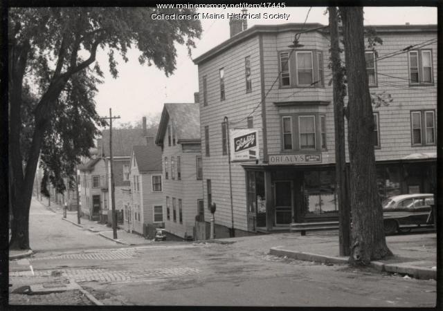
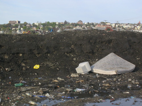
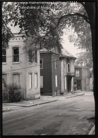
Below, another photograph from the same site of another spot on the former Franklin Street. It's hard to know exactly where, since the buildings, shady elm trees, and even the sidewalks have been gone for decades. For those readers who have never been to Portland, here's what urban renewal gave us instead: a grass median full of garbage, some scrubby trees growing over the old neighborhood's rubble, and four lanes of traffic unencumbered by crosswalks or sidewalks. Here's a photo (the Franklin Towers, Portland's tallest building and a fine example of Soviet Sentimental architecture, commands a fine view of the no-man's-land):


Note how all of these "slum dwellings" in the old photos bear striking resemblance to historic homes that now sell for over $1 million in surrounding neighborhoods. Way to invest in real estate, you jingoist highway-engineering dipshits.

Here's some good news, though: my new buddy Patrick writes about schemes to repair past urban renewal idiocy with a new Franklin Boulevard in the Bollard this week: read about it here. Tomorrow at the Franklin Towers will be a "revisioning workshop" to brainstorm new ideas for the blighted pavement - perhaps I'll see you there. Finally, here's a previous post about fixing Franklin Arterial.

Tuesday, May 29, 2007

Updates from the Rogue Blogger

Exciting news! While helping out at the farmer's market over the weekend, I heard from two separate sources that Chris Busby, editor of The Bollard, Portland's electronic news source, has been disparaging yours truly as "a rogue blogger." Yarr!

Busby's apparently upset about this article from last week's Forecaster, which broke the news of a newly-formed group that is organizing to oppose the Portland Public Library's move to a smaller and more expensive building away from Monument Square.

This very loose organization evolved from informal discussions between Jed Rathband, a local political consultant, and me. Basically, we griped about what seemed to be an impulsive decision that affects a very important public space, and we decided to do something about it. Hence, the PEEPs: Portlanders for Economic and Educational Priorities (Jed came up with the name a few minutes before the Forecaster's press deadline).

Now, even though we didn't really have a name, we did have several supportive individuals encouraging us from the get-go. Like us, they don't have a lot of time or resources to dedicate to the cause, but they do agree it's worth more discussion. We the PEEPs exist to vocalize these opposing views, which, we're finding, are more widespread than the conventional wisdom would have it.

But Chris Busby is definitely not down with the PEEPs. After hearing about our group's humble origins from Jed over a beer at the local watering hole for 30-somethings, the erstwhile amiable Busby reportedly went home and wrote an nasty letter to the editor of the Forecaster. He called for the original article's retraction, criticized reporter Kate Bucklin for writing it, and dismissed the PEEPs as the work of only two people: Jed and "a rogue blogger." Who is me.

Mr. Busby's criticism misses the mark, though. We'd heard from others who oppose the library's move before we had the idea for PEEPs, and following the publication last Friday of this op-ed column of the subject (take a moment to admire the solidity of its arguments and the well-formed prose), we've been hearing from more and more people who agree that the Library shouldn't spend a million dollars to move into a smaller space.

Chris Busby has been working hard to establish The Bollard as a legitimate alternative to other local news sources. This is someone who usually champions free speech and alternative media - so why doesn't he use his own forum to discuss the issue, instead of trying to meddle with the editorial decisions of another newspaper? It strikes me as being a little bit petty, and my esteem for The Bollard's been bruised a bit.

Besides, Busby doesn't know me well enough to realize that he's only encouraging me by labeling me a "rogue blogger." He might as well have called me Captain Awesome. So, lock up the women and children and stay tuned to this blog for more about the PEEPs, why the library should stay where it is, and other rascally roguery.

Tuesday, May 22, 2007

Take two of these pills, get plenty of rest, and DON'T TOUCH THE FLOWERS.


Mercy Hospital planted some lovely flowers right outside their main entrance a few weeks ago. There's nothing like some cheerful little violets pansies to lift the spirits of our sick and infirm.

Unless those flowers are drenched in pesticides. As these are.

The little sign says "CAUTION. Pesticide Application. Keep off [buster symbol] until 5/19."

This is the kind of profit-maximizing synergy we like to see in the modern health care industry: Mercy Hospital has got their landscapers drumming up business for the oncologists.

[EDIT 5/24: Correction: these are pansies, according to Dr. Turbo. Violets do not get planted in front of hospitals because they have been shown to have a greater effect than placebo flowers in lowering the spirits of the sick and infirm.]

Sunday, May 20, 2007

Sane ideas for the Adams School site

A couple of weekends ago I climbed to the top of the Munj to attend a community charrette for the future of the Adams school and the two blocks of East End neighborhood it occupies.

Billed as a workshop for "crazy ideas," the event was intended to guide the neighborhood association towards a set of goals and guidelines for a forthcoming Request for Proposals for the future development of the site. The ideas turned out to be not so crazy, for the most part - at least, no one proposed a space port or anything like that. More often, people struggled with the tradeoffs of more quotidian desires for a neighborhood with scarce land: Would the neighborhood like to see more housing or more parking? More retail space or more grassy lawns?

We split up into three groups, each of which was guided by some Muskie School planning students and an architect or two to put our ideas on paper. We began by ranking our priorities for the neighborhood: family housing came up most strongly, but so did environmental sustainability and open space.

The conflict between these values struck me early on. Every additional quarter acre dedicated to "open space" means one to three families who won't be able to live in the East End (and they'll likely move to the hinterlands of Scarborough or Standish instead - certainly less than a "sustainable" outcome). Besides, the Eastern Prom, one of Portland's biggest open spaces, is just a short walk away from the school in two directions.

But we also discussed how the East End's plentiful open space is actually used. As it turns out, a lot of it isn't very functional: the majority of it is just a pretty frame for views of the ocean or (in the case of the park on North Street) of the White Mountains. A lot of East Enders use their grassy "open space" primarily as a toilet for their pets, if at all. Even if that is a valid priority, people generally agreed that it shouldn't outrank the need for in-town housing.

But the Adams School's existing playground isn't just a grassy lawn (although the site does have one, and again, it's a dog toilet). It's also an active playground and basketball court that's still well-used even two years after the school's closure. This, it turned out, was what the neighbors in my group really valued: not an empty field faking pastoralism in the middle of the city, but a busy, public square where kids could play and neighbors could meet.

So this is what we came up with:


Triple-decker rowhouses (purple) front Vesper and Munjoy and a new pedestrian court between Beckett and O'Brien Streets. A sun-facing playground and plaza (orange-ish, with green trees) open up along the southern end of the pedestrian connection along Wilson Street, and facing the plaza are storefronts for local non-profits (in blue), topped by additional housing. Two alleys (also orange) through the site access flexible storage space (pink) that can be used as parking or as studio space, at the owner's discretion.

Nan Cumming, who attended as a neighbor but also happens to be the executive director of Portland Trails, advocated early on for connecting O'Brien and Beckett Streets as a pedestrian thoroughfare. Also, our group considered reusing the school, but ultimately rejected the idea in order to make the most of the real estate, recycle the old building's materials, and build new, efficient buildings instead. A sub-group discussed possible ownership models for the housing and concluded that the project should sell affordable, deed-restricted condos built for and marketed to young families.

Then we went to present these ideas to the other groups and hear about their own "crazy" (but not really) ideas. As it turned out, the other groups seemed to hold similar values: housing was definitely the most prominent element of every plan, as was a small playground or garden on the southern end of the site. The other two plans proposed reusing the existing Adams School building for "community" uses or as business incubators, but they also suggested hollowing out the middle portion of the building to provide the same pedestrian connection our group had proposed. No one wanted big parking lots (speaking of which, I wonder if anyone from Ocean Properties is reading this blog yet).

This site plan came from the same group that created the lovely adaptive-reuse drawing above. They've got housing on the north side of the site, along Munjoy, and above commercial uses on Wilson, plus an urban square in the middle and a garden to the south. The school building is would be reused for "community" uses, although I'm not sure how "community" uses would fill all that space and I can't recall the details of their presentation. They proposed adding a sort of pedestrian arcade through the building (see drawing above).

The final group had the prettiest drawings (in my opinion) and the most urban site plan:


They proposed four-story townhouses (top left drawing) along Wilson, Munjoy, and Vesper Streets, and a rehabbed school building with new additions for retail and business incubator space. I thought that their drawing of the reused school was particularly awesome (at right): a sort of warehouse/treehouse perches on top of the old school building with wind turbines.

However, all of the good-looking density that comes with this plan comes at a price: they proposed underground parking, which costs a lot more than surface-level lots or garages. While underground parking looks better, it would probably make the housing here prohibitively expensive for most people.

Now that the conceptual designs are in, the School Reuse Committee will consider the options in its final report to City Council, which will probably put out a Request for Proposals or a Request for Qualifications sometime soon.

Tuesday, May 15, 2007

Twilight for the Bayside Glacier

A couple of months ago I wrote about the Bayside Glacier, a three-story-high pile of snow formed by the plowing activities of Portland's Public Works Department.

Two months of spring weather have taken a big toll on Portland's last relic of the recent ice age. Compare the top left photo from March to the bottom right photo taken last weekend. The bulldozer, an important agent in the glacier's genesis and growth, provides a sense of scale.

As was noted previously, the glacier's ice had collected a good deal of debris as it traveled across city streets. Now, as the top layers of ice melt away, that debris is being deposited in a scattered "terminal moraine" of garbage at the melted edges of the glacier.

The amount of garbage in the terminal moraine is so substantial that some Portland residents seem to have mistaken it for a new city dump, and left their own deposits of heavier trash in the same place:


In this photograph, the melting glacier reveals the layers that scribe its formation: there, above the yellow trash bag, for example, is the stratum of the Valentine's Day storm. Rising above the conglomerate of ice and trash is the marquee of Portland's new Whole Foods Market (right) and the piles of scrap metal at E. Perry Metal Recycling (left).

Alpinists traveling over the surface of the glacier should exercise extreme caution, as the melting opens up hazardous crevasses that gape beneath the surface. I made sure that my footing was extremely secure before I took the photograph at right.

Sunday, May 13, 2007

Adaptive reuse

This is a McMansion built atop "Battery Cravens" on the northeastern side of Peaks Island (click the photo to enlarge and read the inscription on the entrance to the battery).

Built in 1942, this battery was one of several on the Peaks Island Military Reservation. It was intended to defend Portland Harbor and its wartime shipping traffic against U-boat attacks. Sixty-five years later, post-9/11 paranoiacs have seized this and other island fortresses as the ultimate defensible vacation retreat.

Nevertheless, these defenses proved useless against an architectural kitsch bomb packed with "New England coastal vernacular" shrapnel. Such senseless destruction... but Battery Cravens survives.


Thursday, May 10, 2007

This Is Broken: Tukey's Bridge (of Doom)

Tukey's Bridge crosses Portland's Back Bay between the Munjoy Hill neighborhood and East Deering. It also completes the circuit of Portland's very popular Back Bay running path and links into the Eastern Prom bike path. In short, it is an important and well-used connection in Portland's bike and pedestrian network.

It is also completely and utterly broken: poorly designed and maintained, inconvenient, and unsafe. The fact that so many people still use it nevertheless testifies to its importance as a connector between neighborhoods.

Here's a tour of the bridge from a pedestrian's and cyclist's perspective:

To get to the sidewalk from the south, one must either take the Back Bay path or, if you're coming from any of the neighborhoods on the north side of the bridge, cut through a parking lot and follow a dark, narrow path under an overpass (broken glass abounds, natch).

The bridge makes room for eight lanes of freeway and one meager sidewalk, which is only on one side of the bridge. For most of its length, the sidewalk only has enough room for two people walking abreast. Bicyclists, runners, walkers, and strollers passing each other in both directions are frequently forced to jockey for space: in traffic engineering terms, this sidewalk's level of service gets an "F".

A big part of the problem is the fact that there's no sidewalk for northbound traffic on the other side of the bridge. Cyclists headed north have the choice of breaking one of two laws: either ride (illegally) on the sidewalk that leads into the bridge from Washington Avenue, or stay on the right shoulder of the road, even for the 100 yards over the bridge where it's designated a freeway and bicycles are forbidden (I opt for the latter option, which is faster and safer to my mind).

Anyhow, continuing southward, bikes and pedestrians have a choice between peeling off onto the Back Bay/Eastern Prom trails or continuing on a narrower sidewalk along the off-ramp to Washington Avenue and the Munjoy Hill neighborhood. If you should choose the latter, you'll encounter this off-ramp to Anderson Street:

Note the beefy guardrails. Traffic here is only supposed to be traveling at neighborhood speeds at this point, but this road is obviously designed to encourage much faster traffic. Not that this could be at all related to the speeding pickup truck that hit me, dragged me along the pavement, and ran away just a few blocks down this same street (see previous post).


Because of the guardrails, bikes and pedestrians must cross the off-ramp at the crosswalk, which at least has a bright sign to get the attention of the hurtling traffic.


Once across the off-ramp, bicyclists have two unsavory choices: either continue up the extremely narrow and overgrown sidewalk, as this guy does, until the guardrail ends and you can hop onto the street.

Or, if you want to be legal, wait until the coast is clear...


At the other side of the crosswalk, make a sharp turn against traffic (keeping a sharp lookout to make sure there aren't any cars coming around the bend at 60 MPH)...


Make a tight turn around the end of the guardrail...


...and ride normally up the right side of Washington Avenue (presuming you haven't been vehicularly manslaughtered in the meantime).


The state DOT could easily and cheaply fix the latter hazard by cutting the guardrail at the other end of the crosswalk and installing a curb cut there where bikes can go directly from the sidewalk to the road. This would also make it easier for northbound cyclists to get onto the bridge path from the other side of Washington.

It's kind of a wonder our highway engineers didn't do this in the first place, but I've seen enough highway engineers to know that they aren't fond of using their legs.

I'll be sending this assessment to the following bureaucrats, and I'd encourage you to send your thoughts on this crossing to the same people:

Tuesday, May 08, 2007

Hit and Run

With the warmer weather, I've been bike commuting to work in Yarmouth three or four days a week recently. This morning, while approaching the bridge on Washington Avenue (near the old Nissen bakery), a road raging psychopath in a pickup truck sideswiped me with his (possibly her) trailer and dragged me ten yards down the street.

I'm fine - luckily it was chilly this morning and the pavement tore up my jacket, not my skin. The incident did fill me with some adrenaline-fueled rage at a certain cowardly hit-and-run motorist.

In almost ten years of bike commuting, I have never been hit until today. This guy hit me even though he had just honked at me and decided to pass anyway: clearly he saw me, and made a conscious decision to try to crowd me off the road. I have a hard time believing that both the driver or the passenger couldn't hear me yelling while they dragged me along the pavement at 25 miles per hour.

I've filed a police report, but the officer with whom I spoke told me not to expect swift justice - I didn't get the license plate number, and so I'm almost certainly out of luck.

That said, I'm going to provide a description of the truck here and hope that a witness might come through with an identification:

The vehicle was a green pickup truck - probably a Ford Ranger (similar in color and size to the truck in the photo, but without the canoe). It was towing a black trailer made of black metal grating, with 1 foot high railings around the edge. Some orange construction cones were in the bed of the trailer when it hit me, and there was a pudgy white-haired guy in the passenger seat (surprise, surprise - a dude of dubious virility riding in a pickup truck). If you see any similar vehicles with aggro drivers behind the wheel, it's worth calling the cops on speculation. Any evidence helps.

I wouldn't have much hope for justice if it weren't for this article about a hit-and-run driver in Oregon who was just sentenced to 9 months in prison thanks to the efforts of the local cycling community out there. If you know anything that might help my case, please call the Portland Police Department: 874-8601. Thanks, all.

Friday, May 04, 2007

Green design jumps the shark

A city as notoriously auto-dependent as LA needs lots of oil. But Angelinos are more aware than ever of the problems posed by their petrochemicals: the brown air, the time wasted in traffic, the asthma and obesity, the global warming, etcetera, etcetera. Increasingly, the freeways and drive-thrus that defined LA for much of the 20th century are becoming a point of shame.

So what's an Angeleno to do? You could join the growing legions of bike commuters, or ride the expanding transit network, but those things would require diversions from your lifestyle of conspicuous consumption. We're at war: this is no time to make sacrifices.

So LA's benevolent oil industry has come up with an easier solution: the "green" gas station.


Photo courtesy of LAist.

So now, as long as you don't think too hard about it, you can enjoy warm, fuzzy feelings knowing that those gasoline fumes are mingling under a canopy of solar panels, then virtuously relieve yourself on the low-flow toilets.

Of course, if your mind slips and fires a synapse during the whole process, you'll be knocked flat by the tremendous irony of a "green" gas station. Judging from the interviews in this NPR piece, a lot of customers are indeed skeptical of the whole premise.

The marketing has got to be tricky: drawing attention to the station's green design will also draw attention to the deleterious effects of the fossil fuels that it sells.

To avoid this conflict, the owner of the gas station, British Petroleum (BP), implicitly falls back on an older green-marketing strategy: people just need cars, they tell us. Not driving just isn't an option, but here's an eco-toilet to make you feel better.

This was essentially the message of an older BP print advertising campaign (at right: a BP stooge compares driving to chocolate).

BP is marketing this new gas station as merely "a little better." Sure, they tell us, gasoline is bad for the environment, but what are you going to do? Everyone needs to drive. And if your only real choices are between BP and the dingy Quik-Mart down the street, then sure, the gas station with solar panels would be the "environmental" option.

But there are alternatives to spending three hours a day in a car: there are sidewalks and bicycles, buses, trains, and neighborhoods with front porches instead of two-car garages. Even in Los Angeles.

The "green" gas station tries hard to hide the pollution behind its product, but it's going to be a hard sell.

Related:

Wednesday, May 02, 2007

Plum Creek III

The third version of Plum Creek's plans for the Moosehead region came out last Friday. It's too soon to know the ending of this saga, but the latest plan leaves things wide open for yet another sequel.

The most visible difference in the new plan, available at www.plumcreekplanmaine.com, is that several housing development areas have been moved from the more remote stretches of Moosehead and Brassua Lakes to areas closer to the towns of Rockwood and Greenville. At the same time, though, the new plan seeks a good deal more land to be rezoned for development, as well as a large increase (500 to 800) in the number of accommodations and condos at a resort proposed near Big Moose Mountain.

Predictably, Plum Creek is crowing that "the revisions would reduce shoreline development on Moosehead Lake and nearby ponds and lakes by 40 percent" (Mike Muzzy, senior manager for Plum Creek), while critics complain that "the plan would double the amount of land on which the project would be developed, from about 10,000 acres to more than 20,000" (Jym St. Pierre of RESTORE: The North Woods). Between these extreme perspectives lies the truth: the new revision doesn't really accomplish much of anything - and it almost certainly won't change anyone's mind about Plum Creek.

A local citizens' group, the Moosehead Futures Committee, has come up with a homegrown set of reasonable recommendations for growth in the area. The group represents diverse interests in the Moosehead region, and has crafted a plan that accommodates substantial new development without raising hackles in the environmental community.

Had Plum Creek adopted their proposal in the first place, their resorts would have been ready to open this summer. Instead, I suspect that the only ones building new houses are Plum Creek's planning consultants, who have secured a long and lucrative tenure through this whole process.

News reports of the new plan:
Plum Creek Revises Moosehead Plan, Bangor Daily News
Critics Not Swayed by New Plum Creek Plan, Portland Press Herald