Saturday, December 26, 2009

Portlandhenge: Winter Street


These photos were taken the morning after the winter solstice - December 22nd at about 7:30 am - on Winter Street in Portland, Maine.

As you can see, the length of Portland's "Winter Street" is almost perfectly aligned with the rising sun on the winter solstice (as well as on the days immediately preceding and following).

Coincidence?

More on Portlandhenge, Manhattanhenge, and other city-henges here.

Friday, December 18, 2009

Using Bikes, and the Social Web, for Environmental Monitoring

MIT's Senseable City Lab has a lot of great projects loosely organized around the idea that a proliferation of cheap sensors, hand-held electronics, and mobile networks offers people more ways to collect and interpret data about their city.

So, for instance, you can embed a cheap radio beacon into a piece of garbage and learn about your city's waste-handling practices (something that city governments rarely like to talk about publicly). The Senseable City Lab did it.

The Lab has a new project they're launching in Copenhagen now, in conjunction with the global climate suicide pact treaty negotiations.

Copenhageners love riding their bikes: it's the dominant mode of transportation in the city, and how 57 percent of workers and students commute. The Senseable City Lab designed a new bicycle wheel (pictured at right) that includes a small electric motor and a 3-speed internal hub, which can transform any bike into a hybrid human-powered/electric bike.

But the hub also includes a GPS unit and an array of environmental sensors that measure levels of pollutants like carbon monoxide and nitrogen oxides, plus temperature and weather conditions. As users ride through the city, they can share their data online with others, and offer real-time environmental transects on a daily basis.


As more users use the wheel and share their data, the city can get a bigger, more complete sense of environmental hotspots, how pollutant levels change over the course of a day, and how to better-manage pollution sources.


I want one. Imagine being able to do your environmental ground-truthing on a leisurely bike ride, or a crowd-sourced revelation of the embarrassing hotspot of volatile organic compounds (from the basement laundry) next to the luxury hotel downtown. I'm hoping these come to the mass market soon.

Wednesday, December 16, 2009

The Boom: Portland's Spoils of the Naughts

The naughts are almost over. This was the decade of the real estate bubble, but it would be easy to assume that the bubble passed by Portland, Maine. After all, the city's skyline, as viewed from Falmouth or across the harbor in South Portland, hasn't changed much in the past 10 years.

But take a closer look, by walking along the city's main streets and through its neighborhoods, and it's clear that Portland is substantially newer and more vibrant than it was in 1999, when I graduated from Bonny Eagle High School and left for college in that other Portland. Many of the buildings are the same, but they've been refurbished and re-inhabited with households and businesses that care more about them. And elsewhere, abandoned lots and under-utilized parking spaces have given way to new housing and businesses.

The Portland peninsula has sprouted dozens of new buildings in the past decade. Here are five of my picks for the best, in no particular order (I'll post five more in a follow-up post next week):

  • Bayside East. Corner of Smith and Oxford Streets, East Bayside. Designed by Scott Teas, TFH Architects. Completed 2008.

    While prosperity arrived in most of Portland's neighborhoods during the 2000s, East Bayside was largely left out. The neighborhood is centrally-located geographically, but it remains isolated thanks to the lousy ideas of 1960s urban renewal: a monopoly of government-owned housing and dead-end streets cut off by the wretched Franklin Arterial. It's Portland's most Detroit-like neighborhood.

    Bayside East is a another affordable housing project, but unlike its older neighbors, it doesn't look like one. The south-facing patio works well as a pleasant public space for the building's residents, and the solar hot water heaters take a prominent place as a sort of awning on the top floor.

    It's not at all flashy, but of all of Portland's new buildings, this one might be the most successful at integrating itself into the scale and context of Portland's central-city neighborhoods. It goes a long way towards healing East Bayside's tattered urban fabric.

  • 280 Fore Street, by SMRT Architects. Completed 2004.

    There was a time when banks invested in good, quality buildings to establish a public trust in the solidity of their institutions.

    During the 2000s, though, most banks were content to put up cheap offices ringed with drive-thrus. Banks literally sought to emulate fast-food joints, both in the facile idiocy of their products and in the shittiness of their architecture. And then they collapsed.

    Bangor Savings Bank wasn't immune from this impulse - they built Burger Bank franchises out on Brighton Ave. and over the bridge in South Portland's Mill Creek Strip Mall - but at least they put some effort into their downtown Portland branch and corporate offices. It's a quality building, and the curved acute angle of its northern corner adds a dynamic presence to the corner of Franklin and Fore Streets. I don't mind admitting that my admiration for the building led me to choose this bank over its competition.

  • 490 Congress St., by Jim Sterling. Completed 2007.

    Like the W.L. Blake Building addition below, this is an attractive modernist structure that fits in well with its historic surroundings on Congress Street. It's even more striking in the context of what it replaced, a pair of half-abandoned 2-story hovels that stuck out like a missing incisor in Congress Street's smile.

    The wide glass windows and striking metal siding probably make this building the city's most stereotypical example of naughts architecture. It's clearly making a hard sales pitch for "loft living" - you can even buy Eames chairs and contemporary art from the ground-floor retail tenants. Still, it's a damned attractive sales pitch, and even if it's a bit cliched I much prefer this to the urban abandonment that prevailed in the latter half of the last century.

  • W.L. Blake Building Addition, 79 Commercial St. By David Lloyd of Archetype Architects. Completed 2001.

    This was one of the first new buildings of the naughts, and it set a good precedent. The new building respects its historic neighbors on either side by adopting the same scale and massing. But it stops short of imitating their brick cladding and granite sills and lintels (unlike most other new buildings in the city, regrettably) with fine-looking building materials of our own era.

    The view from inside the offices must be incredible. But the view from the street ain't bad, either.

  • Unity Village, Stone, Oxford, and Cumberland Streets. By Winton Scott Architects. Completed 2001.

    At the beginning of this decade, the city was in the midst of a severe housing shortage, thanks to decades of pointlessly-restrictive zoning and a resulting lack of investment.

    Unity Village was one of the city's first proactive efforts to turn things around. City Hall offered up three city-owned parking lots behind city hall to developer Richard Berman (disclosure: I helped build his company's website) for a new, mixed-income housing complex. Today, it's a place where the newly-homeless can live comfortably and unassumingly next to white-collar downtown office workers and immigrant families. The homes have abundant porches that mesh the private life of the households with the vibrant public life of the narrow street and a nearby playground.

    If Unity Village hadn't been as successful as it is, the City could easily have slid back into the old habit of Not-In-My-Backyard zoning, which would have effectively stymied most of the other projects listed here. Instead, it helped spark the broader revitalization of Bayside. Unity Village demonstrated to Portlanders that new development - even if it brought poor people into the neighborhood - could be an improving asset for the community.

Wednesday, December 02, 2009

Condemned to Repeat It

Jess and I spent some time in Odesa, Ukraine last month. There are a few posts I'd like to write about the visit, but for today, I'd just like to share this photo of the city's memorial to its casualties of the Afghan War.

Out of sight to the left is a black marble monument (similar to our Vietnam War memorial) engraved with hundreds of names of the dead:


The figure depicted in the statue isn't merely a Soviet soldier. It's an allegory of a weary, disillusioned superpower facing its own mortality.

So, my fellow Americans - how does it feel?

Tuesday, December 01, 2009

Five Minutes on the Bosphorus

The Bosphorus, the narrow strait that connects the Black and Mediterranean Seas through the city of Istanbul, have been a critical shipping channel for millennia: a connection point between the historical empires of Europe and the Middle East, which in turn made Istanbul a capital of several of those empires.

Today, the strait is no longer the exclusive crossroads of global trade. But the Bosphorus is still busy, especially with container ships carrying goods to and from the busy ports of Odesa and Sevastapol in Ukraine, Novorossiysk in Russia, and Poti in Georgia. The chief exports of the latter two ports are petroleum products from the gas and oil fields of central Asia, bound for the West.

These Black Sea ports send huge tankers freighted with highly explosive compressed natural gas and oil to mingle with hundreds of fishing boats and passenger ferries carrying passengers between Istanbul's intercontinental neighborhoods. So far, somehow, there have been no major accidents.

Here's a five-minute time-lapse of the Bosphorus's shipping traffic from the middle of a weekday morning in October:


Tuesday, November 24, 2009

Archaeology of the Space Age

In the previous century, our ancestors went to the moon.

They left Earth in antique capsules perched on top of a million pounds of explosives - the largest rockets ever built.

They navigated with wristwatches, slide-rules, and primitive computers with less processing power than a basic cellphone.

And they took pictures. America's first unmanned satellites carried chemical darkrooms on board, where film was developed, translated into radio waves, and beamed back to Earth. On the ground, the satellites' analog photographic data was stored on magnetic tapes.

And then we forgot about them.

The original data for our earliest pictures of the moon, like the one at left, were very nearly lost - the tapes were filed away, and the machines necessary to translate them into images again were discarded as government surplus.

But a few years ago, a team of technological archaeologists, working in an abandoned McDonald's restaurant, recovered the tapes and painstakingly re-constructed the antique equipment required to translate their data into images.

The Apollo-era tape-readers themselves had been saved by a former NASA planetary phtographer, Nancy Evans, who stored several of the wardrobe-sized machines in her garage for decades in the hope that someone, someday, would want to recover the photos.

It's a pretty remarkable project - as though the complete journals of Sir Walter Raleigh had been found written in an obscure Elizabethan code, and the only way to translate the treasure were by refurbishing a heavy cabinet full of derelict gears and pulleys that someone had found in a cobwebbed dungeon of the Tower of London.


The archivists are working not in a museum, but in a defunct burger joint, with the tapes piled on the floor next to the grills, and a pirate flag hanging from the window. In this headquarters of the Lunar Orbiter Image Recovery Project (LOIRP), workers are rehabbing the old machinery with the goal of recovering and digitizing the old images in their original level of detail.

It's a digital archaeological expedition: recovering precious artifacts of the space age, using machines whose operations have been forgotten, in a fast-food ruin.

The Lunar Orbiter missions produced images of extremely fine detail in order to scout landing and exploration sites for the manned missions. In fact, one reason behind the restoration project is because they're still some of the most detailed images we have of the moon's surface, and NASA is interested in going back.

At the time, due to security concerns about revealing the capabilities of American satellites, the public only ever saw second-hand images - photographs of the original photographs. The LOIRP project will not only digitize these landmark images; they'll also make them available to the public for the first time in all their glory.


Above: crew sleeping quarters and tapes in the McDonald's kitchen. Each canister contains one photograph's worth of data. Photo by jurvetson on flickr.

Read more:

NASA: LOIRP images

KN6DJMJUJGFU

Sunday, November 22, 2009

The Skies of L.A.

Last month in Houston I met the author of L.A. Places, a blog about the city's most interesting buildings, public art, hikes, and parks. It makes me want to visit southern California again.

I really liked her photos of these murals inside the public transit agency's headquarters building. They are titled "Los Angeles Circa 1879, 1910, 1950, and after 2000," respectively, by James Doolin.

"Los Angeles, Circa 1879":

"Los Angeles, Circa 1910":

Los Angeles, Circa 1950:
"Los Angeles, Circa After 2000":
What I really like about these murals is how LA's atmosphere is as much of a character as the city itself. As the city grows from a landscape of farms to a landscape of freeways, the sky above it transforms from a pristine blue to a smoggy, orange blanket of haze. The last mural - depicting the city as it is today - looks like something out of Blade Runner.

You can see more murals from LA's transit stations, and lots of other awesome things in Los Angeles, at Vanessa's blog.

Thursday, November 19, 2009

Foreshadowing from 1962

Grist uncovered this ironic ad for Humble Oil (motto: "Happy motoring!") in a 1962 back-issue of Life Magazine on Google Books. Incidentally, Humble was one of several companies that would merge to become ExxonMobil.


Wednesday, November 11, 2009

Canada's Skateways


I love winter - it's a big reason I left Houston and moved home to Maine.

But the Canadians really know how to enjoy the season. In Ottawa, for instance, the frozen Rideau Canal becomes a 5-mile long skating rink every winter. The "Rideau Canal Skateway," pictured above, extends from the campus of Carleton University south of the city center to downtown's Confederation Park, just three blocks away from Canada's Parliament Hill.

This means that Ottawans who live in the city's inner neighborhoods and work downtown are actually able to commute by ice-skates in the winter. And many of them do.

I was going to make this post exclusively about the Rideau Canal, until I found that the city of Winnipeg has copied the idea and gone one better, by opening "the world's longest skating rink" (1 mile longer than Ottawa's) on that city's frozen Assiniboine River. The Assiniboine River Trail, mapped below, is more of a skating path than a skating rink, but the idea of skating to cover long distances is the same.


Winnipeg's skating path extends from Assiniboine Park, not far from the airport in the city's western suburbs, to The Forks, where the Assiniboine meets the Red River. Along the way it passes through several city neighborhoods, and skirts past the southern boundaries of the Manitoban capitol grounds and the downtown business district.

Here's a time-lapse trip down the Assiniboine skate path from YouTube:


Writing this post makes me look forward to winter even more. So when is this good idea from the Canadians going to catch on south of the border?

Thursday, November 05, 2009

Baggers

PBS has recently been broadcasting a long documentary series called National Parks: America's Best Idea. I haven't seen it, but apparently one of the co-producers, a fellow named Dayton Duncan, took it upon himself to visit every one of the nation's 58 national parks as a lifelong project. This effort was chronicled in an article headlined Collect 'Em All, published in the July-August edition of the Sierra Club's magazine.

"Collect 'Em All"?

In response, Utne Reader published a good critique by its senior environmental editor, Keith Goetzman. "Park bagging," the act of collecting visits to every park, requires a lot of gasoline and a lot of vacation time, he points out, which makes it an elite and environmentally-unfriendly pursuit.

But his last point is his best one: "The “collect ’em all” mentality goes against a better, nobler impulse, which is to get to know the land intimately," he writes.

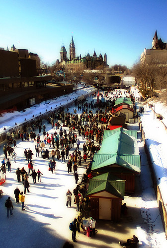
When Jess and I worked in the White Mountains of New Hampshire, we encountered hundreds of "peak baggers" trying to collect all 46 of the state's 4000-foot mountains. Most of them were total douchebags, although, for the sake of full disclosure, I have to admit that I myself climbed the 46 peaks through the course of high school. But back then, I also thought that Ayn Rand was a good writer, so there you go.

Grand Canyon National Park, from Wikimedia Commons.

Anyhow, I have lots of stories about New Hampshire peak baggers. Like the crowd of 20 people that showed up at Zealand Falls Hut one bitterly cold and windy Saturday in January, dead-set on finishing a 20-mile loop to "bag" Guyot and Bondcliff mountains with their huge newfoundland dog, Brutus.

Brutus, they told me, was going to be the first dog to "bag" the 46 peaks in the winter season. This was very important to them. I responded that there were 60 mile an hour winds above treeline, which meant that their planned itinerary would leave them exposed to negative-50 degree windchills for several miles on the ridge. "Don't be stupid," to paraphrase.

They opted to be stupid, of course. They were too late coming back to stop by the hut again, but I heard later through the grapevine that they'd had a miserable trip, and they'd come quite close to leaving a big dog's frozen corpse on the ridge.

Safety and common sense aside, what's really problematic about the baggers' attitude is how it reduces these places - mountain peaks or national parks - to petty consumption items, things to be ticked off on a list, like beanie babies.

This is entirely antithetical to environmentalism, which requires a nuanced and thoughtful understanding of the natural resources and landscapes that surround us.

The National Parks themselves are fetish objects for most environmentalists. Sure, I like them too. Their spectacular landscapes really do inspire a lot of people, including a lot of legendary environmental thinkers like John Muir.

But the National Parks are a lousy place to understand our modern society's real relationship with nature. They don't really offer any lessons about where we get our electricity, or our drinking water, or the raw materials that the Chinese use to forge our consumer goods. Instead, the National Parks offer us an unrealistic vision of the way environmentalists wish things were - a pretty backdrop without any people in it. At their worst (as when the federal army forcefully exiled native tribes like the Blackfoot from parks like Yellowstone and Glacier), the parks themselves could be thought of as costly consumption items tailor-made for "environmentalists."

Organizations like the Nature Conservancy are focused on acquiring land for the cause of environmentalism; hikers acquire mountain climbs; RVers acquire National Park passport stamps. But an environmentalist ethic that's focused on acquisition is an ethic that can not and will not address the fundamental environmental crises of our times.

Tuesday, November 03, 2009

Houston, in bumper stickers

I'm back from a long month of being away from home, thanks to various projects and vacations. The good news is that all of the travel has given me lots of things to write about.

Two weekends ago Jess and I were in Houston for Seth and Maria's wedding. It was really fun, and reminded me how much I love that city. Here's the back of a minivan I found parked in the progressive/gentrifying Montrose neighborhood:


Sure, it's a bit of a contradiction. But when your city is the "energy capital of the world," home to most of the global economy's biggest energy firms as well as dozens of refineries and power plants, you'll find a lot of opinions about energy policy. I certainly don't always agree with them, but I certainly wouldn't dismiss their ideas out of hand, either.

The desire to choose clean wind energy AND drill more oil wells probably reflects this car owner's opinion that what kind of energy we burn is less important than where we get it from - and that it's better to generate energy close to home than import it from dangerous overseas petro-states.

I half agree with this sentiment. If we must burn oil (and it's the rare environmentalist who does not), it would certainly be better if we produced that oil close to home, so that we can at least be honest with ourselves about the consequences of oil extraction and refining, instead of exporting those problems Somewhere Else.

As it is, most of Houston's air pollution, which is some of the worst in the nation, comes from its cluster of oil refiners, which supply gasoline and heating oil to the rest of the nation. Because New England wants gasoline, but doesn't want oil refineries, we're effectively exporting train-loads of toxic air pollution to poor areas of East Texas and Louisiana. [see "Exporting Pollution to Dixie," December 2007].

By producing and refining much of their oil locally, at least Texan consciences can be cleared of our blue-state petro-hypocrisy. I suspect that if any New England or "left-coast" state were forced to refine its oil products locally, they'd probably get a lot more serious about reducing their oil consumption. As it is, they're happy to make it Texas's problem, and Texas is happy to take their money for it.

Besides its slightly more honest position in the sad story of America's oil addiction, the Lone Star State also produces more wind power than any other state (almost three times more than California, the second-biggest wind power producer).

Saturday, October 03, 2009

Out of the Office

I'm headed out this weekend on a trip through northern Maine's "100 mile wilderness," the northernmost section of the Appalachian Trail between Monson and Katahdin.

I'll be incommunicado for the next 8 days but hope to return with lots of new blogging material about nineteenth-century logging artifacts, remote hunting camps, and moose in rut.

Thursday, October 01, 2009

The Future Portland, Oregon, as Envisioned by Robert Moses

The other Portland's weekly Mercury published a great article last week about that city's planned-but-unbuilt freeways. The west-coast Portland is very much in love with itself in general, but the fact that it had the foresight in the 1970s to reject millions of dollars in freeway funds, and re-appropriate the money for the first line in its growing light rail network, is something that it should legitimately be proud of. In the decades since, a number of conventional-wisdom-bucking decisions like this one have made the city what it is today, a leader in urban planning and design.

Before the city abandoned its plans for the Mount Hood Freeway or tore out its waterfront Harbor Drive expressway, though, it was gleefully subscribing to the same happy-motoring, urban-renewal fads that poisoned so many other American cities in the second half of the twentieth century. During World War II, the city commissioned an infrastructure plan from Robert Moses, the same "master builder" who bulldozed hundreds of New York City blocks in order to build new freeways to the suburbs of Connecticut and Long Island.

In a follow-up blog post, Mercury writers posted a PDF copy of the Moses report, which calls for an inner-city loop of grade-separated freeways around Portland's downtown. This loop actually did get built in a slightly modified form, as Interstates 5 and 405.

It's striking to see how the city developed in the neighborhoods where actual freeway construction deviated from Moses's plans. Moses's proposal for an East Side freeway probably would be more appealing to Portlanders than what actually got built: while Moses suggested a route through the industrial neighborhood a few blocks away from the river, the city built the freeway right on the Willamette's eastern bank instead.

Moses also proposed a "Foothill Thruway" that would hug the base of Portland's West Hills, through the neighborhoods of Goose Hollow and cutting diagonally through the city's tony NW 23rd Avenue neighborhood. Here's an illustration from the report:

The caption is vague, but by reading the report's description of the proposed route ("a crossing of Burnside Street near the intersection of King Street... crossing Jefferson Street between Eighteenth and Nineteenth Avenues") and looking at maps, this seems to be a westward-looking view of the Goose Hollow neighborhood. I think that the stadium visible at the lower edge of this drawing is today's PGE Park, next door to the Multnomah Athletic Club, a country-clubbish place where I worked through college as a lifeguard. Here's what the neighborhood looks like today:

High-rise condos and apartment buildings occupy the land that Moses had envisioned for freeway on-ramps, and the neighborhoods of Northwest Portland that would have been bulldozed now host some of the city's most valuable retail and residential properties.

Not to say that the city avoided the destruction altogether; the foothills freeway became I-405, which required the demolition and excavation of about 50 city blocks along the western edge of downtown in the mid-1960s.

In a failed bid for the 1968 Olympics, city boosters/saboteurs published a much more ambitious freeway-development plan, which included the infamous Mount Hood Freeway and many others. Oregon's Cafe Unknown blog has a history of the Olympic bid and a few images from the city's Olympic plans, which mostly consist of suburban stadia surrounded by huge parking lots. A map of the ambitious plans for the freeway network is about 2/3rds of the way down the post.

Moses's report was published in 1943, about a decade before the freeway construction binge caused by Eisenhower's interstate highway development bill. In addition to the freeway plans, Moses included a lot more mundane and uncontroversial advice for improving parks, playgrounds, and sewers.

Still, as commenter "atomic" notes in the Mercury's blog post, it's "strange to think that something so apocalyptic was going on in Europe and Asia, and dudes over here were planning how we were going to manage traffic jams when we were done with it."

Thursday, September 24, 2009

Cryptozoology

I've just learned that THE International Cryptozoology Museum will be opening a permanent exhibit space just two blocks away from my apartment in downtown Portland, Maine.

(logo courtesy of Loren Coleman, www.cryptomundo.com)

Local cryptozoologist Loren Coleman has an impressive collection that includes life-sized Bigfoot replicas, lake monster models, and a Coelacanth, among many other curiosities. These objects had been crowding his living room (BoingBoing wrote about a visit to his home two years ago), where he'd offered private tours of the collection by appointment. The new museum space on Congress Street, in the middle of the city, will give his exhibits a more prominent, public display.

Coleman, the museum's founder, also blogs about cryptozoology at the website www.cryptomundo.com. A blog post announcing the new museum was published two weeks ago:
The mission of the museum is to share the many items I have collected during the last half a century, with tourists, teachers, researchers, scholars, colleagues, students, documentary filmmakers, news people and the general public...

[the collection includes] hundreds of cryptids toys and souvenirs from around the world, one-of-a-kind artifacts, a life-size 8 feet tall Bigfoot representation, a full-scale six-foot-long coelacanth model, over a hundred Bigfoot-Yeti-Yowie footcasts, jackalopes, furred trout, along with such Hollywood cryptid-related props as The Mothman Prophecies’ Point Pleasant “police” outfit, the movie P. T. Barnum’s authentic 3.5 feet tall Feejee Mermaid, the TV series Freakylinks‘ 11 ft long “Mystery Civil War Pterodactyl,” and some of the movie Magnolia’s falling frogs.
The museum is also looking for donors: "For any patron who wishes to send in a donation of $1000 (one thousand dollars) or more, I shall be sending to you ~ anywhere in the world ~ a first generation copy of an Orang Pendek footcast," writes Coleman. If you're interested, follow this link.

Coleman at his home, which he had been sharing with the museum's collections. Photo by Amber Waterman of the Lewiston Sun-Journal.

Coleman seems aware that his field is substantially influenced by pop-culture silliness, and to his credit he seems OK with that.

But cryptozoology is really interested in making new zoological discoveries, and there's still plenty we don't know about the world's biological diversity. A recent post on Coleman's blog heralds the official scientific description of a new deepwater species of ghostshark, and the museum's logo (above) features a Coelacanth, a species known only from prehistoric fossils, and believed to be extinct, until fishermen caught a live specimen off the South African coast.

If modern science can discover a living fossil, who's to say it won't someday discover the real Abominable Snowman?

Wednesday, September 16, 2009

The Recession Armada and Air Force

A fascinating article in Britain's Daily Mail describes the enormous armada of cargo ships that have been idled off the coast of Signapore for the summer (thanks for the tip, Jim).

Above: idle cargo ships off the coast of Signapore.

"Their numbers are equivalent to the entire British and American navies combined; their tonnage is far greater," writes reporter Simon Parry. "Container ships, bulk carriers, oil tankers - all should be steaming fully laden between China, Britain, Europe and the US, stocking camera shops, PC Worlds and Argos depots ahead of the retail pandemonium of 2009."

Of course, the pandemonium of 2009 turned out not to be the sort where frenzied shoppers mobbed shopping malls. Asia won't underwrite our credit card debt and lousy mortgages anymore, which means we can't afford to by container-loads of their manufactured goods.

The Daily Mail article also notes that these ships are being manned by skeleton crews, doing basic maintenance and guarding against piracy. What an incredibly lonely job that must be - it must be kind of like working as a salesperson at Sears (right: inside the Schuylkill Mall, courtesy of DeadMalls.com).

The cargo armada off of Signapore isn't the only idled fleet of the recession, though. Seeing all those ships reminded me of Don Delilo's Underworld, a novel in which there's a character who re-paints and arranges abandoned airliners as huge landscape art pieces in the Mojave desert. Such aircraft boneyards really do exist in the desert southwest, and sure enough, they're filling with new arrivals during this recession. Via an April CBS News report:
The number of planes in storage has jumped 29 percent in the past year to 2,302, according to aerospace data firm Ascend Worldwide. That includes 930 parked by U.S. operators alone....

That makes for busy times at facilities like Evergreen Maintenance Center near Marana. Its super-sized hangar fits a 747, and there are plenty of active planes on hand, including one 747 used to test Pratt & Whitney engines and another converted to fight forest fires.

But outside there's a ghost fleet of 204 parked planes. Some of Northwest's retired 747s are here. Planes from defunct ATA Airlines, 767s from Air Sahara and MaxJet, and a hodgepodge of other airlines from around the world are here, too.
Here's a glimpse through the fence from Flickr user DannyMcL:

And here's another particularly good photo of the Mojave airliner storage lot. Enjoy!

Tuesday, September 15, 2009

Cities, Buried by Signs

"Your gaze scans the streets as if they were written pages: the city says everything you must think, makes you repeat her discourse, and while you believe you're visiting Tamara you are only recording the names with which she defines herself and all her parts. However the city may really be, beneath this thick coating of signs, whatever it may contain or conceal, you leave Tamara without having discovered it. Outside, the land stretches, empty, to the horizon; the sky opens, with speeding clouds."
-Italo Calvino, Invisible Cities
They say that if you take someone who has never been to New York City, but has watched plenty of American movies - a Korean shopowner, for instance, or a Greek hotel clerk- and dropped them in the middle of midtown Manhattan, they would not feel completely lost, because American movies have created a global, subconscious familiarity with the city and its landmarks.

It's possible to wander through Harlem and navigate by landmarks like the university from Ghostbusters and the diner from Seinfeld, for instance, or to navigate through Central Park by recognizing the places where Harry Met Sally or where Macaulay Culkin feeds the pigeons in Home Alone 2.

In most movies, though, the city is only a backdrop. In my experience, books can have a bigger impact on how a city feels, especially with authors who create a strong sense of place in their writing - as though the city itself becomes a character.

Via the Strange Maps blog, I've come across two "literary maps" of cities with strong presences in literature. Here's one of San Francisco, originally published in the Chronicle earlier this summer:

The quotes in this map roughly match the neighborhoods they reflect: Joan Didion's passage about Janis Joplin singing in the Panhandle spans the southern edge of Golden Gate Park near Haight-Ashbury, and a Kerouac quote spans the Russian Hill neighborhood where the beat poets lived.

Today, of course, both Haight-Ashbury and Russian Hill are the opposite of bohemian, full of franchise stores and yuppies with expensive cars. And yet the song lyrics and sentences we've read about these places still somehow imbue them with a bohemian aura, contrary to all reality: aging hippies still come to Haight-Ashbury, wander among the high-end restaurants and boutiques, and manage to keep a few holdout head shops in business.

So where is the real Haight-Ashbury - the neighborhood that exists independently of the writers and musicians who wrote about it? Are the hippies and head shops merely the ghosts of the neighborhood that Joan Didion and Hunter S. Thompson wrote about? Or are the fancy boutiques the impostors, there only because the Haight has become a cultural icon and hence a desirable neighborhood?

Thinking about it, I've concluded that both of these are true: Haight-Ashbury has become a product of our cultural expectations of it. The "real" neighborhood isn't so much concealed by the "thick coating of signs" by which we know it, as defined by it. It's no wonder that these kinds of places in our cities - Times Square, The Alamo, the Las Vegas Strip, and all the other places we think we know from books, movies, or songs about them - can simultaneously feel very familiar and very strange when we finally experience them in person.

Here's another literary map of Saint Petersburg, a city with a much richer literary tradition than San Francisco's. Unfortunately, I've never been there - my understanding of St. Petersburg is completely defined by what I've read by Pushkin, Gogol, and Dostoyevsky. I studied Russian in college, but a part of me is actually afraid to visit the real St. Petersburg, lest I ruin the glorious nineteenth-century city of my imagination.

The St. Petersburg map is a limited-edition print, and if you really love this blog and want to give the author a great surprise, feel free to send a copy to 64 Winter Street, Portland, ME 04102.

Thursday, August 27, 2009

The Aral Sea Is Gone

Via NASA's Earth Observatory, an image of the (former) Aral Sea, this August:


Near the dry harbor of Aral, Kazakhstan. Via Wikipedia.
The Aral Sea used to straddle the border between Uzbekistan and Kakakhstan as the world's fourth-largest saltwater lake. A Soviet industrialization program in the 1940s diverted most of its source water to irrigation projects for thirsty cotton farms in the desert. By the 1960s, most of the sea's water supplies had been diverted, and it began to shrink.

As the sea evaporated, a new desert, known locally as the Aralkum, took its place. The desert's soils consist of fine marine deposits mixed with highly polluted runoff from the former industrial cotton farms that used to surround it. Massive dust storms have blown this soil and its pollutants all over the world. The disappearance of the Sea has also removed a tempering influence on the regional climate: winters are now colder, summers are hotter, and there's less rainfall. Ironically, these problems haven't helped the industrial cotton farms that continue to divert water from the former sea's source rivers.


The Aral Sea seen from space in 1985. Via Wikipedia.
At the same time, as the lake shrank, its waters became increasingly saline. The water that remains in the disappearing southern lagoon is now three times saltier than typical ocean water.

The Kazakh government has undertaken a number of projects to restore the northern part of the sea, where water levels have recently stabilized and a fishing industry has even been able to re-establish itself. But the much larger southern portion has been written off as a lost cause, and continues to shrink at rapid rates.

Pretty amazing: in roughly half a century, a sea that was once the size of Missouri has essentially disappeared.

So long, Aral Sea.
We hardly knew ye.

Monday, August 24, 2009

A Field Guide to North American Seafood Menus


The Monterey Bay Aquarium has put together a consumers' guide to sustainable seafoods. The idea is to encourage grocery shoppers and restaurant patrons to support responsible fisheries, like wild Alaskan salmon, and to avoid fisheries that are environmentally harmful or near collapse, like farm-raised Atlantic salmon.

Snapper, Red

Rating: Avoid


Red snapper is in decline worldwide, and fishing pressure on this species remains excessive. Red snapper should therefore be avoided.

Market Names:
Mule Sow, Rat, Tai, American Red Snapper
The guides started as printable pocket versions that you could fold into your wallet and consult at the supermarket. But now there's an even better, more discreet version for mobile phones, accessible at mobile.seafoodwatch.org (part of the mobile-phone webpage about Red Snapper, a species that's in serious decline, is shown at right). Or, if you prefer, get the iPhone app. There's even a guide tailored for sushi restaurants that translates common Japanese fish names.

These guides are meant to accompany your menu at the restaurant, but I find them pretty fascinating in their own right. For instance, the Aquarium's guide for the Northeast region endorses Pacific halibut as "best choices," but we're advised to "avoid" Atlantic halibut and flounder caught here in the Gulf of Maine.

Clams (both farmed clams and wild steamers) are also endorsed as a "best choice." Which is good news, as long there's no red tide.

And Monterey is lukewarm about Maine lobster, a fishery that's long been hailed for its socially-driven sustainable management techniques. Maine lobster ranks as merely as a "good alternative," not as one of the "best choices," since the "current population status is considered weak or unknown" and there are concerns about right whales getting trapped in the buoys and lines attached to traps. Haddock also falls into the middling "good alternatives" category, with the caveat that "the majority of U.S. Atlantic haddock is caught using bottom trawl gear [which causes] considerable habitat damage to seafloor habitats."

So maybe I'll switch my preferred clam-shack order from fried haddock with tartar sauce to fried clams, and just opt for salad during red tides or after big rainstorms.

If you're a chef looking for sustainable-fisheries cred, Monterey Bay and a number of other marine research institutions also recently launched fishchoice.com, a tool for restaurants and other commercial seafood buyers.

Wednesday, August 19, 2009

Why I Lately Haven't Been Blogging As Much As Usual

In a couple short months, when it's 36 degrees and freezing-raining and you leave work in the dark at 4:30, are you going to be saying to yourself, "I can't believe I didn't go to the beach after work that day while the water in the ocean was twice as warm as it is outside right now."

OR would you rather say to yourself, "Look at this tan I still have, even in November!"

Carpe diem, buddies.

Sunday, August 02, 2009

Beneath the corn, the husks of ancient Venice

This is a farm field near the small village of Altino, Italy, about two miles northeast of the Venice airport, and a mile from the northern edge of the Venetian lagoon:


Look carefully at this aerial view and you can see lines of darker and lighter vegetation slicing across the crop rows. This week's issue of Science magazine features an article by Paolo Mozzi, an Italian geomorphologist who surveyed this same field with infrared cameras during the severe drought of 2007 to analyze subtle variations in plant hydration.

He was looking for crop marks, an archaeological technique that looks at variations in plant health on the surface as a way to discover ancient walls and building foundations that have since been buried beneath three feet of soil. At right is a sketch from Wikipedia that shows how it works: a stone wall just below the surface (on the left side of this sketch) limits the amount of topsoil and stunts the growth of the plants growing above, while an old ditch (on the right) helps the plants above it grow taller with extra topsoil.

Here's what Mozzi's infrared survey found:


This is the ancient Roman city of Altinum, a place that became an important strategic and commercial center thanks to its position at the edge of the Venetian lagoon and at the crossroads of the empire's Via Annia and Via Claudia Augusta. In the fifth century C.E., it and several other Roman cities nearby were conquered and burned by Attilla the Hun, and subsequent barbarian invasions from the north forced the Romans to retreat from the mainland cities to the marshy islands of the lagoon.

Altinum was abandoned completely by the 11th century, but its island refugee settlements grew in size and prosperity to eventually become the city of Venice.

The Roman historian Strabo wrote that "Altinum too is in a marsh... and hence subject to inundations"(see note below). The engineering behind the canals of Venice was pioneered in Altinum, where the Romans built a network of canals to drain the marshes and carry the water away from their buildings. One of the canals is clearly visible in the infrared image above, and, if you know where to look, it's also visible as a slightly darker band of green in the aerial view at the top of this post. When the Romans left, the canals filled in and the marshes took over once again, until the nineteenth century, when the land was reclaimed for farms.

This makes Altinum one of the few Roman cities that wasn't subsequently buried underneath more modern settlements. Instead, it sank into the marshes, only to be re-discovered a thousand years later as a shadow cast over an unwitting farmer's agricultural yield.


Note: Here's the translated source text from "The Geography of Strabo." Strabo calls Altinum similar to the nearby city of Ravenna, which sounds even more like modern Venice: he calls it "a city built entirely of wood [another possible translation is "built on piles"] and coursed by rivers, and it is provided with thoroughfares by means of bridges and ferries. At the tides the city receives no small portion of the sea, so that, since the filth is all washed out by these as well as the rivers, the city is relieved of foul air."

Wednesday, July 15, 2009

Picket Lines and Prairies

Above: An unmown pedestrian bridge in Windsor, Ontario.
Photo courtesy of
wreckingball.org

In Windsor, Ontario (the city directly across the river from Detroit), 1,800 municipal workers have been on strike for several months now. Among other things, this means that no one is mowing the lawns in the city's parks, which are transforming from riverfront esplanades and soccer fields into wild prairies as the summer wears on.

The re-wilding of Windsor's parks has inspired some nice nature writing from Anne Jarvis, a columnist from the Windsor Star, and her readers:

At first, the flood of comments and letters on the strike by 1,800 city workers, including those who cut the grass in the usually manicured parks, expressed anger about the unsightly overgrowth.

Then the grass matured, the wildflowers began blooming and wildlife returned. And the letters began to change.

This one is almost poetic in its description:

"The long grass is now home to so many singing birds and insects and there is such a wide variety of colourful native plants in bloom. The wind can be heard as it blows through the grass ... Such a difference from the plain, flat and empty space it was before."

The park? The soccer pitches at the Ford Test Track [which is exactly what it sounds like: a former proving ground for Detroit's dying manufacturers] in the heart of the city.

"Today was the first time that I have ever considered that park to be beautiful," wrote the woman.

A colony of bobolinks and some eastern meadowlarks, declining species known and loved for their beautiful song, were discovered there last month. They surprised and delighted birdwatchers. A grassland species, they're rarely seen in the city because there isn't much grassland.

I found out about Windsor's strike and unintentional re-wilding project via the Broken City Lab, whose latest project has been to unofficially recognize the city's overgrown meadows with these signs, which they designed and installed themselves:

Above: Strike commentary from Windsor's Broken City Lab.

I love how these signs tweak peoples' perceptions of these places: suddenly, it's not an overgrown lawn or a symbol of municipal neglect: it's a wildlife refuge!

As the Summer Without Lawnmowers wears on, people in Windsor are growing fond of the new wildflower meadows and flocks of bobolinks. In the same Windsor Star column, Jarvis reports that the City has resolved to leave a couple hundred acres of parkland unmown, even after the strike eventually ends.

Wednesday, July 08, 2009

Oil Companies Get Weird

Climate change is doing strange things in Texas.

In the panhandle town of Sunray, Valero Energy Corporation operates an oil refinery that dates to the 1930s and is capable of processing up to 170,000 barrels of oil a day into gasoline, asphalt, and other petroleum products. The refinery is a large industrial operation that uses a lot of electricity: a typical monthly bill runs to about $1.4 million.


Strange neighbors: photo by Michael Schumacher of the Amarillo Globe News.

So Valero recently decided to upgrade the refinery with a $115 million investment that will cut its energy costs dramatically. This month, Valero began operating six wind turbines on the site, which is now also the company's first wind farm. Unlike other wind farms that sell their power into the regional power grid, this one will be primarily devoted to powering the large refinery right next door. By the end of next year, Valero plans to add another 27 turbines, which would make the wind farm capable of powering the entire refinery whenever the wind is strong (the company expects this to be the case 40-45 percent of the time).

Unlike prior efforts from Big Oil (remember the "green" gas station?), this one seems to be a legitimate business effort, not a greenwashing public relations stunt. The company's publicity for the project amounts to a no-frills corporate press release buried in the depths of Valero's web site, and little else. In a recent Wall Street Journal article, the refinery's manager dismisses warm and fuzzy motives for the project: "We didn't build the wind farm so we could get into the wind-energy business. We built the wind farm so we could support the refinery and run it more economically."

Of course, the wind farm is still being used to produce gasoline, and the combustion of refined oil for transportation accounts for nearly a third of the nation's greenhouse gas emissions. But the wind farm replaces energy that Valero had previously bought from Wyoming coal-fired power plants and had delivered over hundreds of miles of transmission lines (along with significant energy loss along the way). So, even though Valero is still manufacturing atmospheric poisons, at least they'll be burning a lot fewer atmospheric poisons in the process.

And here's another story of weird behavior from an oil company: ExxonMobil, the fossil fuel giant that's historically been the most outspoken denier of global warming (the company continues to fund global-warming-is-a-hoax conspiracy theorists at places like the Heritage Foundation) last month announced a partnership with an electric car company to make a fleet of rent-by-the-hour battery-powered cars available to the public in Baltimore.

ExxonMobil has invested $500,000 in the project, which is roughly how much money the company takes in every 45 seconds. Still, it's strange to see them investing in technology and a business model (carsharing) that are designed to reduce demand in their primary product. ExxonMobil is making a very small hedge against the risk that they'll turn into the next Chrysler or Kodak.

It's probably too soon to say for certain, but all of this seems to me to be another indicator of an unsteady climate: when even corporate oilmen from Texas start taking renewable energy technology seriously, could it mean that Hell is freezing over?

Tuesday, June 30, 2009

The Big Box Aviary

The Christian Science Monitor reports that house sparrows love home improvement warehouse stores:

These birds have set up housekeeping in Home Depots, Lowe's, and other big-box stores around the industrialized world. But here's the really amazing thing: from Maine to Virginia, England to Australia, and points in between, house sparrow populations everywhere have learned the motion detector trick [fluttering in front of automatic door sensors] to let themselves in and out of their cavernous homes. In other words, it appears that all these far-flung flocks have independently discovered how to use technology to their advantage.
Home improvement stores offer near-ideal habitat for sparrows: there are none of the housecats that decimate bird populations elsewhere in the suburbs, no hawks, no weather, and there's an abundance of birdseed.

The Monitor article reports that one Home Depot employee in Maine put up a decoy owl to scare away the birds from turding on the kitchen and bath display. Other stores have installed fine-meshed nets around the ceiling rafters to prevent the birds from nesting.

Friday, June 26, 2009

ACES: American Clean Energy and Security Act

There's a climate change and renewable energy bill being debated right now in DC, and it might even have a fighting chance.

Do yourself a favor and call your representatives to help it win. Think of it as a sort of retirement plan: a small insurance policy against famine, drought, and failed states to go along with your 401(k).

1Sky has the phone numbers.

Wednesday, June 24, 2009

Heavy rains and the fecal ocean

A public health advisory:

In the past week, most of the northeastern Atlantic seaboard has received several inches of rain. The storm drains and sewers of the region's cities have been overwhelmed by millions of gallons of runoff, carrying whatever garbage was lying in the gutters and frequently discharging a mix of raw sewage and street runoff in older cities' combined sewer systems.

So (and I'm sorry to be such a bummer), even though it's finally sunny and warm, it would be kind of gross to take a dip in the ocean right now.

Here in Portland, for instance, the East End Beach has been under a pollution advisory for most of the past week, and was closed completely over the weekend. In New York, several beaches in the Bronx and North Queens are under advisory or closed, and a number of beaches around Boston in Massachusetts Bay are either closed or nearing the health limit.

Beach water quality is determined by the number of enterococci bacteria found in a 100 milliliter sample, which is highly correlated with the number of other pathogenic bacteria that are often found in sewage, including fecal coliform. The federal limit defined by the EPA is 35 colonies per 100 mL, but keep in mind that the federal standard has been influenced by lobbyists: Hawaii, the state with the strictest water-quality standards, posts warnings on its beaches if its testing samples find any more than 7 bacteria in 100 ml of water.

So, for instance, you might not want to swim at Boston's Carson Beach, even though its open, since the sample taken yesterday found 31 colony-forming units of enterococci. Scarborough Beach State Park found 20 colony-forming bacteria in its sample on Tuesday. And even in relatively isolated areas of the coast, weird stuff is washing up on beaches - for instance, dozens of used hypodermic needles on a beach in Harpswell, in midcoast Maine.

So, as tempting as it is, I will not be visiting a beach this afternoon. If I were you, I'd lay off the bottom-feeding bivalves and crustaceans for a week or two as well. Luckily, the ocean is good at washing itself out with several tides every day, and if the dry weather continues I might take a dip this weekend.

Here are the public health websites where you can read up on bacteria counts and beach advisories for the Northeast's major cities:

Maine Healthy Beaches
Massachusetts Bureau of Environmental Health
New York City Beach Quality Reports
New Jersey Ocean Beach Information - NJbeaches.org

Tuesday, June 23, 2009

Alpha Site: the Navy's nuclear Grand Central, in the suburbs of San Francisco

Here's a ground-level photo of yesterday's mystery site on the eastern fringes of Concord, California, from flickr user topherus:


Looking at the map, I noticed that these rails all led to the US Naval Station Port Chicago, about three miles away on the shore of Suisun Bay (the Sacramento-San Joaquin River Delta). A quick search uncovered this globalsecurity.org blurb about the base:
The Detachment’s primary purpose is the loading and unloading of large quantities of weapons and equipment from cargo and pre-positioning ships. This differs substantially from most other naval weapons stations and detachments, where weapons are loaded aboard combatants, amphibious vessels or replenishment ships one at a time or in very small groups. Base infrastructure is uniquely suited for bulk quantity operations with one floating crane, seven shore cranes, 1 superstacker, one Rough Terrain Container Handler, 342 forklifts, 101 miles of railroad track, and 79 miles of roadway. During wartime conditions, Detachment Concord has the capability to load 4,500 tons of munitions per day.
This is how frightened we used to be of the Communists: imagine building all this in order to send hundreds of bomb-packed boxcars to explode over Siberia on a daily basis, because the Russians were also planning to send hundreds of bomb-packed boxcars to explode over California on a daily basis. Stuff like this gives me some comfort in knowing that our global society isn't quite as batshit crazy as we were during the Cold War.

The base's inland portions, including those pictured above and in yesterday's post, are massive weapons bunkers, designed to transfer boxcars full of explosives into storage, and then onto waiting Navy ships. The area is currently in the process of being decommissioned, and in the course of planning for redevelopment, newly-declassified details are emerging. One "community representative" at a recent meeting learned from the Navy’s “Historic Radiological Assessment” team that nuclear missiles were stored in these bunkers, and moved through these railyards on a fairly regular basis. The "Halfway to Concord" blogger reports:

The area of these bunkers can be seen from Willow Pass Road as your approach Highway 4 looking South East, there is a set of bunkers set aside surrounded by a double wire fence with telephone poles surrounding it with floodlights on them. It was called in various documents: the Alpha Site or in RAB records as Site 22 Bunker Group 2...

The period of atomic weapon storage was ended “long ago”, but the implication elsewhere is that they removed more than 25 years ago and maybe into the late 70’s...

In the main ‘Bunker City’ area [pictured above] opposite the Dana Estates there were 6 bunkers that housed ammunition for the Phalanx Weapon System that used depleted Uranium bullets. This material is about 1/3 denser than lead, which is why it makes for a better bullet for this weapon system.
The author also notes that, in the city's redevelopment plan, much of the base would be sold off to housing developers to house 33,000 new residents. The area of these bunkers, the Grand Central station of Cold War naval warheads, would become the site of "low density ‘Estate’ style housing," which is Californian for "McMansions."

Other than the fact that Contra Costa County has averaged about 100 foreclosures a day for the past year, building new, radioactive trophy houses is probably a fantastic idea! Hey, Californians: here's some inspiration from ye olde East Coast.


PS- Kudos for commenter Jake D. in the previous post for guessing correctly what these were.

Monday, June 22, 2009

Alpha Site: Concord, California

I was looking at Contra Costa County, California for another project when I spied this odd-looking place, just east of the city of Concord:


"Graveyard," was my first thought, which turns out to be not far off. Zoom in and you'll see that the grid is traced with railroad tracks. Any guesses as to what it could be? I'll post the answer here tomorrow at noon.

Friday, June 19, 2009

Making C02 Visible

This morning, a huge new billboard went up near Penn Station in New York, devoted to keeping track of how many metric tons of greenhouse gases are in our atmosphere at any given moment. The clock started this morning at 3.64 trillion metric tons, based on estimates and reports from the UN's Intergovernmental Panel on Climate Change.

You can track the clock online here, at the Deutsche Bank's website. As I write this, another 1,000 tons are being added into the atmosphere every second. The billboard doesn't say so, but the survival of civilization and most life on earth relies on stopping this clock and beginning to turn it backwards in the next ten to twenty years.

Anyhow, as I've said before, one of the biggest hazards of climate change is the fact that it's hard to perceive: unlike other pollutants we've dealt with, CO2 is invisible and odorless, and you can't feel the effects of a multi-trillion-ton blanket in the atmosphere until a category four hurricane is at your doorstep.

The carbon counter helps with that problem. I'm also encouraged by the fact that the billboard's being paid for by a major global bank: as Mindy Lubber wrote today in the Huffington Post, the costs of greenhouse gas emissions aren't on anyone's balance sheet, which makes them a huge financial loophole in the global economy. Tallying greenhouse gases on a huge billboard in the world's financial capital is a step in the right direction (and
it gives Deutsche Bank a measure of credence in the carbon accounting and trading businesses that are expected to emerge once the United States passes a climate bill).

This is just a couple of blocks away from the well-known "debt clock," which hasn't been successful enough to forestall the addition of another digit when the debt went over $10 trillion last fall. This counter will never need another digit: if our atmosphere accumulates that much carbon, there won't be anyone around to keep the lights on.

Sunday, June 14, 2009

Cartographic Tattoos

Of the several hang-ups that prevent me from inking myself, a big one is how a tattoo will last your entire life: no matter how much you may change as a person, you'll always have some emblem of your past stamped on you. A note to my 70-year-old self: you might be cringing at the turn-of-the-century prose here, but you owe me some thanks for not embarrassing you with a puckered White Whale on your flabby bicep.

Nevertheless, here's a tattoo that strikes me as more interesting because it's almost explicitly designed not to stand the test of time: the cartographic tattoo. Here's one of the city of Portland, via the Strange Maine blog (an 1891 map of the city is on the right, for comparison):

Sure, the cartographic tattoo has some of the same hazards: what if the wearer moves out of town? Or loses her interest in maps? But as the person changes, so will the city: the tattoo will maintain its interest as a historic artifact of how we understood the city in the early 21st century. The city in the tattoo, and it our contemporary mind's eye, is defined by its coastline (in blue), and its highways and principal streets (in red). The railroad lines that featured prominently in the nineteenth-century map are absent from Julia's tattoo, and the coastline has changed, too, as low-lying marshland got filled between the Civil War and the establishment of wetland protection laws in the 1970s.

But fifty years from now, the city's maps will have changed again. The coastline will be somewhere else, as rising sea levels inundate some of the land-filled neighborhoods again; maybe some of the highways will have be gone, and transit routes will figure more prominently. The pleasure of looking at a historic map and reflecting on how a city has changed, in this case, would be amplified by talking with the person who is tattooed. "Hurricane Gordon back in 2012 destroyed this bridge, here. The government couldn't afford to rebuild it so they decommissioned the freeway," she might tell you. Or: "All this was solid ground until 2020, when I was living near this mole, here. That's when they restored the marshes that are there now."

More: Portland, Maine in historic USGS topographical maps

The Strange Maps blog also has a post about a woman who inked an 1896 map of Hannover, Germany on her entire back.