Showing posts with label psychogeography. Show all posts

Monday, January 20, 2014

The Grand Canyon of Westbrook

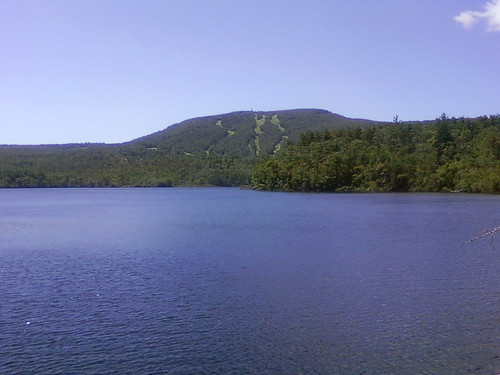
The Grand Canyon of Westbrook is a large volume of negative space out behind the Travelodge (the landmark visible in the photo below, on the Canyon's north rim). I've been past it hundreds of times in my lifetime, but unless you walk out the railroad tracks to stand on the edge, it's easy to miss. The shopping centers and four-lane arterial roads that surround it do a remarkable job of obscuring the city's biggest hole in the ground.


Some online research reveals that the rock of the quarry is gneiss, rock that originally formed as marine clay and slate about 450 million years ago. It was the Ordovician Period, and the mud that would eventually become coastal Maine was accumulating in a shallow subtropical sea surrounding a chain of volcanic islands in the southern hemisphere.
450 million years is a long time. Enough time for seafloor mud to harden into slate, then for that slate to fold onto itself and plunge miles deep into the earth while brand-new Appalachian Mountains rise to the height of Himalayas near the equator, plus enough time for those Himalayan-sized mountains to wear away to White Mountain-sized nubs.
450 million years is nine million times longer than the amount of time it took Blue Rock Industries to make this hole. But now that we're thinking in terms of hundreds of millions of years, in terms of rocks that drifted halfway across the globe and sank four miles under long-gone mountains and resurfaced here, it doesn't seem like such a big hole any longer, in the grand scheme of things, does it?

Just a very temporary divot on a landscape even more temporarily known as "Westbrook," "Maine."

Tuesday, December 10, 2013

Borderlands

I took a walk this weekend out to Westbrook, the city adjoining Portland to our west. Westbrook's Main Street is less than five miles from downtown Portland, but these are small cities and along the borderlands between them there's a still mostly empty landscape of meadows and depopulated infrastructures.

From the edge of Portland I followed the old Cumberland and Oxford Canal, which for a few years in the mid-nineteenth century used to ferry lumber from 20 miles inland to the ocean. It's mostly silted up now, but its towpath is still in use along the edges of the Fore River marshes as a walking trail.


The canal's on the left; the Fore River's on the right. The high-voltage power lines on the right lead eastward towards a substation near the bus terminal, where the power gets stepped down to lower voltages and fed into local delivery lines along city streets. Westward, the same lines lead to higher-voltage lines on the New England bulk power transmission grid. Not far from the junction is the metropolitan area's largest power plant, which burns fracked natural gas delivered from Pennsylvania and Texas via the state's primary north-south gas pipeline.

Under the power lines are the railroad tracks of the old Portland and Ogdensburg line, which put the canal out of business as an overland connection between Portland and Montreal. Over 150 years later the railroad is still less abandoned than the canal is, but only this short section between Portland and Westbrook is at all active. Give it a few more decades and there might not be much difference any longer.

These days virtually all of the cargo between Portland and Quebec is crude oil that goes through in two underground pipelines. Those pipelines also run through these marshes at the head of the Fore River.

And speaking of abandoned infrastructures: on the other side of the marsh I bushwhacked northwards through the woods for a while and found the city's "technology park" (previously written about here). The city finally wrote a seven-figure check to cut down the woods and build a short cul-de-sac here this past summer. And now, just look at all the jobs:


From there I picked up the right-of-way of the oil pipeline back towards the railroad tracks near the Turnpike. Until the Turnpike, the infrastructural routes I'd encountered all trended east-west, from the coast into the mountains. The Turnpike is oriented north to south. Our 19th-century infrastructure treated Portland as a hub of trade to which rural hinterlands could be connected; our 20th-century infrastructure generally treats Portland as the hinterland that needs to be connected to Boston.

There are some decent and uncluttered tags under the Turnpike overpasses here.


A few yards further and I had crossed over into Westbrook, where the silos of a big quarry and asphalt plant loomed over the tracks. It was there that I found the most impressive of all the day's abandoned earthworks — the Grand Canyon of Westbrook. I'll save it for the next post later this week.

Tuesday, April 30, 2013

The Social Life of Small Urban Spaces

My hometown of Portland is currently considering a proposal to privatize two-thirds of a downtown park called Congress Square — a not-particularly-successful product of late-1970s urban renewal.


There's a broad consensus that the park's current design is a failure. Surrounded on two sides by the blank walls of adjacent buildings, and with odd proportions that make most of the park inaccessible to the activity of surrounding streets, the only people who linger here tend to be panhandlers and loudmouthed street preachers.

The neighboring hotel's new owners, a real estate investment trust called Rockbridge Capital, are extensively renovating the building and would like to have a better neighbor. Even before they came along, there had been some rumblings about renovating Congress Square, and even of selling off a portion of it. But their real and specific offer has accelerated the debate.

It's hard for me — and for many other Portlanders — to hear out a pitch to turn over public space to a 1% outfit that calls itself "Rockbridge Capital." And it's disappointing that it was the hotel's owners — not citizens — that were allowed to set the terms of this debate about what the park's future should be.

Yet in spite of those handicaps, I find myself receptive to their most recent proposal for the park, which, though smaller, would be more far more welcoming and engaged as a public space than the status quo is.

Opponents will still object to losing publicly-owned real estate, but the quality of a park's design is far more important than the quantity of its square footage. The current Congress Square suffers from the same basic design problem as your typical suburban McMansion: it's too big, for no good reason.

In their pitch to the City Council, the hotel's architect included a number of points from William H. Whyte's book "The Social Life of Small Urban Spaces," a brilliant empirical study of what makes successful city parks work.

There's a great film version of "The Social Life of Small Urban Spaces" that illuminate Whyte's theories with detailed footage of New York's Seagram Plaza circa 1980. It's a lot of fun to watch, and not just because it offers a filmed version of the people-watching that attracts us to good parks. Whyte's photography also brilliantly illuminates how subtle elements of design — things most of us don't consciously notice — can have tremendous impact on how public spaces are used. It's like a Roman Mars podcast from 30 years ago.

If you're anything like me (and especially if you're one of my Portland neighbors thinking of weighing in on Congress Square), it's well worth an hour of your time:

Thursday, March 14, 2013

Tampa Bay dérive

I've been spending this week in Tampa, Florida for a new website that my employer is building. Before I'd left I'd asked lots of people for travel advice, but even people who'd been here before didn't have much to recommend. So, on my first day here, when we got out of work early for the day, I took a long walk with no particular destination in mind: what the psychogeographers would call a dérive.

We're staying in a pastel-colored high-rise hotel near the convention center and hockey arena, a neighborhood where all the buildings have apparently been built in the past 20 years.

The district's newness led me to presume that it had been, until recently, some kind of waterfront industrial area, or railroad depot, demolished during the urban renewal fads of the 1960s and 1970s and only just now rebuilding.

But as I walked north into the heart of downtown Tampa, I only found similar neighborhoods and buildings. It seems as though almost all of Tampa had been torn down in the last 30 to 40 years, and replaced with a landscape like this:


As I continued northward into the center of the downtown, the street I was on became barricaded to car traffic, and a lush tropical garden replaced the asphalt. It was here, after four blocks of walking near the end of the workday on a pleasant Tuesday afternoon, that I encountered my first fellow pedestrian.


The street I was on appeared to be the city's attempt to recreate the kinds of "festival marketplaces" that had been faddish in the 1980s, like Baltimore's Inner Harbor or Boston's Quincy Market.


A dated building with steel bay windows faced the pedestrianized street with abandoned kiosks, empty arcades, and faded signs that referred to its address as "city center," as though recalling its glory days.


And then there was this "Municipal Building".


On the other side, nestled in the rear corner of the concrete fortress, I found one of the few old buildings in the city. I detoured half a block to find that this was the old City Hall, still occupied by some of the city's more fortunate bureaucrats.


Changing course to the west, I cut diagonally through a tree-lined downtown square to Tampa Street, where there was a small cluster of non-chain businesses somehow subsisting on the downtown's tiny trickle of foot traffic.

There, I found a used bookstore with an impressive collection of old and rare volumes. I learned, from a circa 1979 Chamber of Commerce coffee table book, that Tampa had been a center of cigar manufacture and a major railroad depot in the nineteenth century. There book also had several photos of an impressive turn-of-the century grand hotel, just across the Hillsborough River from downtown, which was still standing and had been incorporated into the University of Tampa campus.


I struck out west toward the river to see the building for myself and rested a while by the river while a rowing team went by. Turning around, back towards downtown, I was confronted with a less impressive view of two condo high-rises, buttressed with huge parking garages.


The downtown skyline is twice as high as it otherwise would be, thanks to these garages, which squat underneath virtually every high-rise.

Tampans must spend hours driving on their indoor ramps, spiraling up to store their cars on the 7th and 8th stories of their office buildings in the morning, then spiraling down again to drive home, then spiraling up again to park for the night in the high-rise parking decks below their condos.


All over the gulf coast there are houses on stilts, and these are giant versions of the same idea. The streets here are not a place to conduct commerce or meet neighbors, they are a place of transience, a means of evacuation, a place that's ready for sacrifice to the inevitable flood.

The real city begins sixty feet above the ground, behind security gates, with views of the distant bay.


Tuesday, November 27, 2012

Cities & Memory


From Italo Calvino's Invisible Cities:


In Maurilia, the traveler is invited to visit the city and, at the same time, to examine some old post cards that show it as it used to be: the same identical square with a hen in the place of the bus station, a bandstand in the place of the overpass, two young ladies with white parasols in the place of the munitions factory.


Photo courtesy of the Friends of the Eastern Promenade


If the traveler does not wish to disappoint the inhabitants, he must praise the postcard city and prefer it to the present one, though he must be careful to contain his regret at the changes within definite limits: admitting that the magnificence and prosperity of the metropolis Maurilia, when compared to the old, provincial Maurilia, cannot compensate for a certain lost grace,


Photo by Corey Templeton

which, however, can be appreciated only now in the old post cards, whereas before, when that provincial Maurilia was before one's eyes, one saw absolutely nothing graceful and would see it even less today, if Maurilia had remained unchanged; and in any case the metropolis has the added attraction that, through what it has become, one can look back with nostalgia at what it was.


Beware of saying to them that sometimes different cities follow one another on the same site and under the same name, born and dying without knowing one another, without communication among themselves. At times even the names of the inhabitants remain the same, and their voices' accent, and also the features of the faces; but the gods who live beneath names and above places have gone off without a word and outsiders have settled in their place.


It is pointless to ask whether the new ones are better or worse than the old, since there is no connection between them, just as the old post cards do not depict Maurilia as it was, but a different city which, by chance, was called Maurilia, like this one.


Photo credits:
Historic postcards from MaineMemory.net.

Present-day photos courtesy of (from top to bottom): Friends of the Eastern Promenade, Corey Templeton via the archboston.org forums, Corey Templeton via the Portland Maine Daily Photo blog, and Panaramio user sacoo.

Monday, June 18, 2012

Foreclosure Farms

Growing food in abandoned city lots? That's so 2007. In the post-recession landscape, the edgiest agricultural trendsetters are growing cannabis in suburban foreclosures. 

"Houses that sold for $1 million before the crisis have been turned into grow houses, equipped with the high-intensity lights, water and air-filtering systems necessary to produce potent, high-quality marijuana," reported the New York Times in an article this spring.

On the other side of the Atlantic, the BBC reports that local police found over 7,800 cannabis farms in the UK last year.

A foreclosed house in Vallejo, California, where illegal wiring for grow lights caused a fire on the second floor. Photo by Jim Wilson for the New York Times.
It's the logical next step of the "urban farming" fad. Abandoned inner-city lots for growing vegetables are becoming increasingly difficult to find. So what's an aspiring inner-city homesteader to do?

Drive 'till you qualify. There's a bounty of abandonment beyond the city limits. Find a nice quarter-acre lot with a nice lawn and privacy from any nosy neighbors, a good school district where well-to-do students will pay top dollar for your product, and five spacious bedrooms for your grow lights.

Who says the American Dream is dead? It just needs some pharmacological assistance.

Wednesday, February 15, 2012

A Very Situationist Valentine's Day

The Occupy camps have been dismantled — and yet, none of the motives behind the movement have disappeared. Maybe that's why I've noticed a revival of Situationist thought on city streets in my hometown and elsewhere around the globe.

Yesterday, for Valentine's Day, a Good Samaritan posted these flyers around Portland, Maine:

(photo by shannont, via Unseen Portland)

It reads: “In societies where modern conditions of production prevail, all of life presents itself as an immense accumulation of spectacles. Love that was once directly lived has become mere representation.” From Guy Debord's Society of the Spectacle.

Another flyer reads "Young people everywhere have been allowed to choose between love and a garbage disposal unit. Everywhere they have chosen the garbage disposal unit" (another quote from Debord).

And in London, artist Robert Montgomery has appropriated billboards to post his Situationist poetry. This one is probably my favorite (via The Morning News, which has more samples of his work):


Valentine's Day might be the perfect Situationist holiday, especially now, when its hyper-commodified version of love is drawing so much cynicism towards itself in our bailout economy.

And yet, for anyone lucky enough to enjoy real love — not the spectacle, but the genuine article, without the chintzy chocolates or greeting cards or mall-bought lingerie — real love is an act of revolution: a reminder that we can be rich without the fake wealth of the global economy.

Thanks to Jess, I count myself in that number. All the hedge fund managers can go fuck their garbage disposal units (and I'd love to see them try).


Tuesday, September 13, 2011

A Supposedly Fun Thing Invades Portland

From midsummer until the end of fall foliage season in late October, cruise ships like the one pictured below dock at the Maine State Pier in downtown Portland, Maine. When they're in port, they loom over the small city's skyline and disgorge thousands of well-fed passengers onto our downtown city streets.

The cruise ships that arrive here are taller than most of the city's modest high-rises, and with 2500-3500 passengers, their arrival increases the city's population by about 5%. They have a certain looming effect on the city's landscape, and not just from their striking physical resemblance to the alien mother ships that blot out the sun above human cities in movies like Independence Day and District 9 (see below at right). They flood the city's streets with a certain breed of well-fed, middle-aged idler, toting cameras and stylized cartoon maps of the downtown district.

The effect isn't limited to the infusion of strangers - it also changes the behavior of the city's native residents.

When a ship's in town, improvised kiosks selling lighthouse paintings, secondhand junk, and items marketed as "redneck wallets" proliferate near the ferry terminal. "The Screamer" and other familiar victims of the state's social service cuts become mysteriously absent, while there's a marked increase in downtown police cruisers. Slow, rubber tired omnibuses roam the downtown area behind incongruous teams of draft horses, a bizarre, segregated, and for-profit public transportation system for tourists.

In short, the cruise ships, while they may look innocuous, also seem to beam advanced psychoactive waves into the city's brains to stimulate desperate entrepreneurial pandering. There's money to be made if we behave like a quaint second-world outpost replete with cheap handmade crafts and sweating, shitting modes of transport.

An acquaintance today remarked that the city's transformation reminded him of Heisenberg's Uncertainty Principle, the concept of quantum physics that tells us how the observation of certain properties of a particle limits our knowledge of other physical properties.* Or, to put it another way, that the simple act of observing something, and your choice of what to observe and how to observe it, can change various properties of that thing's essential nature.

This elegantly applies to tourism, especially the mass-market variety of tour buses and cruise ships. An entertaining thought experiment: how would Portland (both the physical landscape of the city and its citizenry) change if the hundreds of thousands of tourists who came here every summer instead arrived as undocumented migrant laborers? How would the city look if those thousands became occupiers of an imperialist army?

And which of those two landscapes - the city of cheap labor, or the occupied city - is more foreign from the city we know today?**

The idea that we occupy a different, parallel universe from the one that our tourists reside in - and that I, as a tourist anywhere, am unlikely to know the true essence of the places I visit - feels as lonely to me as an insomniac night on a cruise ship at sea, "when all the ship's structured fun and reassurances and gaiety-noise ceased."

But then again, shouldn't the possibility of changing the city you know with a shift in perception also offer us new frontiers to explore without leaving at all? And doesn't the uncertainty principle also apply in all sorts of other ways - not just in how we perceive places, but also people and things? We hear rumors of a scandal and a trusted person becomes repulsive to us; make eye contact two or three times across a crowded room, and a stranger becomes an object of fixation.

So even when you live in a small city that's frequently colonized by tourist hordes, there's no need for us to get discouraged when we perceive ourselves in a rut, in an absence of strangeness and possibility.

There's an infinity of alternative cities available to us, all similar to this one and different in significant ways, every time we seek a new way of seeing things.


*Credit for this insight goes to Dan, who's highly versed in the idea of how shifts in our perceptions can affect our lifestyle.

**Personally, I think that our wealthy tourists and our customer-service-oriented culture make us a lot closer to the empire/colony dynamic than we are to being a land of opportunity - then again, that's just the product of my own observations.

Monday, June 13, 2011

Psychosis and the Suburb

I just finished reading J. G. Ballard's novel Super-Cannes, a scary psychological thriller that runs its gruesome course in the Silicon Valley of the Euro zone, the high-tech suburban office parks in the hills above the French Riviera.


Ballard convincingly asserts that the suburban office park is the architectural manifestation of nihilism. "Thousands of people live and work here without making a single decision about right and wrong," writes Ballard. "The moral order is engineered into their lives along with the speed limits and the security systems."

In Super-Cannes, the absence of moral agency drives executives into bouts of managed psychosis, employed to advance the greater good of executive productivity and shareholder value. As the novel advances, the degree of this executives' violence, sexual predation, and racist xenophobia become more and more intense and unnerving, but Ballard anchors it all in realism by name-dropping familiar corporations (a next-door neighbor who clubs Arabs by night is a Mitsubishi executive by day, a gruesome gunfight takes place on the roof of the Siemens carpark) - and mundane descriptions of the familiar office park landscape.

It's like a right-wing Fight Club, where repressed men band together to enforce corporate power instead of taking it down. And frankly, Ballard's vision - the Man sticking it to us with clubs, a private police force, and a hefty bribery budget to keep other authorities quiet - seems a lot more realistic than any of us sticking it to the Man.

Interestingly, right after I finished reading this, my wife had me listen to a recent This American Life podcast about psychopathy. In Act 2, Jon Ronson (author of the recent The Psychopath Test) interviews a successful business executive and finds that a lot of the traits he considers intrinsic to his success could also be interpreted as indicators of psychosis (actual doctors may find that a stretch, but the guy definitely has antisocial tendencies).

Also interestingly, there's been a flurry of articles this week about the decline of suburban office parks. A special report in Crain's Chicago Business declares that "Like the disco ball, the regional shopping mall and the McMansion, the suburban corporate headquarters campus is losing its charm," and goes on to profile several large corporations that are moving their headquarters offices back downtown.
"The whole corporate campus seems a little dated,” says Joe Mansueto, chairman and CEO of Morningstar... “We've always liked being in Chicago. It helps keep employees on the pulse of what's happening in our society. It keeps them current with cultural trends and possibly technological ones.”
Corporations moved their employees into the highly-controlled landscapes of office parks so that workers would be cloistered from competing job offers and isolated from social distractions for 60-hour work weeks. But maybe killing their workers' social connections and isolating them from creative ideas wasn't so good for profits, after all. Maybe there's still hope for sanity.


Tuesday, June 08, 2010

The Geotaggers' Atlas


On the photo sharing websites Flickr and Picasa, users can "geotag" their photographs with specific longitude/latitude coordinates on a map, as a way of organizing their own collections and seeing other photographers' images of the same neighborhoods.

Geographer Eric Fisher has mined this data using the sites' public APIs to create the "Geotaggers' World Atlas," a collection of maps of 100 major global cities, overlaid with points representing where users have posted their photographs. The resulting images are fascinating, information-rich portraits of the places where photographers (or, more precisely, web-savvy photographers who upload their photos and tag them with geographical data) congregate.

Thus, the map of London shows dense concentrations of photos in the central business district, but also in Greenwich and Canary Wharf (the two blobs near the east side of the map), in Kew Gardens (on the west side), and along the city's principal streets. The banks of the Thames River are clearly delineated as well, and criss-crossed by dense clusters of photographs taken on the city's bridges:


Other maps reveal more about where digital photographers who use Flickr and Picasa are likely to live and hang out. Here's Portland, Oregon, a city I'm familiar with from my college days at Reed College:

As in London, the banks of the Willamette River are clearly delineated in the downtown area, where there's a popular park on the western bank and a bike path on the eastern bank, as are the city's bridges. The horizontal line just south of downtown is the city's new aerial tramway, a photogenic segment of the transit network that connects the riverfront to the Oregon Health Sciences University complex high above in the city's West Hills.

A small knot of photos on the east side of the map represents Mount Tabor Park. Between there and downtown stretches Hawthorne Boulevard, a business-lined Main Street that runs all the way to the Hawthorne Bridge into downtown. You can also make out North Mississippi Ave., plus Killingsworth and Alberta Streets, north of downtown. These neighborhood Main Streets aren't particularly dense areas of the city, nor are they tourist magnets. But they are the business and entertainment districts for gentrifying neighborhoods where Flickr's young, web-savvy users like to hang out and take digital pictures of their friends.

These maps can also say a lot about a city's distinctive way of life. Here's Istanbul:

The dense quadrangle in the bottom-center of the photo represents the city's major tourist sites: clockwise from the western corner, they are the Grand Bazaar, the waterfront near the Spice Bazaar, the palace complex, Hagia Sofia, and the Blue Mosque. Extending north from the Spice Bazaar is a dense cluster of photos across the Galata Bridge, up the hill past the Galata Tower, and along the arc of İstiklal Cadessi, a major nightlife and shopping district.

But unlike other cities, Istanbul's map is defined less by streets, and more by the broad waterways that separate its neighborhoods. From the Golden Horn (the central peninsula at the bottom-center of the map) emanates a web of photographs and multiple-exposure photo paths taken from ferries and other boats traveling along and across the Bosporus straits. Clusters along the shore represent ferry terminals at Beşıktaş, Harem, and other neighborhoods. Istanbulites clearly spend lots of time on boats, and like to pass the idle time on the water by snapping photographs.

More recently, Fisher has updated a number of these maps to differentiate photos from tourists and photos from locals (his methodology: if a photo comes from someone who is still geotagging photographs in the same city within 30 days, it qualifies as a "local"). These "Locals and Tourists" maps add another layer of information to distinguish the places where tourists go from the places that locals find to be the most interesting.

Here's New York. Red dots represent "tourist" photographs; blue dots are from locals, yellow dots could be either:

Ellis Island and the Statue of Liberty stand out as bright red clusters in the lower left corner, connected to the red Battery at the southern tip of Manhattan by a dense web of photos from ferry rides. Just to the right is the blue, teardrop-shaped outline of Governor's Island, a newly-opened park that seems not to have caught on yet with visitors, which is itself just above a blue cluster around Red Hook, another neat neighborhood that is definitely far from the tourists' beaten track.

There's a lot of red in midtown Manhattan, especially along 34th Street (the Empire State Building), 42nd Street (with Times Square, Grand Central, and the UN on the East River), around Rockefeller Center, and in the southern reaches of Central Park. Locals predominate along the avenues of the upper west side, in Riverside Park along the Hudson River, in the Lower East Side, and in the Brooklyn neighborhoods of Park Slope, Fort Greene, and Williamsburg, as well as in the old World Fair grounds in eastern Queens. And note the small cluster of red and blue dots around Yankee Stadium in the Bronx (in the upper center of the map) and around the Meadowlands sports arenas over in New Jersey (on the left edge of the map).

And here's San Francisco. Can you spot Alcatraz?

San Francisco is the center of the metro area where both Flickr and Picasa have their headquarters - apparently a lot of their employees and enthusiasts live in the Castro and Mission districts (the dense blue grids just south of downtown).

What I really like about the Locals and Tourists maps is the possibility of using them as a tourist's guide to un-touristy places. If I were going to Washington, for instance, I might want to cut short the sightseeing on the Mall to check out those blue clusters north of Dupont Circle around Meridian Hill Park, or see what the locals find so photogenic about the Potomac River in Georgetown. The Space Needle is clearly popular among visitors to Seattle, but maybe my time there would be better spent finding out why the locals take so many pictures around East Union and North 45th Streets.

Using the maps this way might be particularly useful in Paris, where there's evidently no shortage of photos of the Eiffel Tower. Parisians seem like the kind of people who'd be a lot more friendly and welcoming to visitors who don't contribute to the mobs around the Louvre and Île de la Cité and are brave enough to venture to the more genuine parts of the city. The 19th and 13th arrondissements look promising.

That said, I've also never been to Alcatraz myself, and I'd like to go. Most tourist destinations attract visitors for good reasons - but these maps demonstrate that there are plenty of off-the-beaten-track neighborhoods that are worth visiting as well.

Maybe Fisher will share his secret coding techniques with the rest of us so we can produce maps of our own - I'd be especially curious to see Locals/Tourist maps of the east-coast Portland, and of Houston.

It would also be interesting to slice this data in other ways, in addition to Fisher's clever tourist/locals divisions. For instance, what if we separated out the photos that were taken on weekends from photos that were taken on weekdays? Or map only photos taken between 9 pm and 3 am, to generate a diagram of cities' best nightlife neighborhoods? You could even go so far as to analyze the light and color balances of these photographs and generate maps of places where people go on gray rainy days, versus places where people go to photograph blue skies, versus favorite destinations on white snowy days.

In the meantime, both the Geotaggers' World Atlas and the newer Locals and Tourists maps are very much worth browsing, although, like me, you may lose hours to scrutinizing the richness of their information.


Tuesday, June 01, 2010

A Park Gained, A Wilderness Lost

When I was in New York a few weeks ago, I finally made a visit to the High Line, the city's new park on an abandoned elevated rail line on the west side of Manhattan.

The High Line, in 2007 and in 2010 on TwitpicLeft: the High Line in 2007 and in 2010: cultivating native plants and overpriced condo towers. Click to enlarge.

I had been pretty excited about this park for a long time - I first learned about it in 2006, the year I was working for the City as an Urban Park Ranger, when the project first broke ground. For me, the High Line was a vindication of my idea that a city's hidden pockets of wildness - often on the forgotten margins, like the abandoned industrial neighborhood around the High Line - could be celebrated for their unique ecosystems and natural resources, instead of being condemned as "blight."

Since it's opened to the public, there can't be any doubt that this abandoned railroad has been a cause for celebration from residents and tourists alike.

But when I visited last month, I had to wonder if something was lost in the High Line's transition from abandoned railroad to public park. The High Line is stunningly designed, packed with native plantings, and it's opened up new ways for New Yorkers and visitors to experience the city.

But is it wild anymore?


The High Line in 2001, by Jonathan Flaum:And in 2009, via Inhabitat:


The overwhelming impression I got from walking on the High Line this spring was of wealth. The park was clearly expensive to build, with tropical-wood furniture, elaborate fountains (they were under repair while I was there), and meticulously tended foliage. The carefully selected varieties of native plants were evenly, geometrically spaced in mulched planting beds outfitted with an irrigation system. A forest of new condo high rises and hotels, designed by global celebrity architects, loomed over the rehabbed warehouse buildings of the former industrial district.

Great architecture is all well and good. But I found that the High Line, in its "finished" state, was less like the wilderness I'd hoped for, and more like a formal garden for the gentry of Chelsea: a sort of post-industrial Versailles.

I feel like this is a missed opportunity. After all, ostentatious displays of wealth in New York City are not all that compelling or interesting - they're pretty much a dime a dozen.

The High Line, before it was a park, had been a refuge from a landscape obsessed with capitalizing and selling every square foot of space. Here there were acres of land that existed outside of the consciousness of real estate, where weeds, small mammals, birds, and the occasional human adventurer were free to wander in a two-mile meadow, simultaneously above and surrounded by the city. That's where it derived its wildness.

As a landscaped park, though, the High Line is obviously a real estate amenity. When every prospect offers views of shiny condo towers and expensive lofts in expensively rehabbed warehouses, and designer signage implores you to stay on the designer concrete pathway, it's obvious to the visitor that this park was financed and built by developers and neighbors angling to increase their own property values. In the process of becoming a public park, the High Line became co-opted by New York City's real estate juggernaut.

In the process, an essential part of the High Line's promise - its freedom, and isolation from the commodification and control of New York City's landscape - has been lost.*

The new High Line park's design also botches the structure's historical context. Until 1980, the High Line railroad had been used to deliver agricultural raw materials to various food processing plants in the neighborhood. Refrigerated boxcars full of cows, for instance, were delivered to the slaughterhouses of the Meatpacking District. Several spurs curve from the main line into adjacent buildings, and in some places, the High Line actually travels through the middle of buildings, with old loading docks on either side.

Here's a photo from the mid-twentieth century of the High Line where it runs through the National Biscuit Company (a.k.a Nabisco) complex. These are the same buildings pictured at the top of this post:


For decades, then, the High Line (and its surrounding neighborhood) played an important role in feeding New Yorkers, and commodifying the agricultural bounty of the Midwest into value-added processed foods. There's a rich historical narrative here about the industrialization of agriculture, the centralization of food processing, the rise of supermarkets... but there's no trace of any of this in today's High Line Park.

This was the other big thing that unnerved me about walking along the High Line. The structure's wrought-iron railings, steel I-beams, and the handful of high-ceilinged brick warehouses surrounding the old railway clearly hearken back to a lost industrial past. But everything about the park itself, and the expensive architecture that surrounds it, drives home the fact that that industrial past is entirely gone. This used to be a neighborhood that made things and trafficked in the heavy, bulky products that required massive railroads to move. The High Line itself used to be a vital connection between the City and the natural resources that fed it.

But today, the neighborhood traffics in abstractions: there's tremendous wealth here, but it's anyone's guess where it comes from.

Back in 2007 I wrote about how the abandoned High Line illustrated the ecological succession of urban vacant lots
:
Over the years, more dust, leaves, and soot blew in. Each fall, the topsoil gained another layer of dead grass and leaves from pioneer weeds like goldenrod, Queen Anne's lace, and Ailanthus Altissima... the new High Line park will have benches, new concrete paths, easy access from the street level, and drought-tolerant landscaping that mimics the wild weeds that inspired the park.

It might seem like an interruption and commodification of the wild successional process, but New York is nothing if not habitat for homo sapiens, and the new High Line fits in perfectly with New York's typical neighborhood succession: places once run-down and diverse inexorably become unaffordable and boring. At least until the next large disturbance, anyhow.
When the new park opened in 2009, we were in the middle of a huge financial crisis that seemed to hold out the promise of being that "next large disturbance." Here's an excerpt of the post I wrote at the park's grand opening:
In the new economy, the High Line feels a lot weirder. It was meant to be a futuristic preserve for New York's past - especially its overgrown lots and abandoned industrial infrastructure. Now that the park is open, though, the ultra-slick High Line feels a bit out of place. Instead of evoking New York City's past, the High Line looks more like an expensive simulation of conditions in inner-city Detroit, or of a foreclosed backyard, or of any of the thousands of newly-defunct car dealerships nationwide. Those conditions were rare in New York City two years ago, but now that they're fairly commonplace in society's consciousness, the High Line seems more artificial and contrived.
Now that I've been there, though, I realize that the High Line doesn't feel anything like Detroit or an abandoned car dealership. That's its problem: it lacks any relationship to the economic or environmental conditions of the city. Instead, it sits aloof from the street, a walled garden guarded against the weeds and the history that used to reside there.

But the views are nice, I'll grant it that.


*Footnote: This is related to the age-old debate about whether we can open up "wilderness" areas to the public without ruining the essential qualities that make these areas feel wild - namely, their isolation and freedom. I'm typically inclined to believe that this is not a real trade-off, especially if we can help people appreciate the relative abundance of places like the (old) High Line that exist right under our noses, in our cities and neighborhoods. Cultivating a sense of stewardship for these places, whether they're in an abandoned downtown area or in a national park, will let more people enjoy them without necessarily "ruining" them.

Unfortunately, in the case of the High Line, we (the public) have surrendered our responsibilities of stewardship to profit-motivated architects and developers.


Tuesday, March 09, 2010

Intermission Floods

Early last year I wrote a post about the sudden spikes in demand for electricity that happen nightly in Britain, when millions of Britons put on their teakettles at the conclusion of the soap opera Eastenders. A lone engineer sitting in a high-tech control room watches the program with the rest of the nation, and as soon as the credits roll, he opens the floodgates through dozens of European hydroelectric dams in order to deliver enough electricity.

It's a deluge equivalent to ten Niagara-sized waterfalls set loose for fifteen minutes every evening. On the surface, it's hard to see any connection between a cultural predilection for hot beverages, a television drama, and the ecosystems of European rivers. But it's certainly there - unfortunately, most Brits are too busy making tea to notice the hydrologic spectacle that their utility bills are paying for.

The big gold-medal hockey game between Canada and the United States provided another striking example of how a cultural phenomenon can set loose Biblical floods through the pipes of our modern infrastructure. EPCOR, the water utility in Edmonton, Alberta, recently published this chart of water consumption during the big game, which two-thirds of Canadians were watching (graph courtesy of Pat's Papers):

The scale of the y-axis is in megaliters, which means that between the final seconds of the third period and the pre-overtime intermission, water consumption spiked by 140 million liters, or 37 million US gallons - roughly the amount of water that flows over Niagara Falls in a two-minute interval. During the span of one commercial break, this water flowed from huge city reservoirs, through arteries of water mains and millions of bathroom pipe capillaries, then out through another mesh of pipes, into Edmonton's sewer system.

How's that for a natural wonder? Unfortunately, most Canadians missed the opportunity to witness it in person - they were locked in their bathrooms instead.

Friday, February 05, 2010

The Wasted Spaces of Bureaucratic Amnesia

Since writing my last post about the opportunities of empty lots in our city, I've come across a couple of other articles on the subject. Funny how this idea is cropping up different places simultaneously.

Although I've been thinking about this for a while, this article by the editor of Governing magazine is what motivated me to finally write about it. The article suggests trying lots of different, temporary uses for the nation's proliferating empty and abandoned lots, in a sort of urban laboratory. But the most striking part of the piece was this sentence: "The typical large city has 15 percent of its land sitting vacant or abandoned, according to the National Vacant Properties Campaign."

This is nuts - especially when we consider that most large cities also have real estate that sells for millions of dollars an acre. This is a clear indication that we have some serious market failures interfering with things. All this land could be used for jobs, or housing, or parks. But as long as they lie fallow, our cities are going to suffer from more income disparity, crime, homelessness, budget cuts, unemployment, and environmental problems than necessary.

I found the Governing article via a Twitter post from thisbigcity.net, a newish urban-issues blog from London that looks very promising. If you enjoy The Vigorous North, you should check it out.

Finally, the same day I published my post, the excellent Opinionator blog on NYTimes.com ran a similar post from architectural critic Alison Arieff. Her piece, "Space: It's Still A Frontier," talks about how Geographic Information Systems are giving cities new tools for identifying and inventorying the empty lots and in-between spaces that have been filed away and forgotten in the bureaucratic purgatory of City Halls. She writes:
"Neglected at the local level because they neither provide nor generate revenue, these sites are markers of larger patterns of neglect (much as we’re seeing with homes abandoned to foreclosure). In San Francisco, they often outline the shape of entire, mostly lower income neighborhoods like Hunter’s Point, Bayview and the Outer Mission. Abandoned by traditional development, such areas are precisely those in need of ecological and social attention."
Arieff also profiles an architecture school project in Berkeley called "Local Code," which has culled forgotten places from a San Francisco city database and proposes "a systemic re-greening of leftover pavement space on a large scale."


Empty lots in San Francisco, courtesy of Nicholas de Monchaux. Via the New York Times Opinionator blog.

The professor leading this project, Nicholas de Monchaux, and his students found 1,625 distinct sites throughout San Francisco - various overgrown lots and informal parking lots with "a combined surface area of more than half of San Francisco’s Golden Gate Park."

This in a city that might have the nation's most acute need for affordable and middle-class housing - unbelievable.

De Monchaux repeated the exercise in other big cities:
“When we examined all the leftover spaces in San Francisco, New York, New Orleans, Minneapolis — we found the same thing to be true in every city,” de Monchaux says. “You had a whole archipelago of city-owned lots lying fallow. In New York they add up to the size of Central Park and Prospect Park together. It’s a massive untapped resource that’s impossible to visualize without these contemporary tools.”
Granted, these empty and forgotten spaces can be really interesting as they are, as tiny refuges for urban wildlife and inner-city forest succession. That doesn't mean they couldn't be improved, though, and put to a better use while also enhancing their value as inner-city habitat - even if we redevelop some of them for new housing or space for businesses, which are critical components of urban habitat in their own right. De Monchaux's project actually calls for transforming San Francisco's forgotten lots into neighborhood-scale environmental infrastructure: small greenspaces designed to capture stormwater, clean the air, and reduce the heat-island effect.

As much as I love visiting abandoned places like these, I'm discouraged at the staggering scale of their proliferation. The fact that we've forgotten 15% of the landscapes in which billions of us live and work every day testifies to a general attitude of environmental neglect in our cities. Environmentalism calls for us to embrace a sense of stewardship and responsibility for our landscapes; these places owe their existence to a complete absence of stewardship or responsibility. It's the polar opposite of Aldo Leopold's land ethic.

We need to do better.

Wednesday, January 27, 2010

A Walk to Wachusett

In 1842, a 25-year-old Henry David Thoreau walked from his home in the town of Concord, Massachusetts to the summit of Wachusett Mountain, 34 miles away. It's a small mountain, barely cracking 2,000 feet in height, and today it's best known for hosting a ski area where one can take a few runs on winter evenings after getting off of work in Boston.

When he got back to Concord, he wrote this:
"And now that we have returned to the desultory life of the plain, let us endeavor to import a little of that mountain grandeur into it. We will remember within what walls we lie, and understand that this level life too has its summit, and why from the mountain top the deepest valleys have a tinge of blue; that there is elevation in every hour, as no part of the earth is so low that the heavens may not be seen from it, and we have only to stand on the summit of our hour to command an uninterrupted horizon."
I can't claim that I've read a lot of Thoreau's writing, but this little passage might be my favorite of what I've come across.

Wachusett isn't much of a mountain, even by New England standards - it's eroded over long eons into a round-shouldered, leafy hill. Still, what humble "mountain grandeur" this hill has clearly made an impression on Thoreau.

He's telling us two things in this passage: first, that we don't need to fly to the Himalayas to awe ourselves with big mountains - we can experience the same feelings in our own backyards, if we care to look for them.

Mount Wachusett. Photo by flickr user ornoth / CC BY-NC-ND 2.0

Second, he's also telling us that we can carry that inspiration with us "in every hour" - that is to say, through the humdrum routines of everyday life. If only we raised our heads to look up, we can command the "uninterrupted horizon" of a summit view.

In my personal reading of this, Thoreau is asking us to continue thinking about our connections to the natural world even in the level life of the city, and in our daily work. If we can manage that, he tells us, we'll be rewarded with a sense of perspective and humility not unlike the sense we get from a clear mountaintop view.

It's common for people and our popular culture to misinterpret Thoreau's later experiment at Walden Pond as a rebellion against civilization. Indeed, this confused reading may be responsible for - and is certainly associated with - the destructive old orthodoxy that environmentalists' activities should be focused on places where there aren't (or don't seem to be) any people - whether the Arctic National Wildlife Refuge or the northern Maine woods. The participants of anti-urban, white-flight environmentalism in the 1960s, '70s, and '80s tried to realize this false conception of Thoreau's experiment in back to the land movements, and the result was widespread urban sprawl along with brutal economic and racial segregation in American inner cities.

The real Thoreau wasn't at all interested in turning his back on the problems of civilization. Unlike the back-to-the-land hippies, Thoreau's time at Walden was intentionally temporary, and mixed with frequent trips back to (and engagement with) society in the busy town of Concord. Being an active, engaged member of society - whether by protesting the institution of slavery, or publishing his writings, or selling the pencils he manufactured in his family's Concord factory - was extremely important to Thoreau.

He loved mountains - even humble ones. But he didn't climb them for bragging rights, or exercise, or to fool himself that the problems of the world didn't exist. He climbed them to bring a sense of clarity and perspective into his everyday life in the valley.

And that's a perspective that I wish more mountain-climbers would embrace.

Saturday, December 26, 2009

Portlandhenge: Winter Street


These photos were taken the morning after the winter solstice - December 22nd at about 7:30 am - on Winter Street in Portland, Maine.

As you can see, the length of Portland's "Winter Street" is almost perfectly aligned with the rising sun on the winter solstice (as well as on the days immediately preceding and following).

Coincidence?

More on Portlandhenge, Manhattanhenge, and other city-henges here.

Friday, December 18, 2009

Using Bikes, and the Social Web, for Environmental Monitoring

MIT's Senseable City Lab has a lot of great projects loosely organized around the idea that a proliferation of cheap sensors, hand-held electronics, and mobile networks offers people more ways to collect and interpret data about their city.

So, for instance, you can embed a cheap radio beacon into a piece of garbage and learn about your city's waste-handling practices (something that city governments rarely like to talk about publicly). The Senseable City Lab did it.

The Lab has a new project they're launching in Copenhagen now, in conjunction with the global climate suicide pact treaty negotiations.

Copenhageners love riding their bikes: it's the dominant mode of transportation in the city, and how 57 percent of workers and students commute. The Senseable City Lab designed a new bicycle wheel (pictured at right) that includes a small electric motor and a 3-speed internal hub, which can transform any bike into a hybrid human-powered/electric bike.

But the hub also includes a GPS unit and an array of environmental sensors that measure levels of pollutants like carbon monoxide and nitrogen oxides, plus temperature and weather conditions. As users ride through the city, they can share their data online with others, and offer real-time environmental transects on a daily basis.


As more users use the wheel and share their data, the city can get a bigger, more complete sense of environmental hotspots, how pollutant levels change over the course of a day, and how to better-manage pollution sources.


I want one. Imagine being able to do your environmental ground-truthing on a leisurely bike ride, or a crowd-sourced revelation of the embarrassing hotspot of volatile organic compounds (from the basement laundry) next to the luxury hotel downtown. I'm hoping these come to the mass market soon.