Showing posts with label Portland. Show all posts

Thursday, March 31, 2016

Public housing for the future

Four years ago I joined the board of commissioners for the Portland Housing Authority with a chip on my shoulder about the fact that it hadn’t built any new apartments for the city since the Reagan administration. So I'm pretty proud about this: we’ve torn out a parking lot on Oxford Street, and in its place we're building 45 new apartments with public housing offices and a Head Start classroom on the ground floor.

This is going to be Maine's greenest building when it's finished. It's aiming for "passive house" certification and we're putting solar panels on the roof. It will have a courtyard that treats runoff under the patio. Most significantly, it’s Portland’s first-ever affordable apartment building that prioritizes housing for car-free households, with no parking on-site, within walking distance of bus routes,  supermarkets, and thousands of jobs. We saved hundreds of thousands of dollars by not building the parking garage that city zoning typically requires, and that's allowed us to build more apartments instead. It’s already won a national competition for innovation in lowering the cost of housing.

Public housing doesn't get the appreciation it deserves. It's facile for liberals to blame it for the tragedies of structural racism in our cities; meanwhile, the right attacks it for its unapologetic Great Society socialism. And as a result we've had decades of bipartisan budget cuts for federal housing programs.

But public housing neighborhoods give millions of people the ability to live amidst the opportunities of our increasingly unaffordable inner cities. Without these neighborhoods, our cities would be even more dramatically segregated and impoverished places.

And if, instead of dismissing it, we can build even more public housing – a lot more, as the Portland Housing Authority hopes to do in the years to come – then the city will be more diverse, more successful and more egalitarian. It will be more like the city we want it to be.

Monday, October 29, 2012

Buried Wetlands Rise from the Grave

This evening, Hurricane Sandy's storm surge will combine with astronomical high tides to give eastern seaboard cities an exciting preview of sea level rise. Forecasters are predicting storm surges up to 10 feet above the average high water mark — especially in western Long Island Sound and New York Harbor, where the storm is funneling massive volumes of seawater into the right-angled corner formed by New Jersey and Connecticut.

As I wrote last week in Grist, most big cities have buried their wetlands and creeks underground. But big storms and flood events like this one have a way of making those hidden waterways reassert themselves, as underground sewers and stormwater channels fill up beyond their design capacity and overflow into the streets above.

That can happen in unexpected places. Here in Portland it wasn't even particularly stormy today, and there was only light rain. But the astronomical high tide did push water up to the surface of Somerset Street, four blocks away from Back Cove (note the empty tree wells — similar events killed the street trees planted here in 2006 due to salt water in the roots).

Meanwhile, in Philadelphia, heavy rains may once again cause problems in the sewer-bound Mill Creek.

And in New York City's Boerum Hill and Park Slope neighborhoods, the old marshes of the Gowanus Canal may once again take over the streets. This overlay of the Brooklyn section of the 1782 British Headquarters Map shows (roughly) how far the old marshes of the Gowanus used to extend across central Brooklyn:

Friday, October 28, 2011

The Ranked Choice Voting Game

This November, voters in Portland, Maine will elect their new mayor using a ranked-choice ballot. Voters will be able to rank as many as 15 candidates in their order of preference.

The ranked choice system will provide a lot of advantages over traditional elections, where you can only choose one candidate. No longer will we have to worry about the "spoiler effect" of third-party candidates: now, we can vote for Ralph Nader AND Al Gore.

Nevertheless, with fifteen candidates (and up to fifteen possible rankings to choose), the novelty of the ranked choice system is causing some confusion for local voters. It's difficult to explain the dynamics of a ranked-choice election in prose, and some attempts have been downright misleading.

So (and I'm puffing my chest out as I write this, because this represents my first substantial foray into practical programming) I've written a Ranked Choice Election simulation game to let people experience firsthand how a ranked choice election will work.


Fill out up to 50 different ballots as though they were coming from different voters. The program will then run through the Instant Runoff counting process, sequentially eliminating last-place contenders and explaining the process of reallocating the ballots along the way, until one winner crosses the crucial 50% threshold.

It may not look like much, but I spent many, many hours working on this over the summer and fall, so please consider leaving a tip if you find it useful (or, click often on our fossil fuel propagandist advertisers). I've tried my best to debug it across various browsers but it'll work best on Chrome, Safari, or Firefox, and don't bother if you're on a phone.

Wednesday, September 28, 2011

Creative Destruction


"The conditions of bourgeois society are too narrow to comprise the wealth created by them. And how does the bourgeoisie get over these crises? On the one hand by enforced destruction of a mass of productive forces; on the other, by the conquest of new markets, and by the more thorough exploitation of the old ones. That is to say, by paving the way for more extensive and more destructive crises..."


"New York, you're perfect
Don't please don't change a thing

Your mild billionaire mayor's
Now convinced he's a king

So the boring collect
I mean all disrespect

In the neighborhood bars
I'd once dreamt I would drink."

- LCD Soundsystem, "New York, I Love You But You're Bringing Me Down"


We live in a nation that no longer makes things, and maybe that's why we're so foggy-headed when it comes to discussions of wealth, class, or even of basic entrepreneurial instinct. How can we hope to understand wealth when "luxury" is pitched to us as a shoddily-built McMansion, and twenty years' worth of retirement savings can disappear in a stock market crash? What does it mean to speak of labor when work is a mind-numbing interval in a cubicle?

Maybe this economic existentialism is also why it's so popular to talk about the "creative economy" these days. Creative industries hold the last vestiges of America's tangible economic output - our last chance to make anything for ourselves.

Like many other cities, my hometown of Portland, Maine is gung-ho about its "creative economy," even though they haven't even finished building the "Biotechnology Park" left over from the last economic development fad.

On the surface, this seems like a positive thing - who wouldn't want more creativity? After chasing smokestacks for decades, City Hall is bringing a long-overdue focus on the small businesses and vibrant neighborhoods that really make our cities welcoming and attractive.

And yet (if the fad comment hasn't already tipped you off) it's beginning to feel like a lot of bullshit to me.

The germ of my ambivalence came from a real estate development proposal in my neighborhood. A billionaire hedge fund manager (and the husband of our congresswoman) owns a pied-à-terre apartment a few blocks away from us, and wants to transform several of the area's working-class tenement buildings that are in his portfolio into a newly renovated cluster of live-work spaces for quote-necessitated-because-I-don't-really-trust-a-billionaire-hedge-fund-manager's-use-of-the-word-unquote "artists".

So. I have some issues with said hedge fund manager's imposition of his aesthetic values on the landscape of our neighborhood, and on the creative output of local artists vis-a-vis the terms of their rental agreements. That's one thing and it might be entirely unjustified.

But I feel more nervous - and more certainly justified in this unease - about how the hedge funded artist colony is going to affect the larger creative environment of the city at large.

His proposed development is located on one of the last working-class neighborhoods of the city. It was part of Portland's Little Italy, and it's one of the few immigrant neighborhoods that wasn't demolished during the urban renewal purges of the 1960s and 1970s.


At one end of the street is the city's friendliest dive bar; at the other end is a day labor agency. It happens to be a pretty great place for artists to live and work right now, as it is. But it's also a great place where teachers, hotel workers, office cleaners, and dozens of other working-class families can still afford to live, within walking distance of downtown's jobs and services. Why would we want to kick those people out?

Simultaneously (and potentially relatedly), a number of the city's economic development professionals and business leaders have recruited ArtSpace, a nonprofit developer of affordable buildings for artists, to investigate the possibility of their developing a project in Portland (possibly on Hampshire Street, and possibly elsewhere).

It may seem counter-intuitive, but even if we did create a walled garden for artists here - and it matters little whether it's built by a hedge fund manager or a nonprofit institution - the experiences of numerous other cities and neighborhoods before us forebodes that the wealth it brings in pursuit of "creative" entertainments will jeopardize the neighborhood's affordability and diversity, and thus undermine the fertile conditions that generate the very creativity we value.

Look at New York City: wealth drove out artists first from SoHo into the Lower East Side, then into Williamsburg, and now deep into Bed-Stuy. If the southeastward exile continues, in thirty more years all the artists will be drowned in the waters of Jamaica Bay.

Forty years ago, Donald Judd tried to escape it by moving from Manhattan to live among ranchers in a miniscule town in west Texas. Today, even that miniscule town is itself losing its identity with the influx of more and more wealth.


The Marfa Prada, a half-joking commentary on "Judd-effect gentrification", on the plains outside of Marfa, Texas. Photo via eartharchitecture.org.

And I saw it happen firsthand in Portland, Oregon, at the turn of this century:
In 1999, I set off to go to college in Portland, Oregon — then known only as a rainy mid-sized city with scenic parks. In the five years I spent out there, I saw the city morph into a self-satisfied model of progressive hedonism. But, as I found after graduation in 2003, and as thousands of other young people have found since then, it’s awfully hard to land a decent job there, and it’s getting harder all the time to find an affordable place to live. (source)
A creative economy requires creative people, and creative people seek out the frisson of affordable, diverse city neighborhoods, where it's easy to discover and interact with new ideas and with people who possess a diversity of cultural and economic backgrounds.

Creative people also require capital: they need affordable places where they can live and create things. But creativity, after all, is fun to be around: it attracts wealth, which ends up competing for the same resources that the creative people need. Thus, to paraphrase Marx, the accumulation of creative capital sows the seeds of its own destruction.

Sure, you can create protected islands of creativity amidst the sterile ruins of luxury condos and fusion restaurants. That's what the hedge fund manager and Artspace want to do, and I suppose that in some circumstances that might be the best option. But how creative can such a place really be, in its isolation? And aren't we declaring defeat prematurely by pursuing that option so soon, while our neighborhoods are still fairly egalitarian and diverse and functional just the way they are?

More importantly, is the exile of creative people from the neighborhoods they make great inevitable? Is the "creative economy" just the post-industrial manifestation of Marx's inevitable creative destruction?

Admittedly, the track record from places like New York isn't great. But I think there are two reasons to be optimistic.

I often think of Houston, where I lived for a year, as one of the most creative places I've lived (it certainly had Portland, Oregon beat). Sure, miles and miles of the city were dead zones of strip malls and cul de sacs. But for every time someone bulldozed a historic edifice to build a Wal Mart, someone else was doing something amazing in a vacant rice factory or shotgun house they bought for dirt cheap. That city thrived on constant change. From the outside, the city might look monstrous, constantly consuming itself and spreading out larger and larger. But on the ground, there was always something new.

If we lose Hampshire Street to a bunch of navel-gazing painters who are condemned to mediocrity because they never meet anyone or anything that challenges their assumptions, then I'll be sad, not least because that's my very own neighborhood that will become a more boring place.

But we live in a city, and cities are meant to change. Creative destruction, after all, is still creative. If one neighborhood becomes boring, another will become interesting. House shows will spring up in unexpected places; empty warehouses or abandoned big-box stores will become artists' squats. If we, as a city, embrace change (and Portland, to own the truth, has some issues with this, a few hang-ups with its nostalgia for the status-quo), then creativity has a way of surviving.

Still, I'd still rather let it thrive. And that brings me to a second reason to have some hope, because here we have a billionaire who wants to do right by downtrodden artists, and it seems churlish to complain about his methods when the impulse carries so much possibility.

If I ever had the chance to meet my billionaire neighbor, this is what I would tell him.

Portland's neighborhoods aren't ruined yet - they're still by and large egalitarian, and affordable, and authentically creative. Even better, a lot of the wealth that might threaten those neighborhoods' creativity is possessed by people who actively want to support a creative environment.

You and the other creative economy boosters want to do the right thing by carving out a refuge for artists - but you haven't yet considered the consequences of how that kind of project could exile dozens of other people who may not make art per se but are nevertheless vital to maintaining the conditions of a creative city.

May I suggest instead diverting your considerable resources toward finding ideas and investments that make the city more equitable and affordable to all people, not just for "artists"? If we can accomplish that, then the entire city stands a better chance of fostering the ideal conditions that generate more and more creative places.

Instead of relying on an institution to build us one Artspace, we could build hundred of Artspaces for ourselves, on our own terms, to our own standards. Sounds good - am I right?


Postscript: I've started writing a biweekly column in a small local paper, the Portland Daily Sun, and I wrote on this subject last week. But 800 words wasn't enough to fit in all the nuances of my mixed feelings about the "creative economy" business, hence this elaboration.

Wednesday, April 14, 2010

Running for Bayside/Parkside

At the urging of some of my neighbors, I have undertaken a bid for Maine's State House, to represent District 119 (the Bayside and Parkside neighborhoods) when Rep. Herb Adams retires this year.

If you read this blog, you're probably familiar with where I stand on a lot of issues. Obviously, getting the state to take more aggressive action on climate change, and making the Maine Dept. of Transportation more considerate and proactive about sustainable modes of transportation, are big goals of mine. But I'm also interested in doing more to cultivaqte small businesses as an economic development strategy, promoting more walkable downtown development in Maine's smaller villages and Main Street areas, and doing more to support immigrant populations in our neighborhood and across the state.

In order to have a fighting chance, I need to collect 60 $5 contributions in one week, in order to qualify for the state's Clean Elections Funding. These contributions all have to come from the Bayside, Parkside, and East Bayside neighborhoods. So if you're my neighbor, PLEASE go to the state's secure website and make a contribution online:

Note that even though I've changed my name to "MilNeil," I'm still listed as "McNeil" with the state. Hopefully this will be sorted out by November.

Even more importantly (because I definitely need help with this), if you know anyone else who lives in Bayside or Parkside, please vouch for me and ask them to chip in five bucks as well. Send them here, or to facebook.com/milneil, if they'd like to learn more about me.

Thanks, readers!

Monday, March 01, 2010

Portland's Unemployed Waterfront

My home city, Portland, Maine, takes great pride in its "working waterfront," and so do I. While most other cities have given over their central waterfront districts to luxury condos, hotels, and outdoor malls, Portland still reserves most of its downtown waterfront for lobster pounds, marine chandleries, and fish wholesalers.

The city has managed this by brute-force zoning laws: when the first tacky condos went up on Chandlers Wharf (pictured) in the 1980s, the city reacted quickly and viscerally to outlaw any non-marine activities on Portland's wharves. This kept rents low for the city's remaining marine businesses and let them continue doing business without fear of offending new neighbors.

But the 1980s, when kitsch like these condos and the "Dimillos Floating Restaurant" were introduced, was also the last time that the waterfront's creaking wharves attracted any real investment. Rental income from fishermen and other marine businesses alone isn't enough to maintain the docks and pilings, and after over two decades of the working waterfront protections, many piers are in dire need of repair and serious investment. Besides that, most of Maine's fisheries have collapsed, and there just aren't enough marine businesses operating anymore to fill up Portland's three-mile harborfront coastline. As a result, one gorgeous 19th-century brick warehouse has had its windows plugged with cinderblocks to be used for storage.

And on the western end of the waterfront, beyond the Casco Bay Bridge, is a mile-long stretch of waterfront that's been abandoned entirely for decades now:

A wrecked wharf and early-successional birch forest on the former Maine Central railroad yards of West Commercial Street, Portland.

This month, pier owners are lobbying the city to loosen its restrictive zoning, to make the business of operating a working waterfront a bit more feasible. Some of their suggested changes are productive: doing away with the requirement to set aside valuable waterfront real estate for parking, for instance. But others seem to be aimed at allowing hotels and other tourist catnip to replace the bait shacks and warehouses.

As many people have noted, though, the fishing piers and marine warehouses on the waterfront are a big part of what define's Portland's sense of itself - even if it isn't a huge part of the economy anymore. If those places get replaced with Hard Rock Cafe franchises and hotels, what's to distinguish our city from Baltimore or Boston or San Francisco or any other of the numerous cities that have auctioned off their historic waterfront districts to transform them into cheesy shopping malls?

The pier owners say that non-marine land uses are necessary to preserve what's left of the working waterfront. But five-star hotels and office buildings for lawyers are almost certain to drive up rents and displace what's left of the city's waterfront marine industries. The pier owners are telling us that in order to save the working waterfront, they need to kick out the working waterfront.

I'm not sure that the choice has to be such a stark distinction, between dilapidated piers and strict, industry-only zoning on the one hand, and Disneyfication on the other. On the one hand, I agree with the premise that the pier owners need their businesses to be more profitable than it is now so that they can repair their wharves and keep them from falling into the ocean. But I also agree that zoning can have a productive role in maintaining a place for struggling marine industries in the midst of development pressure from high-rent offices and hotels.

I've written here before about what I believe the solution would be: allow any kind of development on the city's waterfront wharves and piers, as long as a substantial portion of the ground level of those developments are constructed to be useful and adaptable for marine industrial tenants. Go ahead and build that hotel, on the condition that 3/4 of the ground level will be fitted out for lobster pounds and marine repair shops. The city could also dedicate a portion of new tax revenue from new developments to economic development programs for marine industries, in order to keep that ground-level space occupied.

Sure, we can make room for new development on the waterfront. But that doesn't mean we can't also preserve space for the marine industries that are already there.

This week, March 2nd and 3rd, the City will host (yet another) pair of public discussions about the working waterfront, in advance of a discussion about zoning changes. Details here.

Sunday, January 17, 2010

Fort Gorges, Portland, Maine

Here's a post to remind us of the halcyon days of summer.

Fort Gorges (pronounced "gorgeous") is a military installation that dates to the Civil War era, when Portland's harbor was still a strategic military target. It was built more or less in the ocean on top of Hog Island Ledge. Its thick granite walls were built to withstand cannon blasts, which means that they're still in good condition to withstand the constant waves of Casco Bay.


Its construction continued during wartime, but by the time of its completion in 1865, wartime advances in artillery had already made its walls obsolete against the largest cannons. According to this history, "a modernization plan was begun in 1869, but funding was cut off in 1876, with the third level of the fort still unfinished." That third level was instead covered over in a mound of sand, to insulate the interior of the fort and its stores of gunpowder against attack. Today, that mound of sod grows wild with small trees and shrubs.

Inside the fort's walls is a large open parade ground, which is remarkably calm and quiet:


Granite staircases are still in good condition and lead up to the second and third levels, where there are dark tunnels that lead into the pitch-black powder magazines. The northern side of the fort, facing the city, houses the remnant woodwork of the officers' quarters. Walk on the rotted-out floors at your own risk.


During World War Two, the Fort was basically used as a military storage unit, and there's a concrete pad in the central field where sea-mines were allegedly stored. In 1960, the military finally decided that it had no further use for it, and they donated it to the City of Portland, which has maintained it as a public park ever since. The military cleaned out everything that wasn't nailed down or made of granite, with one exception: a large, Civil War cannon on the eastern side of the third level, which was apparently too large to move out and melt for scrap. It's still there, pointing towards the harbor, half-overgrown in grass and daisies:


The Fort is wide open to the public, but you need a boat to get there - some water taxis will take you there at high tide, or you can rent a kayak (as we did) and paddle there from the East End boat launch. It is a pretty excellent adventure.


Saturday, December 26, 2009

Portlandhenge: Winter Street


These photos were taken the morning after the winter solstice - December 22nd at about 7:30 am - on Winter Street in Portland, Maine.

As you can see, the length of Portland's "Winter Street" is almost perfectly aligned with the rising sun on the winter solstice (as well as on the days immediately preceding and following).

Coincidence?

More on Portlandhenge, Manhattanhenge, and other city-henges here.

Wednesday, December 16, 2009

The Boom: Portland's Spoils of the Naughts

The naughts are almost over. This was the decade of the real estate bubble, but it would be easy to assume that the bubble passed by Portland, Maine. After all, the city's skyline, as viewed from Falmouth or across the harbor in South Portland, hasn't changed much in the past 10 years.

But take a closer look, by walking along the city's main streets and through its neighborhoods, and it's clear that Portland is substantially newer and more vibrant than it was in 1999, when I graduated from Bonny Eagle High School and left for college in that other Portland. Many of the buildings are the same, but they've been refurbished and re-inhabited with households and businesses that care more about them. And elsewhere, abandoned lots and under-utilized parking spaces have given way to new housing and businesses.

The Portland peninsula has sprouted dozens of new buildings in the past decade. Here are five of my picks for the best, in no particular order (I'll post five more in a follow-up post next week):

  • Bayside East. Corner of Smith and Oxford Streets, East Bayside. Designed by Scott Teas, TFH Architects. Completed 2008.

    While prosperity arrived in most of Portland's neighborhoods during the 2000s, East Bayside was largely left out. The neighborhood is centrally-located geographically, but it remains isolated thanks to the lousy ideas of 1960s urban renewal: a monopoly of government-owned housing and dead-end streets cut off by the wretched Franklin Arterial. It's Portland's most Detroit-like neighborhood.

    Bayside East is a another affordable housing project, but unlike its older neighbors, it doesn't look like one. The south-facing patio works well as a pleasant public space for the building's residents, and the solar hot water heaters take a prominent place as a sort of awning on the top floor.

    It's not at all flashy, but of all of Portland's new buildings, this one might be the most successful at integrating itself into the scale and context of Portland's central-city neighborhoods. It goes a long way towards healing East Bayside's tattered urban fabric.

  • 280 Fore Street, by SMRT Architects. Completed 2004.

    There was a time when banks invested in good, quality buildings to establish a public trust in the solidity of their institutions.

    During the 2000s, though, most banks were content to put up cheap offices ringed with drive-thrus. Banks literally sought to emulate fast-food joints, both in the facile idiocy of their products and in the shittiness of their architecture. And then they collapsed.

    Bangor Savings Bank wasn't immune from this impulse - they built Burger Bank franchises out on Brighton Ave. and over the bridge in South Portland's Mill Creek Strip Mall - but at least they put some effort into their downtown Portland branch and corporate offices. It's a quality building, and the curved acute angle of its northern corner adds a dynamic presence to the corner of Franklin and Fore Streets. I don't mind admitting that my admiration for the building led me to choose this bank over its competition.

  • 490 Congress St., by Jim Sterling. Completed 2007.

    Like the W.L. Blake Building addition below, this is an attractive modernist structure that fits in well with its historic surroundings on Congress Street. It's even more striking in the context of what it replaced, a pair of half-abandoned 2-story hovels that stuck out like a missing incisor in Congress Street's smile.

    The wide glass windows and striking metal siding probably make this building the city's most stereotypical example of naughts architecture. It's clearly making a hard sales pitch for "loft living" - you can even buy Eames chairs and contemporary art from the ground-floor retail tenants. Still, it's a damned attractive sales pitch, and even if it's a bit cliched I much prefer this to the urban abandonment that prevailed in the latter half of the last century.

  • W.L. Blake Building Addition, 79 Commercial St. By David Lloyd of Archetype Architects. Completed 2001.

    This was one of the first new buildings of the naughts, and it set a good precedent. The new building respects its historic neighbors on either side by adopting the same scale and massing. But it stops short of imitating their brick cladding and granite sills and lintels (unlike most other new buildings in the city, regrettably) with fine-looking building materials of our own era.

    The view from inside the offices must be incredible. But the view from the street ain't bad, either.

  • Unity Village, Stone, Oxford, and Cumberland Streets. By Winton Scott Architects. Completed 2001.

    At the beginning of this decade, the city was in the midst of a severe housing shortage, thanks to decades of pointlessly-restrictive zoning and a resulting lack of investment.

    Unity Village was one of the city's first proactive efforts to turn things around. City Hall offered up three city-owned parking lots behind city hall to developer Richard Berman (disclosure: I helped build his company's website) for a new, mixed-income housing complex. Today, it's a place where the newly-homeless can live comfortably and unassumingly next to white-collar downtown office workers and immigrant families. The homes have abundant porches that mesh the private life of the households with the vibrant public life of the narrow street and a nearby playground.

    If Unity Village hadn't been as successful as it is, the City could easily have slid back into the old habit of Not-In-My-Backyard zoning, which would have effectively stymied most of the other projects listed here. Instead, it helped spark the broader revitalization of Bayside. Unity Village demonstrated to Portlanders that new development - even if it brought poor people into the neighborhood - could be an improving asset for the community.

Sunday, June 14, 2009

Cartographic Tattoos

Of the several hang-ups that prevent me from inking myself, a big one is how a tattoo will last your entire life: no matter how much you may change as a person, you'll always have some emblem of your past stamped on you. A note to my 70-year-old self: you might be cringing at the turn-of-the-century prose here, but you owe me some thanks for not embarrassing you with a puckered White Whale on your flabby bicep.

Nevertheless, here's a tattoo that strikes me as more interesting because it's almost explicitly designed not to stand the test of time: the cartographic tattoo. Here's one of the city of Portland, via the Strange Maine blog (an 1891 map of the city is on the right, for comparison):

Sure, the cartographic tattoo has some of the same hazards: what if the wearer moves out of town? Or loses her interest in maps? But as the person changes, so will the city: the tattoo will maintain its interest as a historic artifact of how we understood the city in the early 21st century. The city in the tattoo, and it our contemporary mind's eye, is defined by its coastline (in blue), and its highways and principal streets (in red). The railroad lines that featured prominently in the nineteenth-century map are absent from Julia's tattoo, and the coastline has changed, too, as low-lying marshland got filled between the Civil War and the establishment of wetland protection laws in the 1970s.

But fifty years from now, the city's maps will have changed again. The coastline will be somewhere else, as rising sea levels inundate some of the land-filled neighborhoods again; maybe some of the highways will have be gone, and transit routes will figure more prominently. The pleasure of looking at a historic map and reflecting on how a city has changed, in this case, would be amplified by talking with the person who is tattooed. "Hurricane Gordon back in 2012 destroyed this bridge, here. The government couldn't afford to rebuild it so they decommissioned the freeway," she might tell you. Or: "All this was solid ground until 2020, when I was living near this mole, here. That's when they restored the marshes that are there now."

More: Portland, Maine in historic USGS topographical maps

The Strange Maps blog also has a post about a woman who inked an 1896 map of Hannover, Germany on her entire back.

Wednesday, May 20, 2009

The Overseas Shirley


This oil tanker frequents the Portland Pipeline Corporation's oil terminals in South Portland, and was tied up to the Maine State Pier in downtown Portland for a few days this past winter for some repair work. She was last here on April 20th.

Shirley is also a felon, unfortunately.

According to MarineTraffic.com, the Overseas Shirley arrived in Portland early this morning after a stop in Halifax. Curiously, after departing from Halifax on May 14th, the Overseas Shirley took a northeasterly course towards Newfoundland, and was steaming towards Placentia Bay on the morning of May 16th, apparently destined to arrive at the Come-By-Chance oil refinery in Arnold's Cove. On the morning of May 17th, however, it was recorded steaming south out of the bay, about 10 miles away from the refinery - apparently it was either a very quick or a cancelled trip to Newfoundland's sole oil refinery.

Instead, the Overseas Shirley came here, to Portland, apparently to deliver crude oil into the Portland Pipeline and on to a larger refinery complex in Montreal. According to this Canadian history site, the Come-By-Chance refinery has had financial troubles in the past, probably owing to its geographic isolation. It seems likely that the Overseas Shirley filled its tanks with crude oil in Halifax (where, as in Portland, there are huge "tank farms" for oil storage), took some of it to Newfoundland, then delivered the rest to Montreal via the Portland Pipe Line.

Portland's harbor functions primarily as a foreign waystation for the Canadian oil industry. The United States is famously addicted to oil, but in this particular commerce, Maine plays the role of a junkie and of the cross-border mule.

Wednesday, April 22, 2009

Time warps

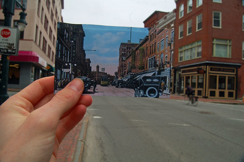
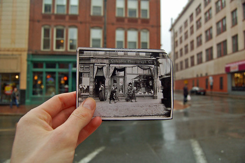
Portland Daily Photo blogger (and fellow Bonny Eagle High School alumnus) Corey Templeton has been doing some really neat photographs of historic postcards framed by the same locations in contemporary Portland:

Above: looking up Congress Street towards Congress Square.

Congress and Oak Streets. The old Columbia Phonograph is now a yoga store where you can drop lots of Benjamins on your path to enlightenment.

There's a whole group of people worldwide doing these framed photos on Flickr. In some, the historic pictures bear very little resemblance to the modern scenes that surround them (poor Lansing, Michigan). In others (especially those from Europe) there's little difference between the old photos and their modern-day frame. To my mind, the best ones, like these from Corey, combine recognizable buildings in both views, but contrast the two scenes with markedly different people, costumes, storefronts, and vehicles. Check out the awesome Strand Theater marquees in the top photo - they're long gone now, unfortunately.

Find more at www.flickr.com/groups/lookingintothepast/

Wednesday, March 25, 2009

The Sable Oaks Glacier

Above: the mighty Sable Oaks Glacier, the final resting place of most of Portland's plowed snow and all the street grime and garbage that was buried beneath it during the past winter's snow storms.

The Sable Oaks Glacier is the city's main "snow dump," a larger version of the Bayside Glacier that has showed up downtown in the past couple of years. I've written about the city's glaciers previously on this blog (here and here), and in a feature for the Portland Phoenix last spring, but this was my first visit to the big one.

I visited this natural wonder this evening right before sunset. It's a time we scenic nature photographers call "the magic hour," because of the magical way the light dances across the filthy, shit-streaked snow.


The Glacier is out by the airport, past the overflow parking lot, at the city's public works yard. There are nice views and these photos can't convey the scale of this thing. I highly recommend visiting. More photos to come tomorrow.

Tuesday, October 07, 2008

Urban Hiking: Portland's Stroudwater Trail


A few weeks ago I needed to pick up my newly-repaired camera at the FedEx warehouse out on Hutchins Drive, in Portland's industrial park fringe. So I hopped on my bike and rode to Stroudwater, where Portland Trails maintains a lovely hiking path through the woods next to the Stroudwater River. Following is a photo-illustrated guide to the hike. Since I didn't have my camera until the return trip, these photos are shown in the opposite order in which they were taken.

As the map above shows, the trail begins just off of Congress Street in a subdivision called River's Edge Drive. A Portland Trails sign marks the trailhead. You go down a hill to the actual river's edge, and wind along there just out of sight of suburban backyards. One of the Rivers Edgers has ingeniously appropriated a city sewer vault as a canoe rack. Who cares if your canoe smells a bit like sewage? Especially if you're paddling the Stroudwater, which includes a couple of sewer overflow outlets and cow farms along its banks?


Since the trail follows the river, it takes substantially longer to follow its loopy course than it would to walk a parallel route along the road. But soon, the terrain gets hillier as the bank leading down to the river also becomes steeper and the trail diverges from the riverside. Unfortunately, my own hike was too long ago for me to remember many of the trees and forest types I was passing through, but I do recall a lot of hemlock trees in this stretch, in the damper, shaded soils along the riverbank's north-facing slopes.

Fairly suddenly, you'll break out of the darkish coniferous forest into an open deciduous forest carpeted by ferns, and not long after that you'll walk through this clearing:


This is the pipeline corridor of the Portland Pipe Line Corporation, Quebec's primary oil lifeline, which connects tanker ships in Portland harbor to oil refineries near Montreal. So in theory, you could follow this path all the way to Montreal, but you'll have to cross a number of rivers along the way (like the one a few yards to your north here) without the benefit of bridges, and besides, as the signs here will tell you, trespassing in the pipeline corridor is not allowed.

Continuing west, then, you'll soon return to the riverbank by walking along boardwalks in the soggy floodplain. Across the river here is a pungent meadow, where the City of Portland's last resident cows chew their cud in sight of the Maine Turnpike.

The trail soon leaves the floodplain and climbs uphill again, until it reaches another clearing hemmed in by a spectacular wall.


Beyond this wall is an eleven acre parking lot - one of several asphalt plains that surround the UNUM headquarters. On the trail's side of the wall is a small wetland filled with cattails and other grasses that help filter the parking lot's toxic doses of stormwater runoff. Also note the sumac in the left side of this photo - it's a sun-loving pioneer species that's frequently found at the edges of meadows and other disturbed areas in temperate deciduous forests.

You'll barely leave the great wall of parking behind when you arrive at another, louder clearing: the bridges where the Maine Turnpike carries four lanes of freeway traffic over the Stroudwater River.


But as soon as you put the Turnpike behind you, there's a time warp! It seems as though you've stumbled into the early nineteenth century... from every parked car, you expect to see emerging a barrel cooper, or a blacksmith, or a fugitive slave bounty hunter!


No, you're still in the year 2008. But here at the Sturbridge Yankee Workshop, history really seems to spring to life! Inside, skilled craftsmen are practicing a time-honored American tradition: distributing decorative accents and furniture that have been shipped from China.

The trail leaves the Workshop's parking lot and descends to a small parking area at the end of Blueberry Road, which leads back to Congress Street. Continuing along the trail, though, you'll enter the woods again, although a razor-wire fence soon appears in the woods to your left. Beyond emanates a steady industrial thrum:


This is ecomaine's waste-to-energy incinerator, which burns the majority of the Portland region's garbage and uses the heat to produce electricity. This is a place that deserves a blog post of its very own, and I plan to write it soon. As the trail passes opposite the incinerator's huge smokestack, you can find a mysterious PVC pipe emptying a steady drip of unknown liquid onto the trail (the pipe seems to lead straight towards the incinerator).

Past this point, the trail is closed in the winter, since the woods beyond the incinerator contain some of Portland's only winter habitat for white tailed deer. The trail winds through upland forests for another half mile or so and passes a minor power line corridor before reaching Hutchins Drive.


The last fifty yards or so of Hutchins (pictured) are barricaded from traffic and overgrown with ten to twenty years' worth of encroaching plant growth. It's kind of neat to see the forest overtaking the no parking signs and guardrails. Even in the middle of the street, weeds are beginning to take over from widening cracks in the pavement.

The trail continues a bit further on to the Westbrook town line, but this is where I turned around. If you're reading this on the blog, just scroll up and read this whole post backwards to get back to where you started.

Tuesday, September 30, 2008

When "open space" is bad for the environment

In the East End of my hometown of Portland, Maine, the city is now entertaining a proposal to demolish an abandoned elementary school and build new mixed-income housing and a park in its stead.
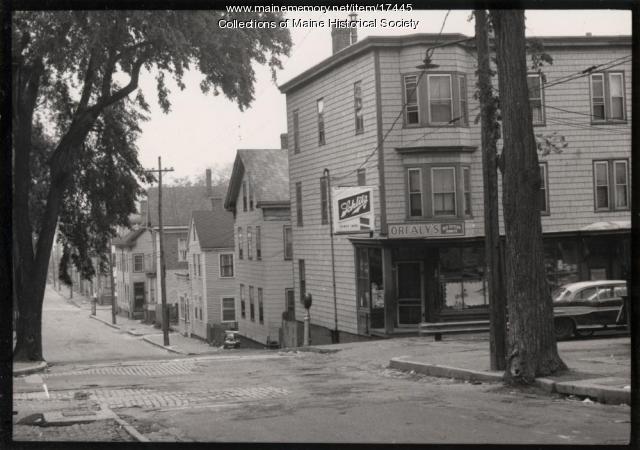
I'm all for the idea: building forty new, energy-efficient units of housing in an urban neighborhood will reduce households' dependence on oil-burning automobiles for transportation and fuel-burning furnaces for heat. Especially when the families who would live here would otherwise have to drive 20 to 30 miles out into the suburbs to find a home for a comparable price.
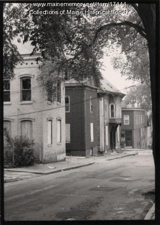


As an environmentalist, then, I have to take issue with one major element of the proposed project: the proposal to set aside nearly half of the site for a park.

To be clear: parks are definitely necessary for a successful urban environment. Most parks provide important ecosystem services, like cleaning the air, filtering stormwater, and providing wildlife habitat, in addition to making the city a more pleasant habitat for humans.

But this site happens to be two blocks away from two of Portland's biggest and most successful open spaces already, so the marginal environmental benefit of a new park is pretty small. In comparison, the proposed housing is providing more important environmental benefits: namely, a big reduction in forty households' energy use, and reduced development pressure in Maine's rural suburbs. What if, by sacrificing a portion of the proposed park, we could realize a big reduction in fifty households' environmental impact?

Building more housing on an already-developed site in Portland will also save acres of forest or farmland from being bulldozed into new subdivisions out in the suburbs. In other words, a small sacrifice in open space here would create a substantial net gain in open space regionally. And more housing here would also reduce the amount of public subsidy this project would require, and free up more funds for affordable housing elsewhere in the city.

We need to ask ourselves this: in a neighborhood that already has so much access to parks and open space, should we really be making all of these financial and ecological sacrifices for another patch of lawn?

Tuesday, August 07, 2007

The Sepulture of Portland Harbor

Portland, Maine, in 1837...


...and in 2001. A bit thicker around the middle, but still recognizable after all these years.

Points of interest in this transformation include Middle Street west of Temple (1960s urban renewal decommissioned the diagonal), Fore Street's ghost waterfront, and the transformation of the 1837 "City Farm" into the present-day stadium complex.

Feel free to download the KML overlay file to view these maps in closer detail. You'll need a free copy of Google Earth, available here.

Wednesday, May 30, 2007

They bulldozed it.


Above: Franklin and Oxford Streets in the 1950s. The other historic photo (below) shows another stretch of the long-lost Franklin Street (historic photographs courtesy of Maine Memory Network)
This photograph here is what the corner of Franklin and Oxford Streets looked like about 50 years ago, before the WASPs on the City Council noticed the Irish name on the corner store, called it a "slum," and bulldozed it all to create the hated Franklin Arterial.

Below, another photograph from the same site of another spot on the former Franklin Street. It's hard to know exactly where, since the buildings, shady elm trees, and even the sidewalks have been gone for decades. For those readers who have never been to Portland, here's what urban renewal gave us instead: a grass median full of garbage, some scrubby trees growing over the old neighborhood's rubble, and four lanes of traffic unencumbered by crosswalks or sidewalks. Here's a photo (the Franklin Towers, Portland's tallest building and a fine example of Soviet Sentimental architecture, commands a fine view of the no-man's-land):


Note how all of these "slum dwellings" in the old photos bear striking resemblance to historic homes that now sell for over $1 million in surrounding neighborhoods. Way to invest in real estate, you jingoist highway-engineering dipshits.

Here's some good news, though: my new buddy Patrick writes about schemes to repair past urban renewal idiocy with a new Franklin Boulevard in the Bollard this week: read about it here. Tomorrow at the Franklin Towers will be a "revisioning workshop" to brainstorm new ideas for the blighted pavement - perhaps I'll see you there. Finally, here's a previous post about fixing Franklin Arterial.

Tuesday, May 29, 2007

Updates from the Rogue Blogger

Exciting news! While helping out at the farmer's market over the weekend, I heard from two separate sources that Chris Busby, editor of The Bollard, Portland's electronic news source, has been disparaging yours truly as "a rogue blogger." Yarr!

Busby's apparently upset about this article from last week's Forecaster, which broke the news of a newly-formed group that is organizing to oppose the Portland Public Library's move to a smaller and more expensive building away from Monument Square.

This very loose organization evolved from informal discussions between Jed Rathband, a local political consultant, and me. Basically, we griped about what seemed to be an impulsive decision that affects a very important public space, and we decided to do something about it. Hence, the PEEPs: Portlanders for Economic and Educational Priorities (Jed came up with the name a few minutes before the Forecaster's press deadline).

Now, even though we didn't really have a name, we did have several supportive individuals encouraging us from the get-go. Like us, they don't have a lot of time or resources to dedicate to the cause, but they do agree it's worth more discussion. We the PEEPs exist to vocalize these opposing views, which, we're finding, are more widespread than the conventional wisdom would have it.

But Chris Busby is definitely not down with the PEEPs. After hearing about our group's humble origins from Jed over a beer at the local watering hole for 30-somethings, the erstwhile amiable Busby reportedly went home and wrote an nasty letter to the editor of the Forecaster. He called for the original article's retraction, criticized reporter Kate Bucklin for writing it, and dismissed the PEEPs as the work of only two people: Jed and "a rogue blogger." Who is me.

Mr. Busby's criticism misses the mark, though. We'd heard from others who oppose the library's move before we had the idea for PEEPs, and following the publication last Friday of this op-ed column of the subject (take a moment to admire the solidity of its arguments and the well-formed prose), we've been hearing from more and more people who agree that the Library shouldn't spend a million dollars to move into a smaller space.

Chris Busby has been working hard to establish The Bollard as a legitimate alternative to other local news sources. This is someone who usually champions free speech and alternative media - so why doesn't he use his own forum to discuss the issue, instead of trying to meddle with the editorial decisions of another newspaper? It strikes me as being a little bit petty, and my esteem for The Bollard's been bruised a bit.

Besides, Busby doesn't know me well enough to realize that he's only encouraging me by labeling me a "rogue blogger." He might as well have called me Captain Awesome. So, lock up the women and children and stay tuned to this blog for more about the PEEPs, why the library should stay where it is, and other rascally roguery.

Thursday, May 10, 2007

This Is Broken: Tukey's Bridge (of Doom)

Tukey's Bridge crosses Portland's Back Bay between the Munjoy Hill neighborhood and East Deering. It also completes the circuit of Portland's very popular Back Bay running path and links into the Eastern Prom bike path. In short, it is an important and well-used connection in Portland's bike and pedestrian network.

It is also completely and utterly broken: poorly designed and maintained, inconvenient, and unsafe. The fact that so many people still use it nevertheless testifies to its importance as a connector between neighborhoods.

Here's a tour of the bridge from a pedestrian's and cyclist's perspective:

To get to the sidewalk from the south, one must either take the Back Bay path or, if you're coming from any of the neighborhoods on the north side of the bridge, cut through a parking lot and follow a dark, narrow path under an overpass (broken glass abounds, natch).

The bridge makes room for eight lanes of freeway and one meager sidewalk, which is only on one side of the bridge. For most of its length, the sidewalk only has enough room for two people walking abreast. Bicyclists, runners, walkers, and strollers passing each other in both directions are frequently forced to jockey for space: in traffic engineering terms, this sidewalk's level of service gets an "F".

A big part of the problem is the fact that there's no sidewalk for northbound traffic on the other side of the bridge. Cyclists headed north have the choice of breaking one of two laws: either ride (illegally) on the sidewalk that leads into the bridge from Washington Avenue, or stay on the right shoulder of the road, even for the 100 yards over the bridge where it's designated a freeway and bicycles are forbidden (I opt for the latter option, which is faster and safer to my mind).

Anyhow, continuing southward, bikes and pedestrians have a choice between peeling off onto the Back Bay/Eastern Prom trails or continuing on a narrower sidewalk along the off-ramp to Washington Avenue and the Munjoy Hill neighborhood. If you should choose the latter, you'll encounter this off-ramp to Anderson Street:

Note the beefy guardrails. Traffic here is only supposed to be traveling at neighborhood speeds at this point, but this road is obviously designed to encourage much faster traffic. Not that this could be at all related to the speeding pickup truck that hit me, dragged me along the pavement, and ran away just a few blocks down this same street (see previous post).


Because of the guardrails, bikes and pedestrians must cross the off-ramp at the crosswalk, which at least has a bright sign to get the attention of the hurtling traffic.


Once across the off-ramp, bicyclists have two unsavory choices: either continue up the extremely narrow and overgrown sidewalk, as this guy does, until the guardrail ends and you can hop onto the street.

Or, if you want to be legal, wait until the coast is clear...


At the other side of the crosswalk, make a sharp turn against traffic (keeping a sharp lookout to make sure there aren't any cars coming around the bend at 60 MPH)...


Make a tight turn around the end of the guardrail...


...and ride normally up the right side of Washington Avenue (presuming you haven't been vehicularly manslaughtered in the meantime).


The state DOT could easily and cheaply fix the latter hazard by cutting the guardrail at the other end of the crosswalk and installing a curb cut there where bikes can go directly from the sidewalk to the road. This would also make it easier for northbound cyclists to get onto the bridge path from the other side of Washington.

It's kind of a wonder our highway engineers didn't do this in the first place, but I've seen enough highway engineers to know that they aren't fond of using their legs.

I'll be sending this assessment to the following bureaucrats, and I'd encourage you to send your thoughts on this crossing to the same people:

Monday, April 16, 2007

The New Coastline Arrives


Just two days after we marched down Commercial Street to demonstrate what a modest rise in sea-level would do to the coast of Portland, a powerful Nawth-Eastah combined with astronomical high tides to actually flood parts of Portland's waterfront (pictured: Portland Pier, courtesy of the Press Herald).

The storm surge added two feet to an already high tide, inundating several of Portland's wharves as well as parts of Bayside and Baxter Boulevard. As coastal geologist Peter Slovinsky noted on Saturday, Maine's sea levels are already on the rise, and continued greenhouse gas pollution will only increase the incidence and severity of these floods.