Showing posts with label history. Show all posts

Wednesday, January 06, 2016

Design iterations of the Chrysler building

A scanned page from a 1929 edition of Progressive Architecture shows William Van Alen's iterative development of the iconic Chrysler Building's crown and spire, which was famously constructed in secret in order to outreach a downtown rival. The spire went up to claim the "world's tallest building" title in November 1929, at the dawn of the Great Depression.

I found this, at random, from the New York Public Library's amazing digital collections, which include hundreds of thousands of scanned items. This particular item comes from The Miriam and Ira D. Wallach Division of Art, Prints and Photographs: Art & Architecture Collection, The New York Public Library. (1929-08) [direct link].

Update: thanks to Neil Kelley in the comments, here's a GIF version:

Tuesday, May 06, 2014

We don't sit in trees any more

In Italo Calvino's The Baron in the Trees, the hero, an adolescent 18th-century nobleman, renounces the earthbound life one evening when his sister serves him a dinner of snails. He spends the rest of his life living in the treetops, from where he falls in love, embraces radical politics, and participates in the political and cultural revolutions of the Age of Enlightenment.

Calvino's novel was written in 1957 — a novel about rebellion in a not-particularly-rebellious era. But a generation later, in April 1970, college students and politicians organized a "nationwide environmental teach-in" held mostly on college campuses. It would later become known as the first "Earth Day."

Historian Jared Farmer recounts one of the first Earth Day protests in his book Trees in Paradise, which I learned about recently on the Huntington Library's blog. A synopsis there recounts how "At Moorpark College, in Ventura County, 50 students laid their bodies down in front of bulldozers to protest the widening of a tree-lined road... By the time 10 students were arraigned in juvenile court on April 22, the first Earth Day, the trees were gone."
“What had been lost? Ancient redwoods? Historic oaks? No. They aren’t even native plants. Most of the trees in question are Australian eucalypts planted in the 19th century as ornamentals.”
With the benefit of 44 years' worth of hindsight, most Golden State environmentalists of 2014 would probably not risk arrest over some Australian eucalyptus trees. Today, they're generally considered an invasive species that sucks away scarce groundwater and fuels dangerous wildfires with their oily foliage and shedding bark.


But trees — especially giant Californian trees — remained a powerful synecdoche for environmentalism. Tree protests reached a peak in the late 1990s when the charismatic Julia Butterfly Hill, with support from Humboldt County Earth First! activists, spent two years sitting in a 600 year-old redwood that she named Luna.

The immediate consequence of Hill's endurance tree-sit was the permanent protection of her tree and a 200 foot buffer zone from a logging operations.

But more generally, Hill's activism attracted national attention to the regional battles between loggers and environmentalists over the fate of the Pacific coast's old-growth forests. Thanks to stronger enforcement of the Endangered Species Act, West Coast logging was already in steep decline by the late 1990s. The activism of treesitting brought the additional accountability of publicity to logging operations.

In the years since Hill climbed down from Luna, living in trees in order to save trees has become rarer and rarer — in part because it has become less necessary. In the interest of avoiding controversy, logging businesses have committed to more sustainable forms of forestry, and conservation organizations have been able to protect most of what remains of the west's old growth trees. More ambiguously, more timber harvesting has moved overseas, away from the critical eyes of Californian idealists.

Today, treesitting feels like a bit of a 1990s anachronism. We're taught, as ecologists, to think about the complexity of global ecosystems. The idea of devoting months' or years' worth of activism to save a small grove of trees can seem like a lark in the context of the world's more pressing, global crises.

But under the apocalyptic threats of losing everything, any form of activism will feel inadequate. Before we throw up our hands, it's worth noting that Julia Butterfly Hill and her tree-sitting colleagues actually accomplished most of their goals, and leveraged influence far beyond their ambitions. It's the Butterfly effect: given enough time, repeated small actions will eventually generate big changes.

Thursday, April 03, 2014

Watch Charles and Ray Eames pitch Eero Saarinen's "Mobile Lounges"

Jess and I took a vacation to the Grand Canyon last week, which was fantastic — but as spectacular as it the thing that actually inspired me to post on this neglected blog was a bleak bit of airport architecture we encountered on our way home.

Our flight got diverted through Washington D.C.'s Dulles airport, and on the way through we were herded into one of these bizarre vehicles (which you might recognize if you've been there yourself) for a ride to the next terminal. They kind of resemble an open-plan double-wide trailer stacked atop a tank chassis:
(image from Wikimedia Commons)


Being in Washington, my initial guess was that these were the unwieldy product of some pork-barrel military industrial contract. But I was mistaken — these weird buggies are actually the vestigial remnants from an unfulfilled future of jet travel.

In 1958, the architect Eero Saarinen was commissioned to design Dulles, which would be one of the first major airports built from scratch to serve jet aircraft. Foreseeing the long walks and sprawling terminals of our modern era, Saarinen suggested that it would be better to employ a kind of satellite parking system for planes, with passengers shuttled from a compact, comfortable terminal onto the tarmac via these mobile boarding platforms, which he called "mobile lounges".

I could go into more detail about the details and rationale behind this idea, but luckily for us Saarinen commissioned this wonderful short film from his friends Charles and Ray Eames as part of his campaign to sell the authorities on his design, so I'll just let them explain it:


Untitled from CHRISTINA LAETZ on Vimeo.

The mobile lounges are like a horizontally-oriented elevator: a door opens, you walk in, you wait a while, another door opens and you exit somewhere else. Airport travel was more glamorous back then, though: on our short ride between the modern Dulles terminals, the mobile lounge was pretty dingy and crowded — certainly nothing like the luxury buses depicted in the Eames' cartoon.

Saarinen's concept enjoyed a brief popularity in the early 1960s — mobile lounges were also adopted at Montreal's Dorval airport and Charles de Gaulle in Paris — but like the Betamax video player, they were an innovation that never quite caught on.

Monday, January 20, 2014

The Grand Canyon of Westbrook

The Grand Canyon of Westbrook is a large volume of negative space out behind the Travelodge (the landmark visible in the photo below, on the Canyon's north rim). I've been past it hundreds of times in my lifetime, but unless you walk out the railroad tracks to stand on the edge, it's easy to miss. The shopping centers and four-lane arterial roads that surround it do a remarkable job of obscuring the city's biggest hole in the ground.


Some online research reveals that the rock of the quarry is gneiss, rock that originally formed as marine clay and slate about 450 million years ago. It was the Ordovician Period, and the mud that would eventually become coastal Maine was accumulating in a shallow subtropical sea surrounding a chain of volcanic islands in the southern hemisphere.
450 million years is a long time. Enough time for seafloor mud to harden into slate, then for that slate to fold onto itself and plunge miles deep into the earth while brand-new Appalachian Mountains rise to the height of Himalayas near the equator, plus enough time for those Himalayan-sized mountains to wear away to White Mountain-sized nubs.
450 million years is nine million times longer than the amount of time it took Blue Rock Industries to make this hole. But now that we're thinking in terms of hundreds of millions of years, in terms of rocks that drifted halfway across the globe and sank four miles under long-gone mountains and resurfaced here, it doesn't seem like such a big hole any longer, in the grand scheme of things, does it?

Just a very temporary divot on a landscape even more temporarily known as "Westbrook," "Maine."

Thursday, May 30, 2013

The folk art of national identity

Growing up in Maine, the Canadian flag was a common sight — especially in the summertime, when the nearby town of Old Orchard Beach turned into a Québécois Saint-Tropez.

So I was surprised to learn that the Canadian national icon — its maple leaf flag — is a relatively recent invention, and the subject of bitter debate when it was proposed in the Canadian parliament in 1964.

Canada's old flag featured the Union Jack symbol, which was a a snub to French Quebec. In the mid-1960s, when the Québécois separatist movement began to organize, Prime Minister Lester B. Pearson proposed a new national flag that could shore up the nation's unity and give it its own post-colonial identity.

This may not actually have been a productive political gambit. "Quebec does not give a tinkers dam about the new flag," said Liberal politician Pierre Trudeau (Trudeau himself would go on to become a Canadian icon in his own right as one of the nation's most successful and beloved Prime Ministers, mainly for moving the country beyond its British roots and championing a bilingual, multiethnic Canadian identity).

Fortunately, though, the rest of Canada did care about the flag. They mailed in thousands of suggestions in pen-and-ink drawings and watercolor paintings. Beavers, maple leaves, fleurs-de-lis, or the old Union Jack were common themes. Some of the public's suggestions have been digitized on this website from the University of Saskatchewan, and they're pretty amazing examples of Canadian folk art at a time when the adjective "Canadian" was actually beginning to mean something. Each one is a snapshot of a nation that's still trying to figure itself out.

A British-French mashup.


From Manitoba, April 1963:
"The top green strip portrays in the background the Rocky Mountains of the West and the Laurentians of the East....The second strip of yellow gold depicts the growing grain for which Canada is famous...The third strip describes untold numbers of rivers and thousands of lakes...the Atlantic, the Pacific and the Arctic....The coats of arms of the ten provinces which make up Canada are in the shape of an arc and depicts its beginning and origin. Even the shape of the arc has a meaning - freedom, better life and individualism for all those who want to make Canada their new country."


I feel like lots of designs resemble hockey jerseys. From Alberta, 1964:

"Through the Maple Leaf, this flag represents Canada as always being in "the peerpetual light." A light shining over one Canada. People's choice #1."

 From Ontario, 22 May 1964:

"If we must have a new flag, it should be one to be proud of, that will bring unity to this wonderful country of ours....The ten maple leaves, for ten provinces. The Canadian Beaver, and waves are for 'from sea to sea.'"

 Quite a few didn't get the memo about how the Union Jack is faux pas in Quebec (submission from New Brunswick, 30 November 1964).
Canada rejected this one, but Idaho picked it out of the garbage and adopted it as its own state flag in 1967.

In the end, Canada avoided old-world heraldry altogether and went with a clean and strikingly modern design. Neither French nor English, the new Canadian flag was one of several mid-century innovations that helped the nation clear out its colonial baggage and define itself on its own terms.


Hat tip to Burrito Justice for finding these and writing about them in his post about funny animals as national symbols.

Thursday, February 28, 2013

The Chase Manhattan Bank of Cholera

You probably know that Aaron Burr murdered Alexander Hamilton in a duel. But I recently learned of Burr's surprising and grotesque role in some of New York City's worst plagues — including one we're still suffering through to this day.

My dad recently gave me a fascinating (but not online, unfortunately) medical history of New York City's water supply by Dr. David E. Gerber, from which I learned this:
"In 1799, New York City passed on the responsibility of constructing and maintaining a waterworks to the newly charted Manhattan Company. The company, the brainchild of the improbable team of Alexander Hamilton and Aaron Burr, received from the state legislature a mandate to supply New York City with 'pure and wholesome' water."

Left: Manhattan Company log pipes excavated in 2004 near Coenties Slip. Via New York City Walk (photographer unknown)

But the Manhattan Company was terrible at providing "pure and wholesome water." They employed cheap wooden pipes and instead of procuring fresh Bronx River water, as had been proposed by city officials, they dug wells on the outskirts of the growing city (near today's Greenwich Village) where the water supply quickly became polluted with the city's sewage, or dried up altogether from overuse.

So in spite of a $2 million charter from New York's state government, the growing city continuted to suffer from polluted water. In 1832, the very first year that cholera arrived in New York City (from Asia, via overseas trade), 3,515 New Yorkers died.

There was a reason why the Manhattan Company was so negligently, fatally incompetent at its purpose: it was run by some of the city's earliest investment bankers, including the murderer Aaron Burr.

At Burr's initiative, the Manhattan Company's charter was amended shortly before it took effect to allow the new company to spend its excess capital "in any way not inconsistent with the Constitution and laws of the United States."

The Legislature and Burr's business partner, Alexander Hamilton, seemed to believe that this would allow for additional, future waterworks. But Burr almost immediately exercised this clause to capitalize a new bank, using the money intended for waterworks to give out loans to New York merchants.

The Bowery Boys, the New York history podcasters, have an episode on the Croton Aqueduct that tells some of this same story, and they put it this way:
"There was a banking monopoly where you had the US Federal Bank [i.e., Alexander Hamilton's First Bank of the United States] and the Bank of New York, which was founded by Hamilton, Burr's rival and victim. Burr and his company got a $2 million contract from the state legislature to bring fresh water into New York City.

They decided to spend it thusly: $100,000 on waterworks and bringing fresh water into the city — so 1/20th of the total — and $1.9 million on creating a bank!"

Providing "pure and wholesome water" was just a distracting sideline. In fact, the more the Manhattan Company spent on public waterworks (there were no water meters back then, thus no reliable user-fee system, thus no profit motive), the less they had to spend on high-interest loans to New York City's merchant class.

Hamilton evidently didn't like the competition from a new bank in town: he left the Manhattan Company shortly after Burr capitalized his new bank with 1.9 million New York State taxpayer dollars.

The citizens of New York suffered the Manhattan Company's filthy water until 1842,  when the City of New York finally opened an aqueduct from the Croton River, which provided public drinking water that was genuinely pure and wholesome, and does so to this day.

So New York eventually addressed its sanitation problems and cured its epidemics of cholera and yellow fever.

Unfortunately, Aaron Burr was only an early vector in New York City's raging plague of assholes who collect millions of dollars from the government in order to enrich themselves in the global banking casino.

In 1955, Aaron Burr's Bank of the Manhattan Company merged with the Chase National Bank to become Chase Manhattan. And in 2000, Chase Manhattan bought out the investment firm JP Morgan to become JP Morgan Chase, on whose website you can today download a short history that tells part of this very same story. This document includes some pictures of old wooden pipes and a quaintly threatening engraving (below) of their company's founding chief executive ballistically perforating the Founding Father on our $10 bill.

However, somehow JP Morgan Chase's PR department neglected to mention the part about all the cholera — hopefully they'll appreciate this addendum.


Tuesday, November 27, 2012

Cities & Memory


From Italo Calvino's Invisible Cities:


In Maurilia, the traveler is invited to visit the city and, at the same time, to examine some old post cards that show it as it used to be: the same identical square with a hen in the place of the bus station, a bandstand in the place of the overpass, two young ladies with white parasols in the place of the munitions factory.


Photo courtesy of the Friends of the Eastern Promenade


If the traveler does not wish to disappoint the inhabitants, he must praise the postcard city and prefer it to the present one, though he must be careful to contain his regret at the changes within definite limits: admitting that the magnificence and prosperity of the metropolis Maurilia, when compared to the old, provincial Maurilia, cannot compensate for a certain lost grace,


Photo by Corey Templeton

which, however, can be appreciated only now in the old post cards, whereas before, when that provincial Maurilia was before one's eyes, one saw absolutely nothing graceful and would see it even less today, if Maurilia had remained unchanged; and in any case the metropolis has the added attraction that, through what it has become, one can look back with nostalgia at what it was.


Beware of saying to them that sometimes different cities follow one another on the same site and under the same name, born and dying without knowing one another, without communication among themselves. At times even the names of the inhabitants remain the same, and their voices' accent, and also the features of the faces; but the gods who live beneath names and above places have gone off without a word and outsiders have settled in their place.


It is pointless to ask whether the new ones are better or worse than the old, since there is no connection between them, just as the old post cards do not depict Maurilia as it was, but a different city which, by chance, was called Maurilia, like this one.


Photo credits:
Historic postcards from MaineMemory.net.

Present-day photos courtesy of (from top to bottom): Friends of the Eastern Promenade, Corey Templeton via the archboston.org forums, Corey Templeton via the Portland Maine Daily Photo blog, and Panaramio user sacoo.

Tuesday, September 18, 2012

How an Icon of Journalism Became a Hollowed-Out Billboard

When it was built at the southern end of Longacre Square in 1903, the new headquarters of the New York Times became a landmark of midtown Manhattan, and helped publisher Adolph Ochs convince the city to rename the famous intersection in front of the building as Times Square.

One Times Square in 1904 (source).One Times Square in 2010.
Photo: Bernt Rostad/Flickr
By the mid-20th century, though, the Times had sold the building, and a new owner dismantled the intricate granite and terra-cotta facade to replace the exterior walls with plain concrete panels. In 1996, shortly after the City Council passed new laws that expelled porn theaters from the area, the building got sold again, to Sherwood Outdoor, an advertising firm. By then, the building's signage was covering most of the exterior windows, leaving the offices inside rather dark and dreary.

Rather than spend money to renovate, the new owners decided to simply abandon the building's interior above the 3rd floor, and use the top part of the building exclusively as a billboard (the lower 3 floors are still used, periodically, as retail space — it's currently a Walgreens drug store).

So for the past 15 years, the iconic building that was the namesake of Times Square itself, and a major headquarters of journalism, has become a hollowed-out shell, a mere scaffold for electronic signs.

At the Crossroads of the World, the value of advertising has trumped the value of journalism, and of work in general. 


Postscript: Illustrator Joe Mckendry has made a gorgeous before-and-after elevation drawing of the building's eastern facade in 1904 and in 2010, for his book One Times Square.

Monday, September 10, 2012

The Indian Burial Ground in the Basement

I was walking the dog this weekend along Hammond Street, a quiet residential block squeezed on the hillside between busy Washington Avenue and the industrial district of lower East Bayside here in Portland. They're building two new apartment buildings on a lot at the end of the street, and have started digging out the foundations.

Fascinatingly, the basement excavation has revealed a cross-section of the hillside, which is full of shells. Mostly longneck clams, with a few oysters here and there:


The dense layers of shells are sandwiched between clayey marine soils that are typical of our neighborhood, and they follow the slope of the hillside, such that the same layers are visible twice in the excavation: once against the vertical wall on the uphill side, and once again on the floor:


I'm pretty confident that this is a Native American shell midden — a trash heap from seafood feasts of centuries past. Though it's several blocks and a freeway crossing away from the ocean today, this hillside used to drop straight down into the tidal flats of Back Cove, as you can see in this 1837 map of Portland. The red dot shows the site of this construction site, smack dab on the old shoreline:


Back Cove is a tidal basin — exactly the kind of place where longneck clams thrive, although you wouldn't want to eat them these days. Other parts of the shore around Back Cove were probably marshy and difficult to access from land, but this location, next to a steep hillside, probably offered more direct access to the flats for humans, and for clams, there was relative proximity to the nutrient-rich tidal flows at the Cove's outlet.

I've been kind of stumped by how the shell heaps are interspersed with layers of clayey soil. This photo shows the horizontal cross-section of two layers (on the future basement floor in the foreground) as well as the sloping vertical cross-section (on the street-facing wall, in the center of the photo). At the left edge of the photo is Anderson Street, which was once the shoreline. How did all that clay get in between? 


Stranger still is how some of the shell layers seem to overlap with each other:


My guess is that the steep slopes of the hillside probably set off occasional landslides, which would periodically bury a heap of shells under a thick layer of mud washed down from the higher ground above.

Any archaeologists care to comment?

Related post: Longfellow's Garbage

Update: Howard Reiche e-mailed me this this morning (Sept. 11):
The Knudsen home, which
stood on the site until this
summer. From the City of
Portland's 1924 tax records
.
 Good for you. That was my grandfather’s (Knud Knudsen) house where he raised 13 children after immigrating from Denmark. We have a family photo of my mother, Laura Christine (Knudsen) Reiche, feeding the ducks in the water which came to the foot of their garden which I walked in many times..
    Hammond St. was named after the Hammond rope walk which was originally at that site. Possibly the “layers of clay” mystery had something to do with the construction or changing of the rope walk. 

Tuesday, March 13, 2012

A Relic from the Gold Rush Space Program

A couple years ago I wrote about the Mannahatta project, an effort to reconstruct the pre-colonial ecosystems that existed on Manhattan Island, and the gorgeous computer-generated birds-eye-views that it produced.

Now, a Californian geographer named Mark Clark has made a similar speculative map, showing most of California as it might have looked from space in 1850 (via the Strange Maps blog):

What's most striking to me is how edenic the Central Valley looks with its original rivers and marshes streaming snowmelt from the Sierra Nevada into the lush swirl of marshes in the Sacramento-San Joaquin delta in the north, or, in the south, into the long-lost Tulare Lake, once the largest freshwater body west of the Great Lakes.

Now, the same landscape is all massive monoculture farm fields spotted with dusty, heat-blasted cities like Bakersfield and Fresno. Even more remarkable is that most of the transformation happened within a single generation during the early 20th century. Why aren't there more Hollywood blockbusters about this story?

And speaking of native Californian hydrology, a friend recently turned me onto the L.A. Creek Freak blog, which is all about trying to restore watersheds and their ecological functions in the Los Angeles metro area. I'm actually planning a visit to southern California early this summer — if any Californian readers want to leave tourism suggestions in the comments, or just say "hello," it would make my day.

Friday, February 10, 2012

How the Baby Boom Became the Apocalypse Boom

I recently started following the amazing Twitter feed of William Gibson, author of Pattern Recognition, Neuromancer, and a new collection of essays called Distrust That Particular Flavor.

The title of the latter, it turns out, comes from an essay about his childhood reading of H.G. Wells's Time Machine, around the time of the Cuban Missile Crisis. Quoting at length from the end of this essay, titled "Time Machine Cuba":


The future, according to Hollywood, in 1968 (from 2001: A Space Odyssey) and in 2009.

"In his preface to the 1921 edition of The War in the Air, Wells wrote of World War I (still able to call it, then, the Great War): 'The great catastrophe marched upon us in daylight. But everybody thought that somebody else would stop it before it really arrived. Behind that great catastrophe march others today.' In his preface to the 1941 edition, he could only add: 'Again I ask the reader to note the warnings I gave in that year, twenty years ago. Is there anything to add to that preface now? Nothing except my epitaph. That, when the time comes, will manifestly have to be: "I told you so. You damned fools." (The italics are mine.)'

"The italics are indeed his: the terminally exasperated visionary, the technologically fluent Victorian who has watched the 20th Century arrive, with all of its astonishing baggage of change, and who has come to trust in the minds of the sort of men who ran British Rail. They are the italics of the perpetually impatient and somehow perpetually unworldly futurist, seeing his model going terminally wrong in the hands of the less clever, the less evolved. And they are with us today, those italics, though I've long since learned to run shy of science fiction that employs them.

"I suspect that I began to distrust that particular flavor of italics when the world didn't end in October of 1962. I can't recall the resolution of the Cuban missile crisis at all. My anxiety, and the world's, reached some absolute peak. And then declined, history moving on, so much of it, and sometimes today the world of my own childhood strikes me as scarcely less remote than the world of Wells's childhood, so much has changed in the meantime.

"I may actually have begun to distrust science fiction, then, or rather to trust it differently, as my initial passion for it began to decline, around that time. I found Henry Miller, then, and William Burroughs, Jack Kerouac and others, voices of another kind, and the science fiction I continued to read was that which somehow was resonant with those other voices, and where those voices seemed to be leading me.

"And it may also have begun to dawn on me, around that same time, that history, though initially discovered in whatever soggy trunk or in whatever caliber, is a species of speculative fiction itself, prone to changing interpretation and further discoveries."

I love that last sentence. There's a whole academic field of historiography: the study of how our historical narratives change and have changed over time. Historiography is essentially a literary exercise: understanding the stories we tell about ourselves. Is there really much difference between the stories we tell about our pasts and the so-called science fiction stories of our futures?

"That particular flavor" of dystopian science fiction is particularly strong right now, with heady notes of Mayan prophecies and mideast uprisings and financial collapses. In a recent interview with Wired magazine, Gibson elaborates on his skepticism:

"Futurists get to a certain age and, as one does, they suddenly recognize their own mortality, and they often decide that what’s going on is that everything is just totally screwed and shabby now, whereas when they were younger everything was better.

"It’s an ancient, somewhat universal human attitude, and often they give it full voice. But it’s been being given voice for thousands and thousands of years. You can go back and see the ancient Greeks doing it. You know, 'All that is good is gone. These young people are incapable of making art, or blue jeans, or whatever.' It’s just an ancient thing, and it’s so ancient that I’m inclined to think it’s never actually true. And I’ve always been deeply, deeply distrustful of anybody’s 'golden age' — that one in which we no longer live."

As concerned as I am about human civilization's capacity to commit suicide, I'm still with Gibson here. America's baby boomers have been a uniquely self-important generation — and uniquely destructive. But the idea that they're the apex of a million years of humanity, after which everything must decline, really takes the cake for arrogance.

Monday, August 01, 2011

Back to the land... in outer space!

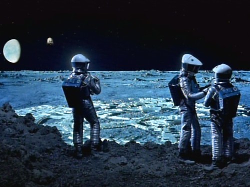
The peak of the American suburban impulse may well have been the year 1975, the year a group of earnest technocrats and back-to-the-land hippies converged to make the case for orbiting shopping plazas and ranch-style homes in deep space.

When I was a kid obsessed with astronomy, I spent hours staring at paintings by 
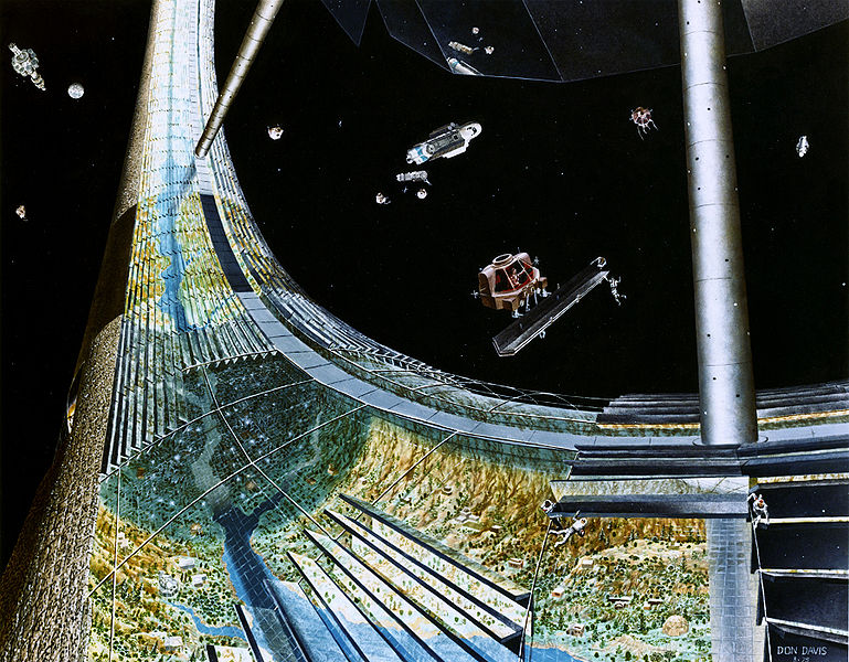
Don Davis, an American artist best known for his sci-fi illustrations. The works that I remember most vividly were his depictions of the space colonies advocated by Princeton physicist Gerard O'Neill in the mid-1970s, which were brought to my attention recently by a recent blog post on The Atlantic's technology blog.


These paintings were, and still are, utterly bewildering. To simulate gravity by centrifugal force, the theoretical colonies generally had a cyclindrical or toroidal design, which meant that landscapes didn't recede to a vanishing point on a horizon, but instead curved up and overhead. Meanwhile, mirrors and shades on the exterior controlled night and day cycles, and blended scenes of clouds with the starry dark of deep space. All in all, trying to figure out the logic of perspective in these paintings is like puzzling through a complicated Escher print.


But even weirder than all that were the pastoral scenes depicted, floating around in tubes through the vacuum of space. The picture above was intended to simulate the northern Californian coast, according to an autobiographical statement on Davis's website:
"It was painted this way under the direction of Gerard O'Neill himself, who related a recent impression of the vantage point from Sausalito being an excellent scale reference for a possible setting inside a later model cylindrical colony... I deliberately wanted to imply the challenge of trying to transplant a workable ecosystem to a giant terrarium in Space."
Many of these paintings came out of a NASA-sponsored summer camp for space theorists held at Ames research center in 1975. In that same year, Stewart Brand, the creator of the Whole Earth Catalog, gave O'Neill several pages to make the case for space colonies in his new publication, the CoEvolution Quarterly.


It's easy to ridicule these space suburbs now, with the benefit of hindsight. In 1975, though, the brand-new Space Shuttle was being designed and promoted as our cargo utility truck to the heavens, and the idea of space colonies resonated with at least a few back-to-the-land hippies (like Stewart Brand) who dreamed of a new frontier in which to escape the Earthbound troubles of energy shortages, nuclear war, and the decline of American cities.

Big-name environmentalists of the era mostly ridiculed the idea of space colonies - but they still took the idea seriously enough to send in responses to the idea for Brand's magazine, something that would be hard to imagine today.

Some, like Buckminster Fuller and Carl Sagan, doubled down on their faith in high technology and fully endorsed the concept. But most of Stewart Brand's readers and contemporaries were more skeptical. Steve Baer, a designer of off-grid houses, had this critique, which reads like a purloined passage from J. G. Ballard or Don Delillo:
"I don't see the landscape of Carmel by the Sea as Gerard O'Neill suggests... Instead, I see acres of air-conditioned Greyhound bus interior, glinting slightly greasy railings, old rivet heads needing paint - I don't hear the surf at Carmel and smell the ocean - I hear piped music and smell chewing gum. I anticipate a continuous vague low-key "airplane fear."
And Gary Snyder, the beat poet who practiced Zen Buddhism in the rural suburbs of the Sierra Nevada foothills, bemusedly shrugs off Brand's enthusiasm:
"Thanks for the invitation to comment on O'Neill's space colony. I'm sure you already suspect that I consider such projects frivolous, in the all-purpose light of Occam's Razor my big question about such notions is "why bother?" when there are so many things that can and should be done right here on earth. Like Confucius said, 'Don't ask me about life after death, I don't understand enough about life yet.' Anyway. I'm hopelessly backwards, I'm stuck in the Pleistocene. That is, seriously... I'm still mucking around in the paleo-ethno botany, which is a kind of zazen."


While I agree with the substance of what Snyder and Baer say, I find their commentary ironic in light of the back-to-the-land lifestyles they practiced and advocated. 
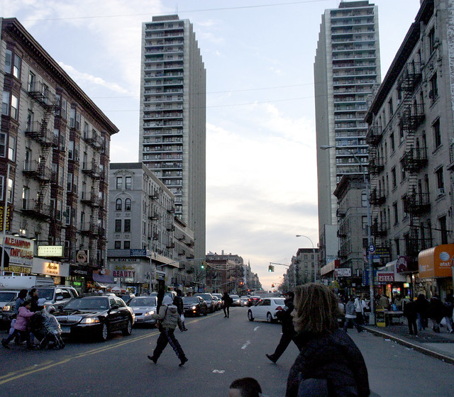
Baer, after all, made his living by designing off-the-grid homes for communes like Drop City - space stations for the deserts of the southwest, in other words. And while I admire much of what Snyder wrote, I also regret that his political and environmental activism suffered from his self-imposed suburban exile in the Californian foothills. When he writes "there are so many things to be done right here on Earth," I want to shake him out of his meditation long enough to point out the racial and social iniquities in his own backyard.

In the end, isn't an idyllic sylvan landscape millions of miles away from the nearest city the logical extreme of the back-to-the-land movement that Baer, Snyder, and a million other Whole Earth Catalog readers dreamed of? Lewis Mumford, the famous champion of closely-knit urban neighborhoods, is a more reliable critic of space suburbs, and sure enough, his critique was the sharpest and most succinct of the bunch:
"I regard Space Colonies as another pathological manifestation of the culture that has spent all of its resources on expanding the nuclear means for exterminating the human race. Such proposals are only technological disguises for infantile fantasies."
Simply replace "Space Colonies" with "shopping centers" or "subprime mortgages", and it can still apply today in our post-space age.

Wednesday, June 01, 2011

From Skid Row to Starbucks

The alleged etymological origins of the term "skid row" are in the Pacific Northwest, in districts where lumbermen "skidded" logs down towards mills and ships lining the waterfront, and where disreputable trades served lumbermen who were eager to spend their earnings on vices after long and sober months in the woods.

One of the most famous skid rows is in the neighborhood around Seattle's Pioneer Square, centered around Henry Yesler's sawmill. The neighborhood followed a familiar skid row trajectory: first, the waterfront industry moved away. Then, urban renewal projects manifested the city's disrespect for the neighborhood by demolishing lots of buildings and leaving the rest to wither in the shadows of ugly, soot-soaked freeway viaducts. Under the traffic, intentionally hidden from view, strip clubs, drug vendors, and homeless agencies flourished.

And then, when developers realized how close these skid rows were to downtown, and how cheap the real estate still was, the skid rows quickly flipped into yuppie pleasure districts, from New York's Bowery to San Francisco's Tenderloin District. And Pioneer Square attained the ideal embodiment of this post-industrial destiny when Starbucks built its complex of corporate headquarters offices in the neighborhood.

By the time crews started excavating for the 4-level underground parking garage, they confirmed that the old age of logging was dead and buried. Literally.


Photo by Scott Durham, of centraldistrictnews.com

Instead of digging down into post-glacial gravel, backhoes found a morass of rotting timber instead: the discarded slash from the old mills, the century-old pilings of old wharves and railroads, and the miscellaneous debris that nineteenth-century land developers had tossed into the city's marshy waterfront to transform wetlands into dry quays above sea level.

This item came to my attention via hugeasscity, which noted that the city's plan to renovate the aging Alaskan Way Viaduct (the concrete urban renewal scar visible in the background of the photo above) calls for putting the freeway underground. Which sounds like a neat-o plan for a Tomorrowland version of Seattle, until you consider that the whole gleaming, modern Seattle waterfront district is actually built atop an unstable, sinking pile of wood. Plus an active fault line.

In the end, it doesn't matter how many lattes and condos you sell above ground: the roots of the city will always be in Skid Row.


PS- the bike tour to Walden post I'd promised yesterday is still coming - check back tomorrow! I'm going on a blogging tear this week to make up for lost time.

Tuesday, May 31, 2011

Walden

While in Boston over the weekend, we took our first swim of the summer in Walden Pond, the famous suburban retreat where Henry David Thoreau lived for two years.

Walden was never a wilderness - even when he lived there 150 years ago, it was still within a 30 minute walk of Concord's busy downtown, where Thoreau managed the family's pencil-manufacturing factory. The commuter rail line that skirts the western edge of the pond today was still there in Thoreau's time (he'd often walk along it as a shortcut from his cabin to the town).

But, inspired in part by Thoreau's writings, people have changed the woods around Walden tremendously in the past century and a half. Americans following Henry David's suburban impulse ("I have, as it were, my own sun and moon and stars, and a little world all to myself," Thoreau bragged in a chapter of Walden titled "Solitude") have transformed Concord from a small agricultural and manufacturing center into a convenient bedroom community halfway between Worcester and Boston.

Three miles east of Walden Pond, modernist cubicle farms for software and pharmaceutical companies crowd along the Route 128 corridor, surrounded by greenery designed to be enjoyed at 55 miles per hour.

From there, a four-lane expressway, the Concord Turnpike, runs within a hundred yards of Thoreau's homestead site. In the time it took him to make his daily 2-mile walk to Concord, modern Thoreauvians can drive themselves all the way to Logan Airport (albeit with less self-reliance).

The road goes two ways, of course, which means that Walden Pond has also become an extremely popular destination for anyone in the metro Boston region who wants to live deliberately and front only the essential facts of life for a few hours after a rough day of shopping at the nearby Burlington Mall.

The state has gradually tried to buy up the land around Walden Pond to turn it into a state reservation. Still, in doing so, the remaining privately-owned parcels nearby have become increasingly valuable as tourist traps and highway rest stops, making additional land conservation asymptotically difficult.

And as a public park, several acres of Walden's former Woods have been cleared to make way for parking lots, a replica of Thoreau's cabin, and the "Thoreau Society Shop" (Thoreau's famous quotation on poverty - "Do not trouble yourself to get new things, whether clothes or friends... Sell your clothes and keep your thoughts. God will see that you do want society" - graces the shop's best-selling t-shirts).

A large bathhouse overlooks a tiny beach on the eastern end of the pond near the parking lots and souvenir shop. The spring-fed pond itself is facing serious erosion problems in the face of all the foot traffic and bootleg sunbathing clearings on every shore, and the state has built a long concrete wall to keep the land nearest the beach from sliding into the pond:

The pond's circumferential footpath in many places runs within inches of the water, compacting the forest soils and making it difficult for plants to take hold and establish their natural filtration functions.

Thankfully, the agency in charge is taking a more aggressive stand against erosion, and erecting fences that keep people from treading on every inch of shoreline. The conserved forestlands that surround Walden Pond do a good job of filtering out the oil- and pesticide-soaked runoff pollution from surrounding freeways, parking lots, and McMansion developments, and so Walden Pond itself is remarkably clean, in spite of its metropolitan surroundings. It's one of my favorite swimming holes anywhere - and I say this as a connoisseur who lives in a place with a bounty of swimming holes.

In a follow-up post tomorrow, I'll write about one of my favorite Boston bike rides: downtown to Walden Pond in about 2 hours, which makes for an ideal summer day trip.

Monday, April 04, 2011

The Utopia Over the Freeway

The Bridge Apartments in Washington Heights. Photo used by permission from photographer Mario Burger,
Burger International, Inc.
.

Last fall, the Cooper Union hosted a show dedicated to Paul Rudolph's Lower Manhattan Expressway (or LOMEX) proposal - a design study intended to enamor New York City's modernist architectural elites with Robert Moses's freeway-building ambitions.

Rudolph was a genius draftsman, and he produced stunning drawings that manage to generate a sense of futuristic optimism and excitement around the idea of living above thousands of exhaust pipes stuck in traffic:


One of Paul Rudolph's LOMEX studies.


From at least the 1930s, when Moses was in charge of the Parks Department, New York's "Master Builder" wanted to build a freeway through lower Manhattan, connecting New Jersey to Brooklyn by way of the Holland Tunnel and the Williamsburg and Manhattan Bridges. Interestingly, Paul Rudolph's proposal came only during the Lower Manhattan Expressway's dying days, and only at the sponsorship of the Ford Foundation.*


Jane Jacobs had published The Death and Life of Great American Cities seven years previously, in 1961; a year after Rudolph began his study of the Expressway, in 1968, Governor Rockefeller would freeze Moses out of the city's transportation agencies. By the time Rudolph stopped working on this proposal in 1972, the city was on the verge of bankruptcy and grand building schemes like this one were relegated to the realm of fantasy. In a review on the Design Observer blogs, Mark Lamster wrote that Rudolph's was "an extraordinary vision, if not a practical one."


Rudolph's drawings are indeed amazing, especially the ones that compare the hugeness of his vision to existing landmarks (the red drawing above frames the towers of the Williamsburg Bridge, which is huge in its own right, in the center).

The show is powerful not just for its audacity, but for what we know now, forty years later, when the historic neighborhoods that Rudolph and Moses would have liked to have bulldozed are worth hundreds of billions of dollars. In hindsight, it's easy for us to say, "something like that could never actually happen."

Except for one thing: something like Rudolph's vision actually did happen. A few miles away, on the same island of Manhattan, urban renewalists and highway builders had actually finished a massive cross-island expressway, topped with apartment towers and a major transit hub, several years before Paul Rudolph started designing the LOMEX.


The new Trans-Manhattan Expressway seen from a tower of the George Washington Bridge. Photo from the LIFE Magazine archives.


This is the Trans-Manhattan Expressway, also known as I-95, the only Interstate highway that crosses Manhattan Island. It was opened in 1963, when a second deck was added to the George Washington Bridge to New Jersey. It crosses the island in Washington Heights, where the island is only one mile wide, but its construction still required the demolition and clearance of dozens of buildings on eight dense city blocks.
When the Expressway opened in 1963, Robert Moses, the freeway's champion, foreshadowed Paul Rudolph's work to come later in the decade:

"This is the first expressway to be built across Manhattan, and we hope that the Lower Manhattan and Mid-Manhattan expressways, both of which have been the victims of inordinate and inexcusable delays caused by intemperate opposition and consequent official hesitation, will follow. These crosstown facilities are indispensable to be effectiveness of the entire metropolitan arterial objective of removing traffic through congested city streets."

Of course, the scorn for opposition that Moses has on display in this quote was even then sowing the seeds of his downfall. And with the benefit of hindsight, it's easy for us to chuckle at the notion that building a fast and convenient route for cars and trucks to enter Manhattan would do anything to remove any traffic from New York's streets:

Photo by Zach K.


The Trans-Manhattan Expressway wasn't merely a freeway, though. It was a linear megastructure that stacked a complex of modernist transportation hubs and huge apartment blocks overhead. On the western end, Moses built a winged bus terminal that squatted over the freeway's entrance ramps:

Looking west towards New Jersey over the new Trans-Manhattan Expressway and the George Washington Bridge bus terminal. Photo courtesy of the Port Authority of NY-NJ.


George Washington Bridge bus terminal. Photo by gezellig-girl.com.


On the eastern end, the city sold development rights to private developers who built four enormous apartment towers, known today as the "Bridge Apartments." The New York Times did a story a few years ago called "Life on the Road," a chronicle of the apartments' history and what it's like to live there. "If the windows are open, the noise is most deafening on the middle floors, and people inside find that they need to raise their voices to hold a conversation or talk on the phone," writes reporter David Chen. "The winds carry vehicle exhaust upward, which is especially noticeable on the terraces. And on most floors, the vibrations of trucks can clearly be felt, along with those of any construction equipment."


Two of the four Bridge Apartment towers, which mark the path of the Trans-Manhattan Expressway beneath. Photo by Zach K.


The Bridge Apartments loom over Washington Heights like mother ships from a sci-fi movie. I remember catching sight of them from time to time when I worked as a park ranger in Inwood Hill Park, two miles away, and being startled by their incongruous appearance on the skyline. This in a city known for its tall buildings - but the four towers, lined up in a row and hulking over a major freeway, have an otherworldly quality to them (Mario Burger's photo at the top of this post is the best illustration of this feeling that I was able to find online).

In all the reviews I've seen of Rudolph's show, I'm surprised no one has mentioned the Trans-Manhattan Expressway. It was obviously a major precedent in Rudolph's mind and in his designs - when he began working on LOMEX, the Trans-Manhattan Expressway would have still felt new and futuristic, not yet dated and dingy with soot and exhaust as it is now.

And for those modernist romantics who wonder at the ambitions of people like Robert Moses and Paul Rudolph, and yearn for a future that might have been: the gritty reality is on plain view to all in Washington Heights.


*The Ford Foundation's involvement in promoting LOMEX was probably not a self-serving effort to get more New Yorkers into Fords, as I'd initially suspected. By the late 1960s, the Ford Foundation, most famous for sponsoring the Corporation for Public Broadcasting, was separating itself from the Ford Motor Company through stock divestiture and new members of its Board of Directors (source). Instead, the Foundation seems to have hired Rudolph in a well-meaning - if misguided - effort to promote "urban renewal" in what were then some of the city's most impoverished neighborhoods.